Celebrate!
From Sunday 13th September 2026, an actual real Auckland Rapid Transit (ART) network will exist, for us all to use and enjoy!
You can see it – and its artful name – on the map below.
Comprised of three rail lines and five rapid bus lines, all in various stages of development, this multi-modal retro-fit of Aotearoa’s biggest city is one hell of a massive achievement.
Take a bow, 21st Century Tāmaki Makaurau!
The ART covers most (but not yet all) directions of the compass, with an underground rail line through the city centre at its heart. It’s not complete by any means, yet it constitutes a radical improvement on anything previously available in Auckland in my lifetime. (Alas, the comprehensive tram system left the scene well before I was born).
When considered along with the really very comprehensive networks of supporting bus and ferry systems, the ART makes the Auckland of 2026 meaningfully discontinuous with its past, in terms of how the city can be used, experienced, and lived by people. Those who live here, and those who visit us.
This is a new conception for Auckland. We are a transit city now, as well as still a deeply auto-dependent one, yes. But at least that long-built-in auto-dependency is now complemented by a growing and substantial alternative.
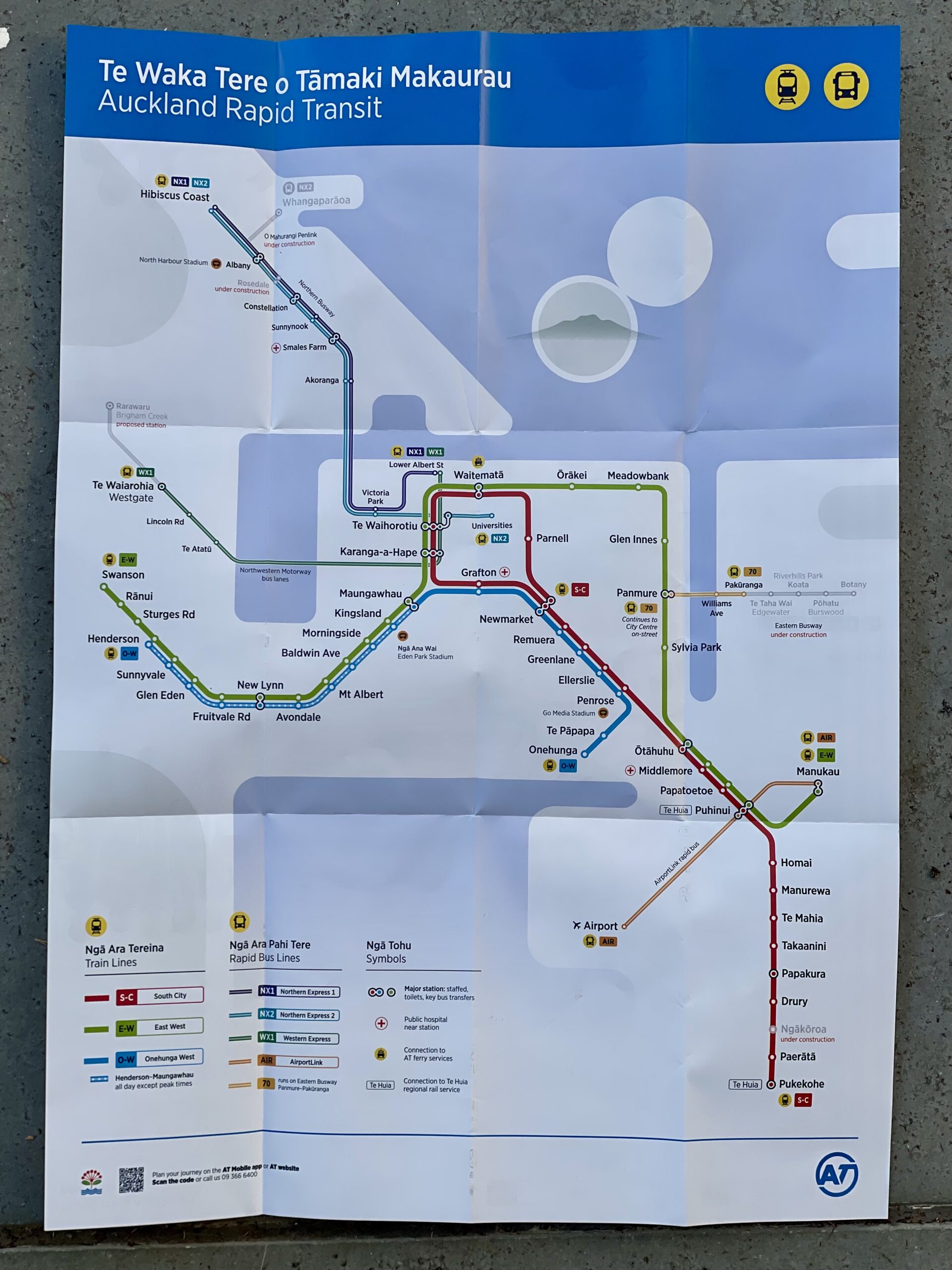
The ART of 2026, illustrated on a map handed out at the City Rail Link station public open days.
I particularly like the map used as a schematic in the very good Auckland Transport Bringing you closer, campaign, below. This campaign is very good for two reasons.
First because the text – Bringing you closer – describes the purpose of a transit network: it reshapes space, attacks distance and separation, building access and connection. Brings you closer. That’s the why.
Second, because the image shows this graphically, in the way that city dwellers everywhere instantly understand. This is what a true city needs, the key to unlock all its potential. The visible network – that’s the what.
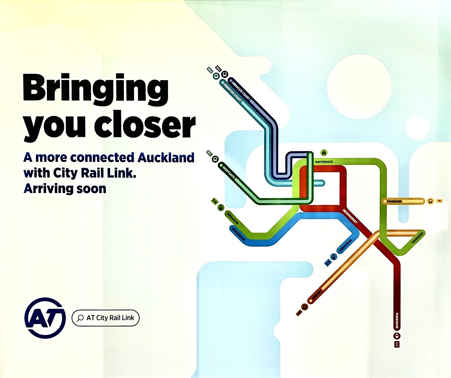
An image from Auckland Transport’s 2026 “Bringing you closer” campaign in the lead-up to the City Rail Link launch.
With the opening of the City Rail Link stations and lines, Auckland’s multi-modal rapid transit network is now widespread enough, interconnected enough, and good enough to finally describe the city.
That’s it: Auckland as a transit map.
An Aussie firm has even added Auckland to its catalogue of merchandise celebrating Australasian Transit Cities:
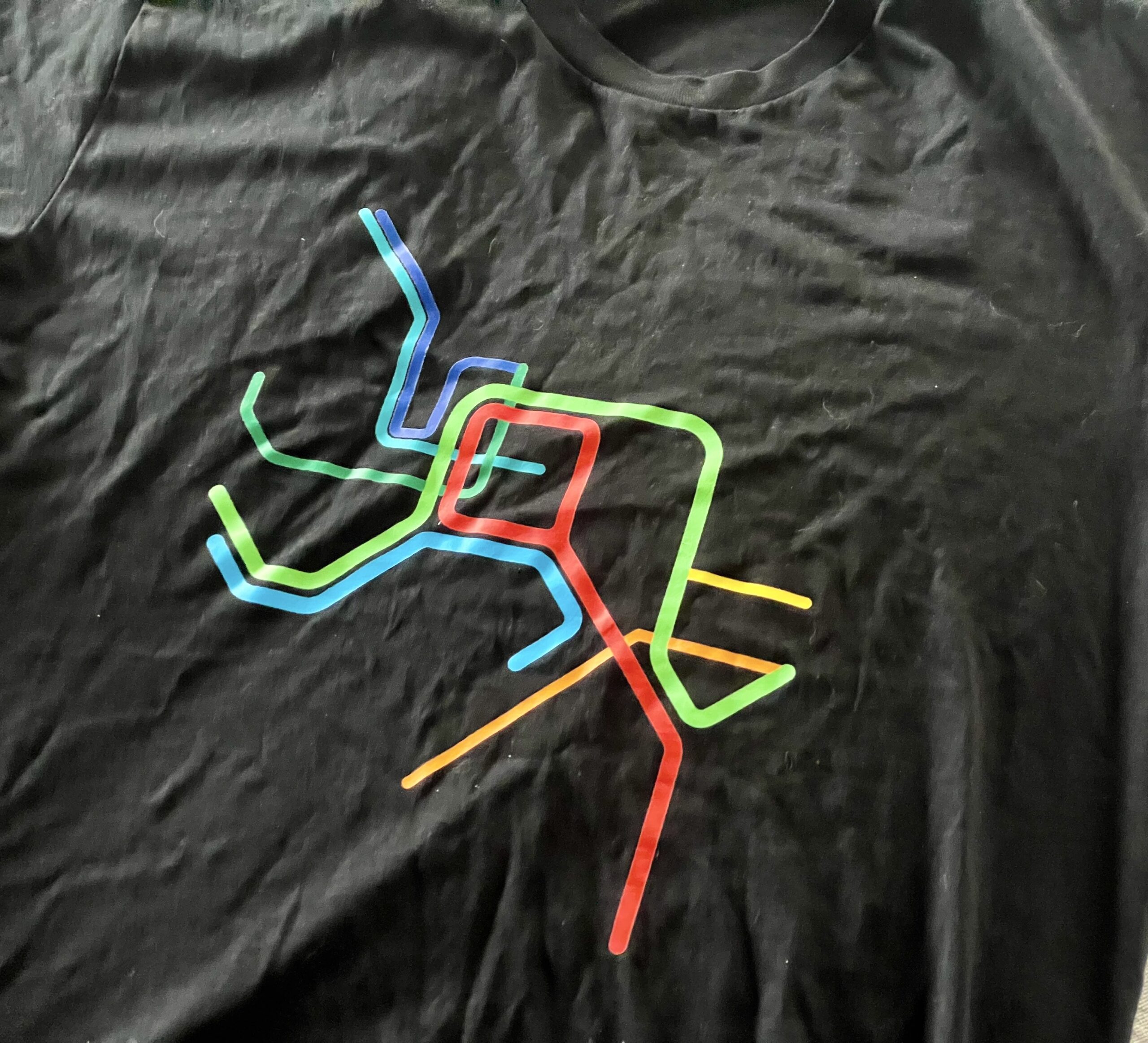
An ART T-shirt from our friends across the water, Peak Transit. Also available on stickers and totes.
For comparison, just 25 years ago this was the total extent of Auckland’s Rapid Transit Network:
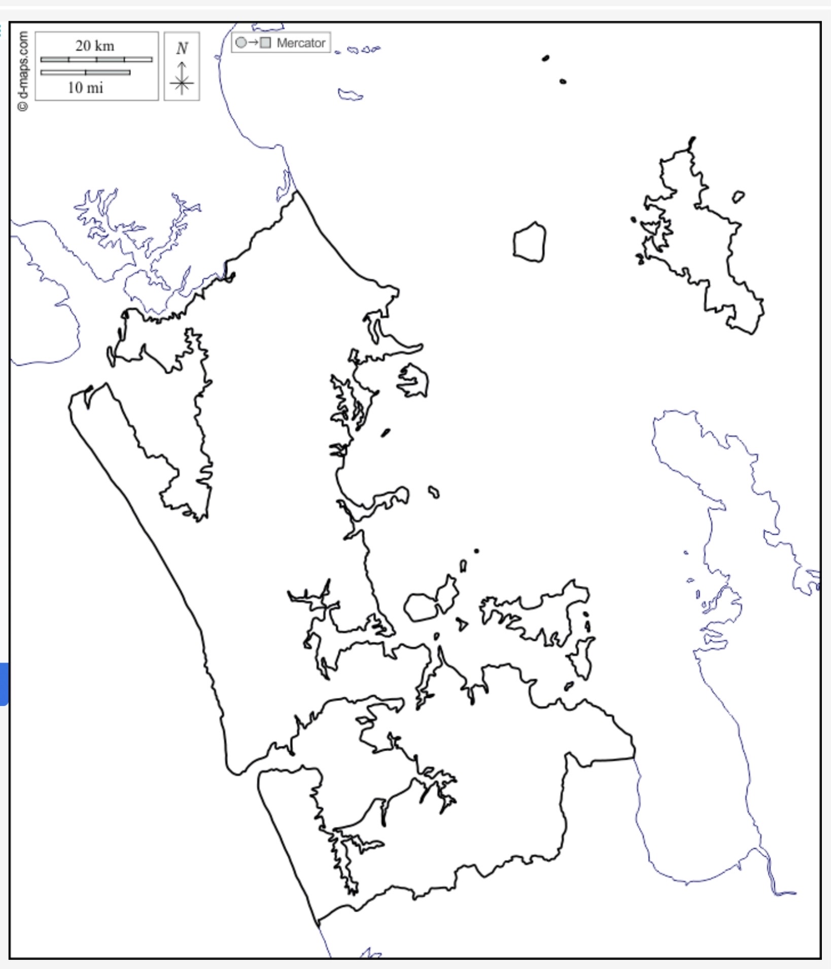
Auckland Rapid Transit Network, 2001: you’re not imagining things, there really wasn’t one.
Had some magic urban fairy – the ghost of Jane Jacobs, say, or a playful shade of our own Robbie – appeared to me in 2001 and said: “Auckland could have this ART rapid transit network in 25 years time”, would I have grabbed at it with both hands, barely believing it possible? Yes, absolutely.
So this is a real moment for celebration, with many many people to thank, and a fascinating tale to tell.
But that’s not what I want to do here, Darren Davis describes the transport milestones well in this post, and I discuss the city shaping outcomes that have already changed Auckland for the better in this one.
Because now is also exactly the right time to ask: what’s next? What should we expect – and vigorously, cheerfully work towards – for the next 25 years, for 2051?
Going from nothing to something is a lot harder than extending and improving what we already have. So, now we have the makings of our ART, there is no end to our ambitions for Auckland’s urban future. We should aim to make as much difference in the next 25 years as in the last.
The simple answer to “what next” is that we need to complete the emerging networks for public transport and active modes, to complement our only fully mature (and complete) transport network – the driving system. This is, after all, what the stewards of that very system themselves say, in the Auckland Motorway Strategic Plan.
And as an aside: public transit, walking and micromobility are here to stay. No, I do not believe there is any magic technology on the horizon that will change the fundamental laws of geometry and physics to render these foundational tools for urban success redundant. There’s been 75 years of that “any-minute-now” distraction from clever idiots, and it is clear what it is: misdirection. Musk off.
A vision for 2051+
In practice, for our rapid transport network (ART) we should aim to both build up and complete all the Bus Rapid Transit (BRT) routes currently in development and planning. We should do this in the immediate term – starting now – WHILE ALSO preparing for them to be replaced or supplemented by higher capacity rail-based systems where necessary or preferable. That is the somewhat contradictory double future for the task ahead. Carry on, and quantum leap. Vision -> Strategies -> Programmes -> Projects.
This means, for example:
- The next harbour crossing must include a new rail-ready rapid transit path – to serve the busway from the start, and to be able to support a rail system in time. Just pouring an infinity of buses over the old bridge, from the growing North Shore onto city centre streets, is not any kind of enduring solution.
- Any structures built for the North-Western busway must have suitable geometries to accommodate a future higher capacity rail system – for the same reason as above. Ridership on the WX buses, without even a proper busway in place, is already accelerating faster than the Northern Busway did at a comparable stage. Not likely for a couple of decades, but this century has shown that decades come around fast for urban transport networks.
- Likewise for the City-Māngere route through the heart of the isthmus, one of our busiest bus routes and most densely populated zones. This should, in the near-term, be transformed into a BRT-lite line, with greater capacity, speed, priority, and frequency – and added to the ART map. Achieve this, and the need for a (light?) rail system in this direction will become, in all likelihood, even more apparent, logical and deliverable.
- Bring the BRT approach to more cross-town routes, like an Upper Harbour service paralleling SH18, and other candidates. This should be begun as soon as possible, and can likely remain bus-based for some time.
But wait, there’s more!
- Of course, the existing rail network still needs development – including grade-separation, and more track; and whatever it takes to link into a proper regional rapid rail network that enables intercity access from Auckland to the rest of Aotearoa, for locals and visitors alike.
- Likewise, the absolutely vital first-mile/last mile networks for the humblest and most efficient modes: walking, biking and micromobility of all kinds. The journey of a thousand steps (whether by bus, train, or light rail) begins and ends at your door, with properly good and smooth footpaths; easy and inviting all-ages bike routes; and good safe crossings and intersections everywhere you go.
The key to doing this well is a clearly articulated vision, that then drives plans and actions on differing time scales: 30 year, 10 year, 3 year.
Get ready for CFN3
If we can go from that barren map above to this year’s new one in 25 years – despite often dysfunctional city-central government relationships – and chopping and changing city and transport governance structures…
… then just imagine what we can achieve over the next 25+ years! Even with the ever-present challenges of funding and consensus, and amidst an increasingly challenging climate, which itself is making the argument to think differently and move faster.
Greater Auckland is working on mapping out this vision.
That’s right – a fresh and smartly staged Congestion Free Network is in the pipeline. We are producing an updated map of what we think we should aim for, to further unlock our lovely city full of so much promise. Stay tuned for the latest iteration of the big holistic vision, our specialty.
Meanwhile, readers: we’d love to hear your thoughts. What do you see in your crystal ball, that will help uplift and connect our ever-surprising city in the decades ahead? Transport-wise and otherwise, what else will bring us closer?
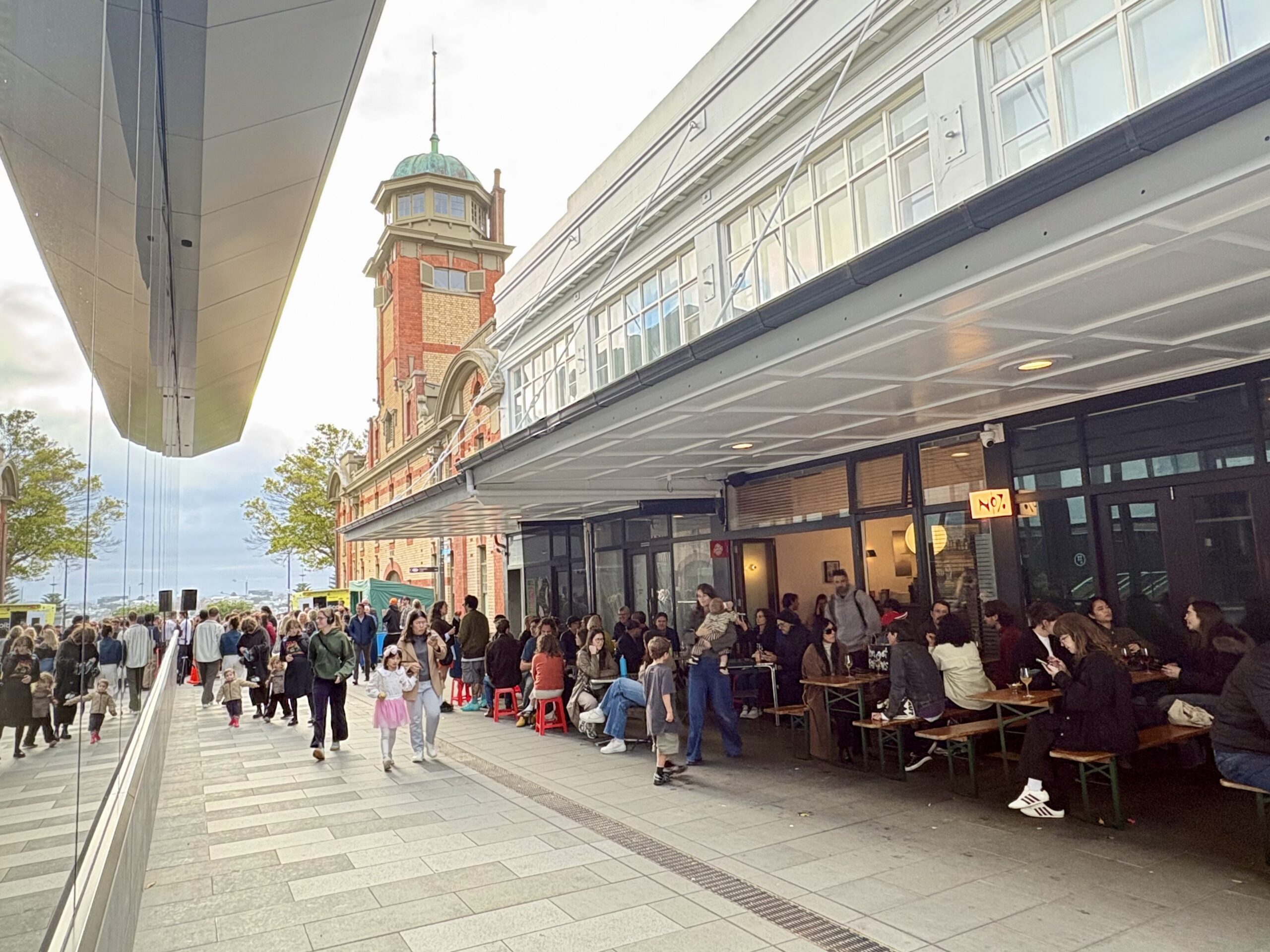
A moment of connection in August 2026: Beresford Square buzzing with people on the public open day for Karanga-a-hape Station. Photo: Jolisa Gracewood
See you all on Sunday!

 Processing...
Love the ART name. Motto: Ride ART for ART’s sake. Network status could be ‘State of the ART’. Fancy pass could be ARTsy Fartsy (or maybe the toilets?). This stuff writes itself.
A couple of years back there was talk of an NX3 – a high frequency route that replaced the 866 which only runs Mon-Fri. Would be a logical step which I’d love to see
Yet another example of something that not having an Onewa Road station on the northern busway has robbed us of.
The 966 is duplicated by the 97 until it hits the motorway (and the 94 most of the way). And then by the 866 once it hits the motorway.
We are left with two (infrequent) bus routes serving the Newmarket North Shore (via Ponsonby) market (866 and 966) and no way for those living on the shore to switch between them, instead of one frequent service connecting to multiple frequent services for the last mile on the Shore.
(Sigh) I’ve been submitting on the proposed NX3 every time there’s the opportunity. I’ve not seen any reference to it in AT documentation, alas, since the first RPTP done under AT auspices.
More rail, always more rail! Be it heavy or light rail/ Trams. More busses are great as an intermediary step, but as you put it Patrick, first/ last mile access is critical for the success of a transport network, and currently I cant take my bicycle on a bus! (Excepting every third NX1, but unfortunately, I have 4 friends!) Everyone I know who scoffs at using Public Transport, the first point they raise is “But I can drive there in 30 mins, the walk to and from the station/ bus stop alone is that much” I too followed this thought process, until I commuted with my Bicycle. And suddenly, I CAN get there just as quick if not faster, depending on traffic, by public transport as my bike (or an E scooter) cuts the walk to / from the station from 30 mins to 5. For the transport system to thrive and get the patronage we crave, we need to empower wheeled patronage.
There are still too many discontinuities in the bus lanes for the rapid routes, linking up the remaining sections where possible would make buses far more appealing and appears to me like pretty low hanging fruit, cost-wise.
Fantastic to see the progress over 25 years. I’d love to see widespread pedestrianisation and reclaiming our streets from cars!
Prising New Zealanders out of their cars is the trick!
We have been our own worst enemies when it comes to public transport. When I arrived in NZ 63 years ago, being used to very good public transport in the UK. I used public transport here as well. Truth to tell I didn’t need a car, and now I do.
Slowly and by the mid to late 1970’s, most of it was gone.
Fun fact: I have been back to UK three times, and public transport is improving all the time.
I know it would be expensive, but I would to see 4 tracking on the Southern and Western lines so Auckland can have:
1. Express Trains – these would be a game changer, speeding up trips from Swanson and Pukekohe / Papakura into the city. It was a real shame that the previous Government only did the 3rd main, and not the 4th.
2. Fully separate Freight from urban rail – Again a game changer with AT able to run trains when and as often as they like with no conflict.
I would love it if they could do 4 tracks at the same times as the Grade Separation on the Western line and do the 4th main ASAP
Definitely on the southern line, but I can’t see it happening on the western line with only 2 freight trains a day.
There was some logic to only doing the 3rd main as a 4th main was not needed immediately and it would have involved demolishing bridges built 10 years earlier as part of the electrification programme.
Getting a third main from Panmure to Papakura would be the priority.
Agree – extending the third south and east is the urgent task on the rail network.
I would love to see a technical analysis of what is the minimum amount of freight bypass track on the eastern line to accomodate more port shunts while enabling all day metro frequencies.
My intuition is that a lot could be achieved with a 3rd on the cheaper to build “plateau” section south of the tunnel. How much would be needed to get most of the benefits is a super interesting question.
Also extend the 3rd to Papakura would really be powerful too. Higher frequencies on the Red line could start/end there, in line with demand.
They did the BCRs and the only option better than the 3rd main was doing them both together. They attempted to redact the info but they missed a table which is how we know.
Is there even room for a 3rd main along the western? Being able to run express services from the outer west into the city would be amazing for sure and would make the train a clear winner versus driving for many more people.
I can’t see significant sums being spent just to run express trains. While they are quicker for those living further out, they reduce frequency at each station, which erodes this benefit and makes things worse for those closer in.
It is just another encouragement for sprawl.
I don’t think it’s necessarily an encouragement for sprawl, these stations are already there, people already live around them, and they’re already going to the city. Reducing Henderson to Te Wai to 20 minutes makes rail and bus combos highly competitive timewise with cars over those distances.
But sure, agree on the trade-off with reduced frequency; maybe something to think about long term when the full network TPH is unlocked after the level crossing problem has been addressed completely.
Travel times from the West are still a problem though. The train from Henderson will still take 39 mins (!!) to go Downtown post CRL. Got to work on that.
The WX1 is currently a 25 min trip from Lincoln Rd to Albert St without traffic. Making it congestion free at all times would be a good investment.
Something I wonder about how the city + AT will boost ridership?
How and where will they run effective and popular BRT?
Looking at the last year of stats for the 309x, 36, 38, 311, that kinda corridor between Onehunga, Māngere and the Airport aren’t fab (309 still doing well enough comparatively).
The 309x surprisingly isn’t meeting its targets.
Personally I’d drop the 309 in favour of the 309x and have connections in Onehunga via 36 + 38 pick up that slack but the data suggest that wouldn’t be popular either.
The 311 hasn’t taken off yet at all unfortunately, I use it to get to the city but I wouldn’t be surprised if its gotten rid of, a shame given the CRL to boot.
If the road has a route number, it shouldn’t have parking.
In essence this means that those regional routes get more space, to allow for bus lanes where required.
This will mean that parking in centres like Mt Eden become more difficult, getting people to start rethinking how transport works for them. This is considered a feature not a bug.
I’ll go for this but worded in a different way. If a lane is already designated bus-lane or T2/3 lane, you should never be allowed to park in it regardless of time of day. Even if it becomes a normal lane outside of peak. As anyone who has ever been on remuera road (and i’ve got to imagine, many others) out of newmarket knows, absolutely noone uses that left hand lane at all because at any point you could come round the corner and it have parked cars in it, regardless of the time of day.
100% . Arterials and/or major bus routes should be broken yellow lines 24/7. Also get rid of T2 and T3 and just make them bus lanes. I don’t believe they change behaviour at all and just clog up the bus lanes with school runs. These changes would be the biggest, quickest and easiest bang for buck.
This would indeed be the quickest, biggest, bang for our buck. It would also face the most resistance from shop owners, etc.
Still, we have to start somewhere. Its brain dead that we have a congestion issue in part, and buses stuck in traffic, because of private car storage (for however long) on public roads.
The CRL has spurred development. Albert St is almost unrecognisable from what it was a decade ago. Now what was Simon Bridges saying about needing better value capture in that interview. If a development agency had brought up all those end-of-life buildings in Albert St, could the added value been enough to finance the CRL as well as co-ordinating the construction activity. There are a number of different options for value capture. Expecting the project review to examine them.
Will future PT development still be stand-alone projects? Is higher rate income on improved land value sufficient?
Those two maps are clear evidence in support of the saying, widely attributed to Bill Gates, who stated, “Most people overestimate what they can do in one year and underestimate what they can do in ten years”
To sort of paraphrase what you said above, I think part of the reason is that we miss how much easier it is to build the second, third and subsequent stacks on a pyramid once the base layer is properly laid down.
Auckland now has a great RTN base so it’s right that GA should be looking ahead to what we can do next.
My modest suggestion on the ART map, would be to link in key destinations like Zoo/Stadium/Ferry terminal as well as station names
It has the airport, which on this map is shown as clearly accessible via rapid transport. That is a good thing; a lot of time on travel forums, people overlook the PT option as it doesn’t seem clear, but it is a low cost and easy way to get to/from the airport. Seeing that visually on this map is important
I (and visitors to Auckland) also prefer to go to events at Mt Smart (Warriors) and Eden Park via ART. IKEA/Silva Park are also destinations. I see in small print that ‘Go Media Stadium’ is written there, but my suggestion would be to mark stations (even as icons) as; ‘this one’ for Ferry Terminal/Stadium/Zoo/Shopping mall
Maybe different tourist orientated overlay to avoid this map getting cluttered?
I am hoping like in other cities, people get used to the concept that when they are considering taking the family to the mall/sports/zoo/beach etc, and feel like they can jump on rapid transport to get there and don’t need the SUV
Its awesome to see the progress that Auckland has made over the last 25 years. I don’t think many Aucklanders are aware of the significant progress Auckland has made since the turn of the century. Obviously there’s still a long way to go but its incredible that Auckland has a rapid transit network in a good amount of the city after one didn’t exist a little bit before I was born.
This article has also sparked the idea for me to make a video on how Auckland built a rapid transit network from scratch in 25 years. Hopefully I can release it within the next few months (highly edited, highly researched videos take a lot of time to make).
By changing the CRL operating configuration to have just two new simple routes, the vast majority of train users could have a direct one seat journey service, including Western Line passengers to Newmarket and Onehunga passengers to the CBD, addressing the flaws with the current complicated CRL timetable:
Green Line
Swanson-CRL-Parnell-Newmarket-Manukau
Red Line
Pukekohe-Panmure-CRL-Newmarket-Onehunga
This would cover all the network with just two simple routes and would provide Western Line passengers with services running to Newmarket and the Southern Line – the destinations which the majority of Western Line passengers travel to, as per AT’s own statistics.
Express train services should be introduced between Pukekohe-Paerata-Drury-Papakura-Puhinui-Middlemore-Otahuhu-Sylvia Park-Waitemata-Te Waihorotiu-Karangahape using the new third main track to provide quicker services between the major growth areas in Franklin and the central city.
A commuter train service should be put on between Swanson and Helensville using ex-AT carriages and diesel locomotives owned by Glenbrook Vintage Railway.
These same carriages should also be used to run a weekday morning and afternoon peak period commuter service between Pukekohe and Waiuku as well.
A new railway station needs to be built on Walters Road midway between Papakura and Takanini stations to provide better access to train services next to the Southgate shopping centre and Takanini Town Centre, where there has been a considerable amount of growth along the full length of Walters Road. A new station could be built at the same time as the grade-separation of Walters Road crossing.
The Onehunga Line needs to be extended to Auckland Airport.
If the long-proposed Avondale-Southdown line gets built, a new direct west-south service could be introduced between Henderson and Otahuhu using this new route via Mount Roskill and Onehunga.
The Te Huia service needs extending to Cambridge and Tauranga / Mount Maunganui.
The Northern Explorer Papakura stop should be changed to Pukekohe, which is now the major southern transport interchange in Auckland.
The Rotorua Branch line should be reopened and a new Great Journeys New Zealand Scenic Plus service established between Auckland and Rotorua.
The current Auckland Harbour Bridge needs to be replaced with a new bridge, to a design similar to that proposed with the ANZAC Centenary Bridge a few years ago, which would incorporate road traffic lanes on the top, with rail, pedestrian and cycle paths underneath, running in a more direct route from the Victoria Park flyover in the CBD through to Northcote Point:
https://www.greaterauckland.org.nz/2009/12/04/anzac-centenary-bridge-information/
https://www.greaterauckland.org.nz/2009/12/03/the-anzac-bridge-idea/
Trams need to be reintroduced to Auckland in conjunction with congestion charging and a new harbour bridge. A new light rail tram line could run from Britomart to Takapuna via the new bridge, extended into a new central city loop running from the Wynyard Quarter to Britomart, up Queen St, along K Rd to Western Springs, and Ponsonby Rd, down College Hill back to the Wynyard Quarter. Light rail could also be added to the Northern Busway, linking to a line along Symonds St and Dominion Rd.
The new bridge and light rail could be funded with congestion charging on all motorways across Auckland, with removing all the congestion-causing on-ramp signals on the motorways and replace with toll gantries. There would still be free routes with using local arterial roads like Great South Road and Great North Road.
Land that the current motorway approaches to the existing bridge sits on, could also be sold to offset the cost of the new bridge.
Good post. We need to celebrate but also move ahead. What are the changes we need for the coming 10 years. When can we get a Mayor and Minister for Transport that push through the last few transformational projects we need (SW Auckland plan anyone).
With budgets being limited, we need to be realistic and focus on projects that we can drum up support for and not come with a long christmas wish list. Currently it means finishing the NW busway and removing the crossings (thats really all we can afford). And whether we want to or not it seems like after that were building a new harbour crossing.
With that said, what I don’ want is that we loose sight of the holistic view of transport. We need a good share of the budget given to a team dedicated to continuous improvements. A team, with budget, that looks at how to make things smoother and better. Reduction of busstops for example, it seems like every block has one on Dominion Rd and Mt Eden Rd, is that really necessary? Does NX2 need two stops at Victoria Park or can the Halsey Street passengers walk an additional 150 metres etc etc. Can we add 150 metre of buslane and bypass a set of trafficlights that hold the bus up for 5 minutes during rush hours? And in the suburbs, we need busshelters, heaps of them (it rains a lot in Auckland and when the bus isn’t clockwork standing 10 minutes in the rain is a dealbreaker for most). These small incremental projects are what makes the network user friendly. A dedicated team, a dedicated budget and clear KPIs.
And then we need a vision for what we do with the added number of vehicles that will clog our city streets when this new harbour bridge is completed. I do question whether we really need more vehicles to the one place in Auckland that almost everyone have fast access to via PT (If you live in SW Auckland your excused). Anyway since politicians in Wellington seem hellbent on the extra bridge, perhaps someone can figure out what we will do with the additional vehicles in the citycentre and make sure all of them dont block the busway routes…
Looking forward to the next 25 years. I’ll be on the first train into the CRL tunnel this Sunday.
I heard this on the RNZ news tonight: https://www.rnz.co.nz/news/world/1326235/ai-traffic-lights-to-be-trialled-on-major-brisbane-city-council-roads. I think this would be something that could make a big difference in problematic areas – for example Newmarket and all the traffic lights there, impacting buses and cars, and not good for pedestrians either. It would be great to get a trial going here.