We’re now less than two weeks until Christmas Day, can you believe it? Our second-to-last roundup of the year, featuring stories that caught our eye this week.
Today’s header image is Canada St, courtesy of Jolisa.
This Week in Greater Auckland
- On Monday, Matt looked at topics for Council’s inaugural meeting of the Transport and Infrastructure Delivery Committee, including higher public transport fares
- On Tuesday, Patrick explored a specific example of how local control of local streets could be good, actually
- On Wednesday, Connor broke the news that AT is looking to re-open Queen St to all-comers overnight (and launched a quick campaign to restore sanity)
- And on Thursday, Tim asked if the current state of Lightpath is a metaphor for the state of Auckland in general. Spoiler: yes. It’s also a recipe for how we get out of the current funk.
This roundup, like all our work, is brought to you by the Greater Auckland crew and made possible by generous donations from our readers and fans.
We’re now a registered charity, so your donations are tax-deductible. If you’d like to support our work – and, what better time of year to make a gift for a better world? – you can join our circle of supporters here, or support us on Substack.
Better and better bike networks
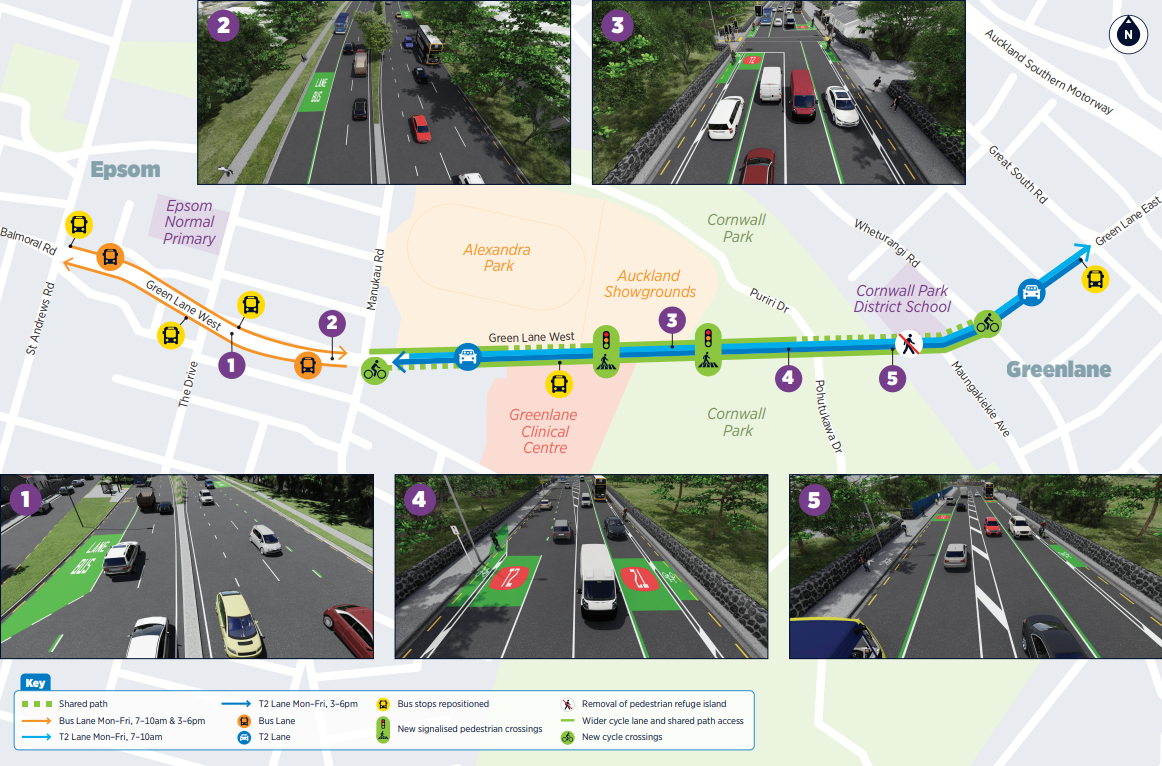
Auckland Transport is proposing improvements on Green Lane West, which include slightly widening the on-road bike lanes, and introducing some sections of shared path.
Bike Auckland makes the strong case these must include physical protection of the bike lanes. This is a no-brainer: it’s a key route and there’s definitely space. And yes, the bike lanes should be extended west to St Andrew’s Ave.
Check out the feedback guide here, and add your voice before consultation closes next Friday 19 December.
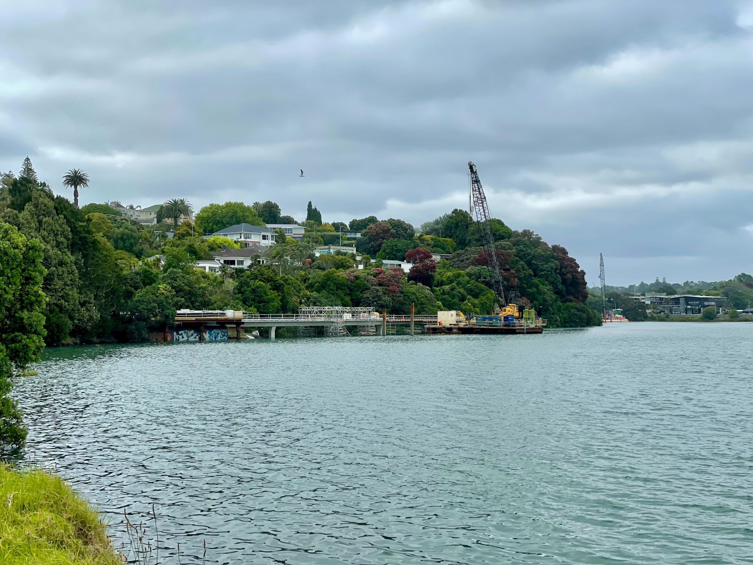
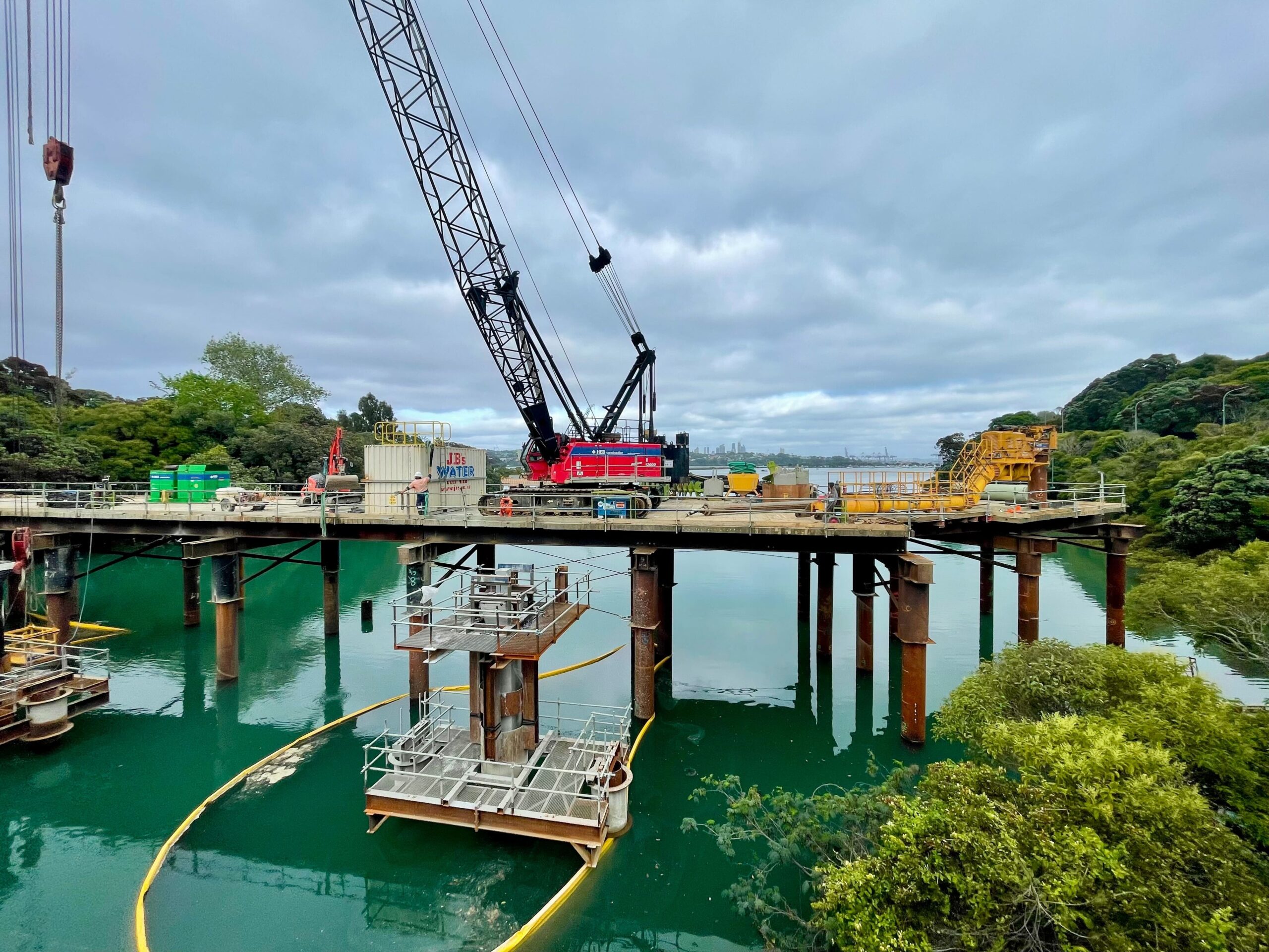
 Over in Ōrakei, things are cracking along on the final section of Te Ara Ki Uta Ki Tai, the great Glen Innes to Tamaki Drive Path. As captured in these photos by Patrick Reynolds, this is significant work and major investment in connecting people in the east right into the central city, by bike, scooter, and foot.
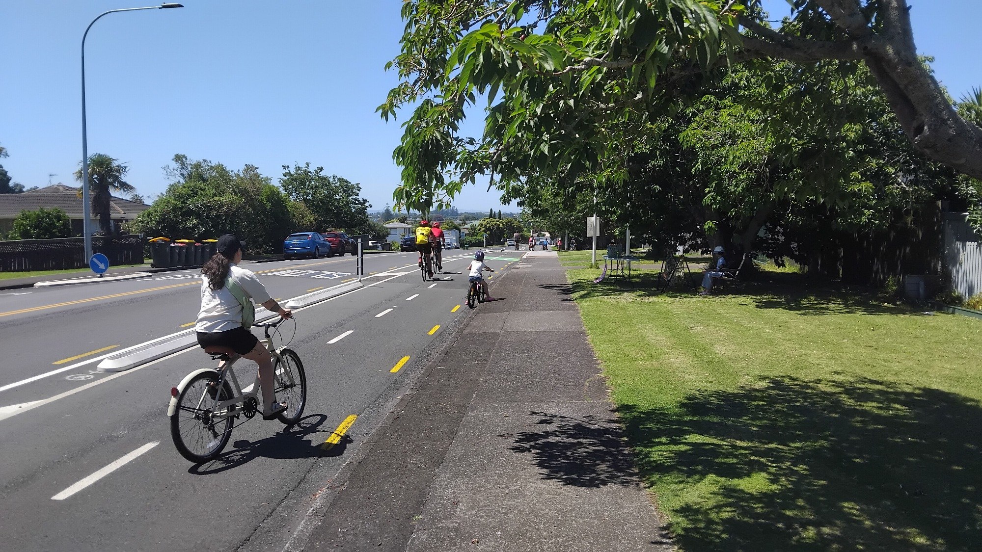
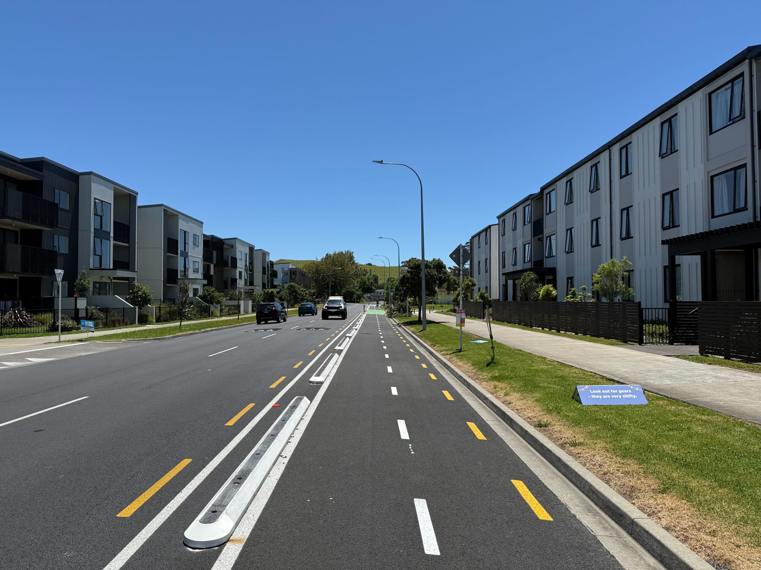
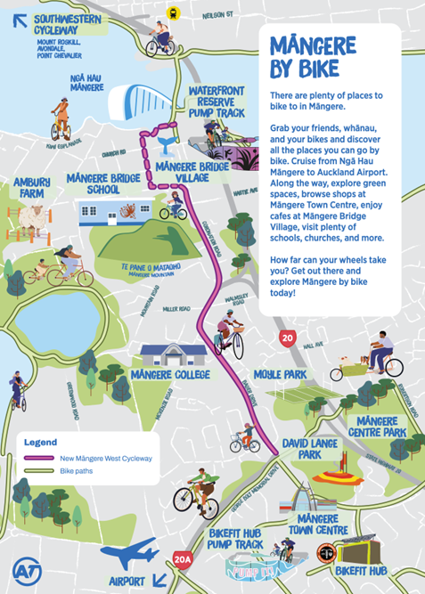
Out south in Māngere and Māngere Bridge, excellent vibes at last weekend’s Party on the Path inaugurating the new cycleways, which establish some sweet new connections around the area and beyond. (Photos by Connor and friends.)
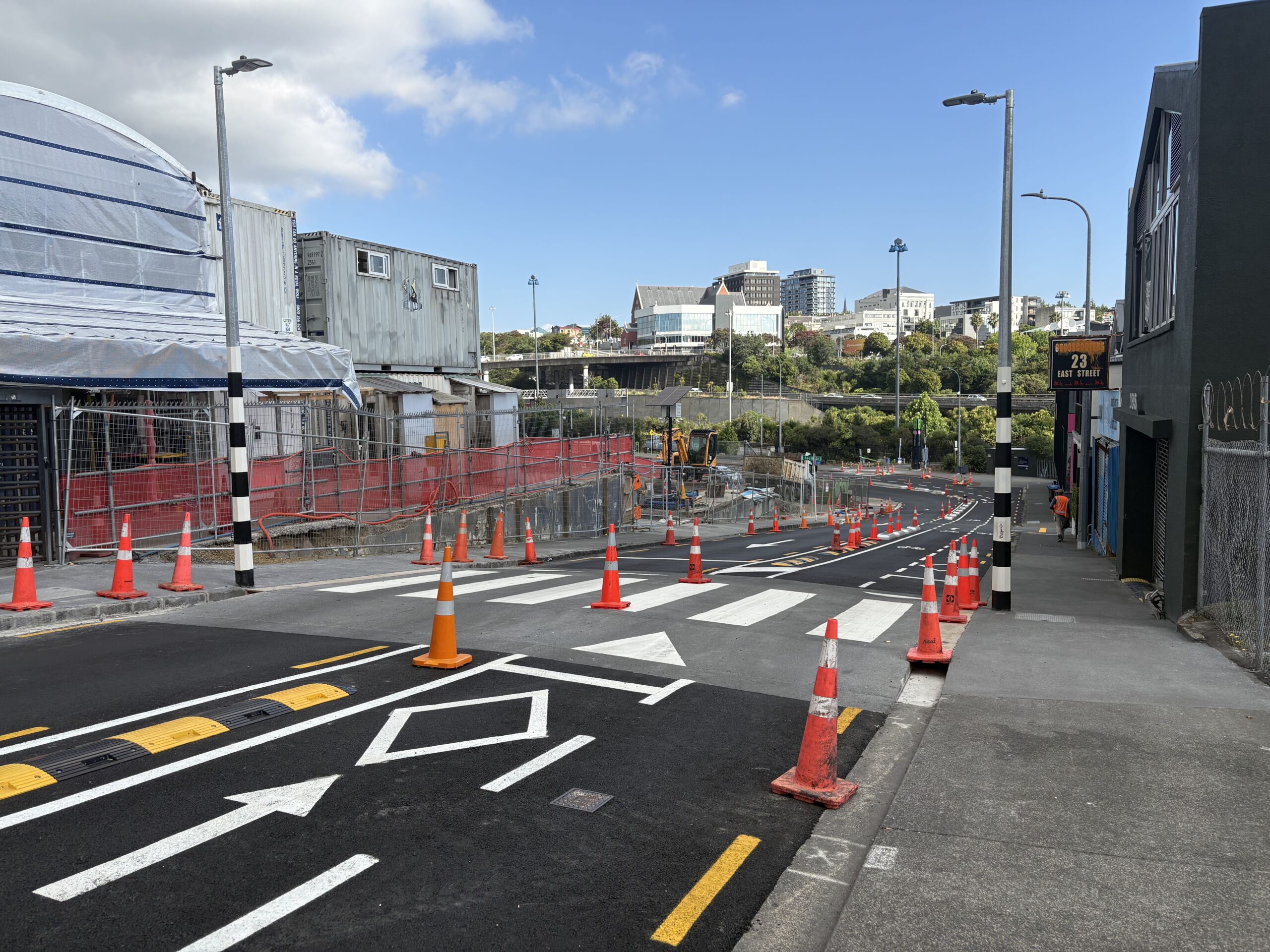
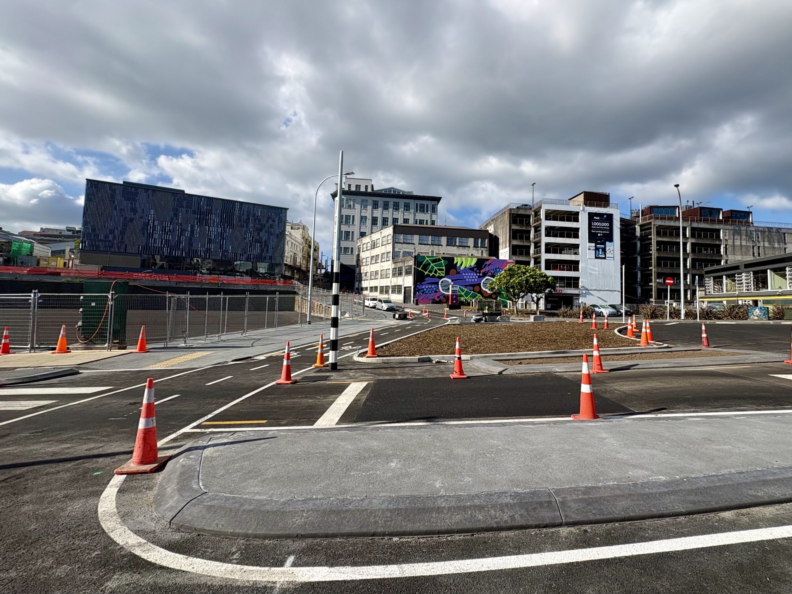
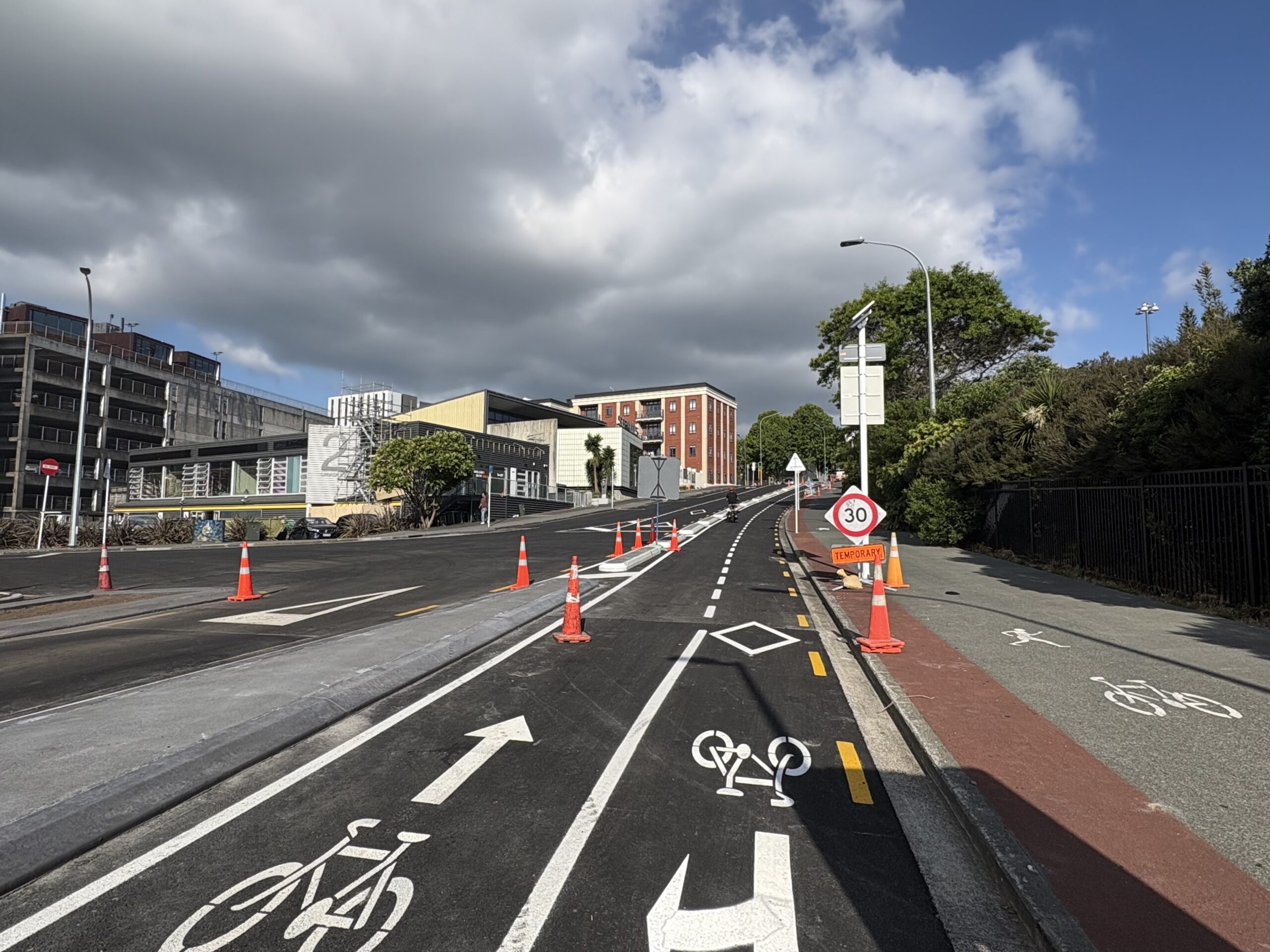
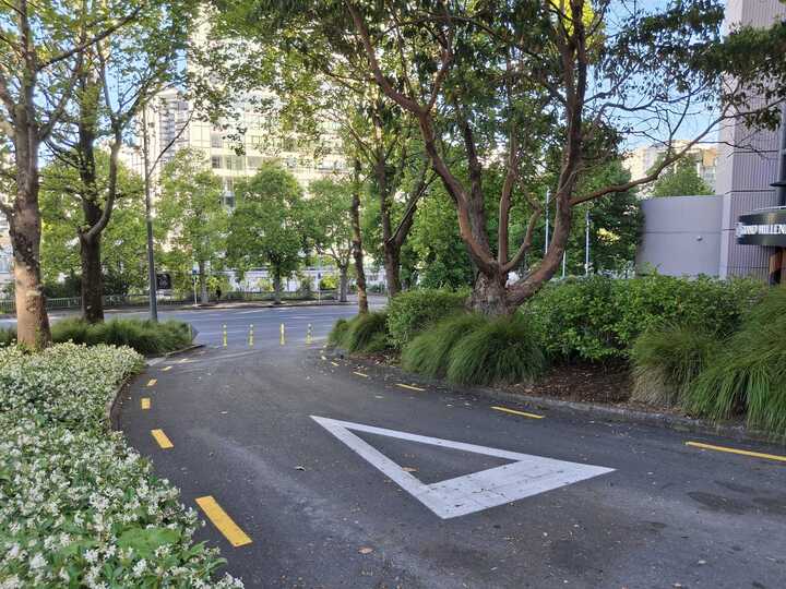
In the central city, cycleways are taking shape around the Karanga-a-hape station precinct – fulfilling the promise of Project K. Down East St and up Canada St, and connecting to Mercury Lane, Karangahape Road, and Upper Queen Street. It’s all coming together. (Photos by Jolisa)
 And on the other side of the Karangahape ridge, the Pitt St cycleway and the Vincent St cycleway link you through to Aotea Square. Our fave bit: this little bit of gorgeous greenway from Mayoral to Vincent, making use of a former turning lane. (To quote ourselves from five years ago: Slip lane, be gone!)
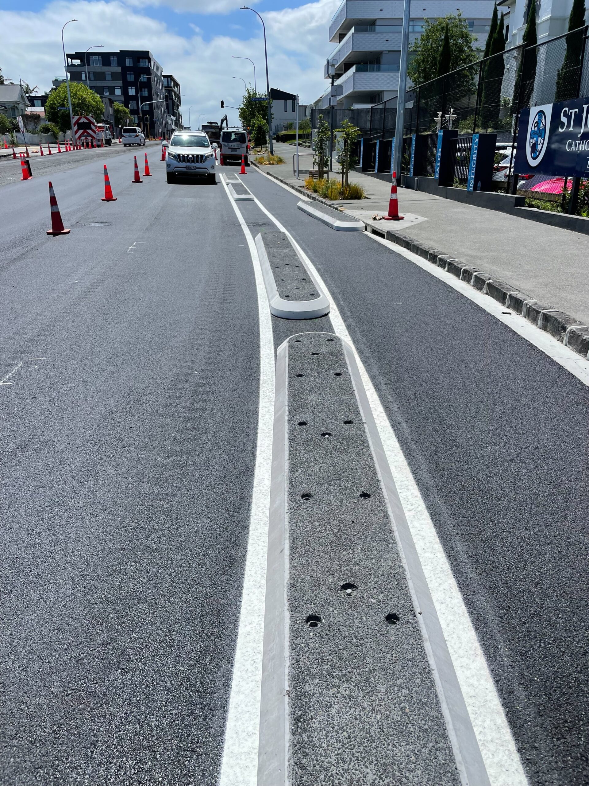
Plus, great progress on Great North Road: AT says work will be substantially finished by Christmas, with just a few finishing touches in the New Year. (Photo by Patrick).
We are still on track to complete the road resurfacing (asphalting) and most of the line marking by the end of next week (21 December) … Weather permitting, the road should be fully resurfaced and line marking completed over four to five nights (Sunday to Thursday).
Some of the cycle lane separators will go down at the same time. Night crews will install the rubber separators across driveways. Next year a crew will return to apply the green bus lane and cycle lane markings.
A reader has contacted us about the shared path alongside O Mahurangi Penlink, which appeared as a sealed path in all the early renders and flyovers.
So our correspondent was startled to discover that “the majority of the proposed shared-use path on the O Mahurangi – Penlink project will be delivered as a gravelled unsealed path (the section from Stillwater to the motorway).”
He’s just received this update from the project team, which sounds suboptimal. Imagine treating a road this way?
The shared path was not part of the original consented design, but was added later in the planning process. In 2024, the agreed design specified a chip seal surface from Whangaparāoa to Stillwater, transitioning to a granular surface from the Stillwater/Duck Creek Road connection through to East Coast Road. As this section is initially a much lower usage area, this approach reduces construction costs and allows for the granular section to be chip sealed in the future as the area grows.
Welly wheels on!
Two good cycling stories from Wellington: first, a report from Wellington City Council on the growth of ridership across the growing network:
Since 2022, the Council’s Bike Network Programme has delivered 32 kilometres of new bike routes across the capital. The result? A meaningful shift in access; 53% of Wellingtonians now live within 500 metres of a cycleway, compared with just 12% in 2021.
Cycling volumes are climbing too. Daily counts are up across most routes, with increases of 11–87% on new routes, contributing to an 18% citywide increase in cycling since 2020. And Wellingtonians say they feel safer on upgraded streets. Satisfaction reaches 75% in suburbs and 65% in the CBD where bike lanes exist but drops to 28% where they don’t.
And secondly, a strong proposal from advocates Paihikara ki Pōneke/ Cycle Wellington, for a safer route along the New Old Hutt Road:
Cycle Wellington is calling on Wellington City Council, Waka Kotahi and KiwiRail to improve the shared path on Old Hutt Road. People who will be using the soon to open Te Ara Tupua coastal path need a safe and attractive continuation of this soon to be iconic seaside path. This section needs to complement the quality and vision of the Great Harbour Way linear park around our beautiful harbour environment.
In the city, under the mountain
Two intriguing stories of exploration from The Spinoff. First, Hayden Donnell reports on how people are gravitating to the new, groovy and specifically car-free parts of town:
On Facebook, people will often post photos of Queen St from the 1960s, when the footpaths were packed with pedestrians, and the comments will fill with people saying we need to restore its four car lanes.
Te Komititanga’s popularity shows, if anything, the opposite is true. Pedestrians haven’t ditched Queen St and midtown because they’re yearning for the sweet scent of exhaust. They’ve migrated to the parts of the city centre where there are no cars at all. They’re hanging out on the benches at Te Komititanga eating a sandwich and watching an elaborately dressed man roll around inside a hula hoop. They’re having a beer at Wynyard Quarter, doing a manu into Browny’s pool or taking a Lime scooter down Quay St to one of Britomart’s restaurants.
And a corker of a yarn from Joel MacManus, about a long-lost slab of pounamu, that may or may not be buried somewhere on the western slopes of Maungawhau (or indeed, another maunga).
Down a long garden path, behind some suburban houses, there is a hole in the ground. Go down the hole and you’ll find yourself in a muddy pit, surrounded by jagged rocks. Crawl along a low passageway, then cling to a rope as you lower yourself down a perilous drop. There, you’ll find something special: an expansive, airy chamber, with bioluminescent bacteria sparkling on the walls and pōhutukawa roots dangling from the surface like delicate stalactites.
This is Stewart’s Cave in Mt Eden. Underneath Auckland’s streets there are hundreds of caves like this formed by ancient lava flows from the city’s volcanic cones. In one of them, some say, there is buried treasure.
Karangahape Road Buzz
Is Karangahape Road doing okay, asks Emma Gleason in The Spinoff, covering a lot of angles and talking to all sorts of businesses along the strip. We liked this from Jamey Holloway, general manager of the K’Road Business Association, on the power of closing the road to traffic and opening it to people:
“I think what The Others Way showed is that with the right creative approach you can do things that you wouldn’t have thought were possible.” Like close down a major arterial for an event. Holloway thinks Karangahape Road should close six to eight times a year for a wide variety of events. “That’s the vision.”
In a sign of confidence, Crushes is moving into the corner shop on Pitt St, which used to be O’Malley’s Menswear:
It is an end and beginning for Crushes, which has stocked vintage and second-hand clothing alongside NZ-made homewares, art and slow fashion since its beginnings in 2011 (Hope opened the first location with Sarah Firmston in 2013).
The new space, which Hope estimates is six times bigger than their last, will more closely resemble that of a department store.
And just down the road, the company that owns retailers such as Farmers, Whitcoulls and Pascoes are buying up the former Beca building.
A company owned by billionaire retailers Anne and David Norman is buying Auckland’s ex-Beca headquarters, with David Norman citing the benefits of being near the new $5.5 billion underground City Rail Link as one of the reasons for the purchase.
The building at 21 Pitt St has been empty for months after Beca left for Precinct Properties’ new Wynyard Quarter building.
Norman cited buses and trains as a reason why the business would buy.
We believe that the City Rail Link will be a game-changer with the Karanga-a-Hape station only metres away from the building. This will encourage the use of public transport,” David Norman said today.
Likewise, being on major bus routes, particularly from the west, was a big advantage, he said.
Safety and Productivity
Auckland University’s Tim Welch has another great piece, this time on the cost of disruption from crashes.
Crashes on major roads hit more than just the people involved. Thousands of other drivers get caught in the delays that spread across the network.
Traffic engineering consultancy Flow Transportation Specialists recently worked out these network delay costs for Auckland Transport for the first time.
…..
A multi-vehicle crash on Auckland’s motorway network generates between $1.4 million and $3.5 million in network delay costs. Even a serious crash on an arterial road can cost $26,000 to $37,000 in lost time across all affected road users.
When applied across Auckland’s crash data, network delays add roughly $195 million to the region’s crash costs, a 2.2% increase over conventional estimates.
These costs matter to the debate over the current government’s rollback of its predecessor’s speed reductions. The claim is that moving traffic faster will boost productivity and grow the economy.
But there’s a problem with this logic. It counts time saved from higher speeds as pure economic gain, while ignoring the time lost when those higher speeds increase crash frequency and severity.
Bucking the speed reversal trend is SH25 north of Thames.
New Zealand Transport Agency (NZTA) is pumping the brakes and reducing speed limits on several sections of a popular holiday route in time for Christmas.
Four sections of State Highway 25 will drop to 50km/h from 80 or 70km/h.
Waka Kotahi said there were 982 submissions on the speed review in the Coromandel region, and the majority saw benefits in lowering the speed limits.
It said the new speed limits will kick in ahead of the summer holiday peak.
A look at how well Helsinki has done at lowering road deaths.
This past summer, Helsinki made an astonishing announcement: as of August, the Finnish capital went an entire year without any traffic deaths. Not a single pedestrian, cyclist or driver died on the city’s roads. Not. One.
And this wasn’t an outlier year. Helsinki’s traffic deaths have been steadily declining for decades.
Lower speed limits and income-based speeding fines helped the city get to this point. Maybe others should give this a try.

A study from Cornell University reveals another benefit of (de)congestion pricing in New York Cty: air quality improved, not just in the tolled area, but beyond. Smoother commutes, fewer crashes, revenue for the city, less honking, cleaner air everywhere… what’s not to like?
Since New York City introduced congestion pricing in January 2025, the state has heralded significant reductions in traffic and rush hour delays, fewer crashes and noise complaints, and toll revenue projected to hit $500 million by the end of the year.
Now, Cornell researchers have tallied the environmental benefits. In the first six months of the program, air pollution – in the form of particulate matter 2.5 micrometers and smaller – dropped by 22% in the Congestion Relief Zone (CRZ), which encompasses all local streets and avenues at or below 60th Street in Manhattan. The team also reported declines across the city’s five boroughs and surrounding suburbs.
The real costs of More RoNS
Former Wellington Councillor Iona Pannett has written about the proposed Wellingtion SH1 improvements including a second Mt Victoria tunnel.
It is the country’s single most expensive Road of National Significance (RoNS), with the lowest benefit-to-cost ratio (BCR) at 0.6-1.2. In other words, there are likely to be more costs than benefits.
The Government has also acknowledged that it doesn’t have enough money to pay for all the roads it wants, currently costed at up to $56b, so hard choices will have to be made between projects and regions.
…..
Experience with other highway projects shows that the costs of this highway are highly likely to rise significantly once design work is completed, to the tune of many millions if not a billion or two. For example, the cost of Transmission Gully blew out by well over 47%. It is thus likely that all the tools being looked at will need to be used to pay for this highway – a potentially unpleasant surprise for residents and businesses.
And Wellington group A City for People has put out a great piece on why Cities need infrastructure to grow, but Roads of National Significance ain’t it:
Wellington needs more homes, in the right places. Our city is growing and we want to welcome new neighbours. City for People welcomes investment in high-quality infrastructure, so that we can build more homes. Wellington needs a transport network that serves life in the city rather than undermining it. It needs frequent and reliable buses, it needs cycle paths, and it needs footpaths. Better public and active transport options means more people can live in the heart of the city without needing a car.
But instead of investing in the infrastructure we need, the government wants to expand the state highway that cuts through the city with two new tunnels and a flyover into Hataitai. We think this is a bad idea. Some friends of the City for People campaign have put together information to help you take action, which we’re sharing with you because this matters for the future of our city.

New ticketing system off to a flying start
The new National Ticketing System was launched just over a month ago and The Press reports:
More than 100,000 contactless payments have been made by bus and ferry users in Greater Christchurch in the first month since the new contactless ticketing system was introduced.
Launched on November 10, Motu Move is a new national payment system that will eventually be used on public transport all across the country. Canterbury is the first region to use Motu Move and the system is being rolled out in stages.
More than 20,000 bus and ferry users have used the new system, with over 27% of adults who pay a non-concession adult fare choosing to use contactless payments.
What to do with all our poo
For a decade, Watercare has been telling the public that it is “rehabilitating” and “restoring” the once-quarried Puketutu Island in Auckland’s Manukau Harbour. What made that PR narrative so attractive was that they were doing it with a waste product – human faeces.
…..
It turns out that, hidden behind several layers of gates and fences, and atop the island’s maunga is what appears to be a full-scale landfill, with scores of diggers and trucks burying what is a “seriously” toxic material.
…..
Metropolitan Auckland produces 400 tonnes of “biosolids” a day, and the big hole on Puketutu we’ve been dumping it into is getting full, Williams told the Sunday Star-Times.
Within the next 10 years, the city is going to need to find a new repository, and any solution is going to require at least that long to get built. It means a conversation “urgently” needs to be held with Aucklanders, said Williams.
…..
At this stage, she said, there are two realistic options. Either another landfill is built in a new location, or the city builds an incineration plant, which would be the first of its kind in New Zealand.
Seasonal gift corner
A great guide from Bike Auckland for the bike-lovers in your life.
Emily Writes’ gift guide is full of interesting locally made goodies.
The Spinoff has a guide to gifts made by Māori and Pasifika artists
And we’re now a registered charity, if your thoughts turn towards donations to a good cause.
That’s us for the week – enjoy your Friday and have a great weekend!

 Processing...
And posted on The Conversation and re posted in this morning’s Stuff.
Auckland’s higher posted speed limits are actually slowing our traffic down, and lowering our productivity. The resultant higher crash rate, translates into increased crash caused delays, (and decreased journey reliability times) and increased motor vehicle repair and replacement costs, (and increased insurance premiums)
https://theconversation.com/higher-speeds-lower-productivity-what-the-data-shows-crash-delays-really-cost-auckland-271734
Interesting that they don’t police following distances at all on the motorways considering the cost of a motorway crash. So many idiots drive unnecessarily close, I’ve even seen police do it themselves.
Is there such a thing as a following distance camera? Put one on each overbridge, save ourselves billions.
Uber drivers are especially terrible. One of the reasons I don’t take Ubers. Was in one once that rear ended the car in front.
Germany takes this seriously and has cameras to monitor it and the Polizei will not hesitate to pull you over. The fine system is scaled by speed and following distance, with the highest consequences being EUR400 and a 3 month driving ban.
https://www.adac.de/verkehr/recht/verkehrsvorschriften-deutschland/abstandsmessung/
Wow, all those Motu Move users in Christchurch must be travelling on buses I don’t use. Since the time it has been introduced, I’ve only seen three people use the system, compared with the hundreds who still use the old Metro Card. But I mainly travel off-peak. I think that paying with your Credit Card may be useful for hip people without families. It is no use if there are more people than credit cards in the family and for those who use budgeting tools. At the moment no use for me – I do both personal and trips for my employer on the one card. I don’t want to give my credit card statement to my employer. It’s far easier to give excerpts from my Metro Card journey history for travel claims.
Is there a possibility with Motu Move to review trips and challenge any charges?
I think you misunderstand how it works, you can just use regular debit cards – something almost everyone with a bank account carries.
Unfortunately I carry more than one credit/debit card, so a $3 trip the other day cost me over $12 as I tagged on with one and off with another. I’ll stick to my HOP card now.
no offense intended, but that seems like a user error more than an issue with using contactless
Correct, the user had a few too many beers. But with Hop you can log into your account and request them to fix it. I am not sure if its possible with contactless?
I think contactless use will grow over time. If you already have a transport card its better just to use it, but once you lose it or they cancel it on you for no reason, probably just use contactless.
I doubt it, I think they would state the onus is on the user to make sure they’re using the same card to tag on/off. In any case I agree, I still use my HOP card for commuting. I don’t get any concessions so if I lose the card or it becomes inoperable for some reason I will probably switch to a debit card.
I was thinking about this when I took the ferry to Devonport the other day. It looked like you could also get a ferry to Waiheke from the same terminal. So if you accidentally don’t tag off in Devonport, you will be charged the max fare (Waiheke)? And if that is contactless, bad luck? What if the card reader is down in Devonport?
Those are good questions worth asking. I think you would be able to contest charges in the cases of equipment failures at least.
Perhaps best thought of as a beer tax? 🙂
Jimbo, contact AT with all the details and they will reimburse you.
I don’t think I misunderstand how it works. The fare is directly debited from a bank account or credit card account. It is not a separate pre-paid transport card. At the moment it seems there is also no functionality to review trips. For some people that may work, for others it’s a definite downgrade from the current system. There’s the promise of adding that functionality later on, but so far it’s very unclear what it will look like. I was looking forward to more functionality, not less.
Ok, it was just your reference to credit cards specifically that confused me. For a lot of PT users, myself included, there is no functional difference between using the old card and a debit card. It’s a worthwhile addition to any network as on aggregate it makes using the PT network easier. I think it is a case of better to add it in now and incrementally improve than try and wait for the perfect replacement.
The Auckland HOP contactless system allows you to review trips, ask for refunds etc., was more than I expected.
“More than 100,000 contactless payments have been made by bus and ferry users in Greater Christchurch in the first month since the new contactless ticketing system was introduced.”
That sounds quite a lot but it’s less than one in ten public transport trips.
I think there is a lot of inertia to stick with what you already use if you already use PT to commute or get around. Also any concession holders won’t switch to contactless and I would assume a lot of trips are done by students.
Exactly – a lot of the decision makers do not seem to be users. It’s great for casual users, but not so much for regulars, particularly students. I certainly wouldn’t let my 10-year old carry around a credit card or debit card.
Easy fix, make under 16’s free.
They should have outsourced the whole thing to the private sector instead of spending decades and billions getting almost nowhere.
Looks like Watercare is softening us up to fund a bespoke sludge plant like those people in Wellington got away with. When public servant start talking about ‘first of its kind’ we should oppose it stubbornly.
While I get your worries about cost overruns for things that are out of the ordinary, taken at face value your comment then means we either a) should never ever have the “first of it’s kind” for anything in NZ, so basically stick with what we always did, yay, or b) we should trust the private sector when THEY propose the first of it’s kind, rather than govt.
Sometimes new things are just that, new. New things may or may not make sense. Cynicism is easy to get into the habit of (don’t I know it after a decade in advocacy) but it still isn’t a good habit.
Dunedin has been incinerating biosolids for some time and is working on a shift to gasification which will convert biosolids into relatively inert biochar. A shift to incineration or gasification will not be a NZ first. Gasification plants are already running successfully in Australia with more planned – https://www.logan.qld.gov.au/residents/water-and-wastewater/biosolids-gasification.
Well done Helsinki (pop. 685,000) for getting pedestrian and cycle deaths to zero!
I think income-based speeding fines would be a great idea for AKL that I’m sure the current coalition would support in a heartbeat as they are about to add eligibility criteria for Jobseeker Support for single 18 and 19 year olds based on parental income. The fine premium above base could be returned to the local council as an alternate income source not subject to a rates cap.
“income-based speeding fines” – or just go for more speed cameras.
All that is needed is video cameras in various locations around the city with number plate recognition, and if you happen to get from one to another in less time than possible with the speed limit, you get a ticket. Move to 2020 technology instead of 1990 technology.
Even old-fashioned single-point speed cameras (and red-light cameras) would be a significant improvement. Put them on arterial roads (Ellerslie-Panmure highway, Gt North Road, Onewa Road, …) and some city streets like Symonds Street and enjoy.
Google maps tells you where they are these days, almost useless.
The link to the old slip lane article shows a really nice MTB locked up on Beach Rd in one of the pictures. No way I’d be leaving a bike like that out central Auckland today!
Great Spain channel I watch. Kiwi living there now. Latest video on their public transport, biking and walking. Do you need a car there and or car share etc.
https://youtu.be/EyT0OHBf87I?si=9S227HqkrL0jymOV
Cheap metro and bike share.
Yes I noticed the nostalgic FB posts & comments on Queen St filled with cars and people. People associating the two together but have they ever hear of a city growing up, overseas examples and the physics of trying to fit a much large population into the same space? Like we should be able to jsut drive to Queen St and park on the street for free, lol.
Running out of space to dump our shit eh?
Another reason that increasing the drastically increasing the density of Auckland for the sake of a few miles of train track is insane.
So… building houses farther out somehow removes the need to get rid of the shit? Or would it just mean that we need longer systems to carry all the shit somewhere?
Shit post
Sounds like he finally found a positive aspect of sprawl. Less shitting?
Thanks to Tim Welch for yet more excellent work.
Thanks to GA for another great Weekly Roundup.
I’m just looking at the Greenlane West proposal. AT is tweaking, rather than solving problems, and leaving people unsafe as a result.
I note they’re taking away a pedestrian refuge beside Cornwall Park District School “as it creates a safety risk by leading directly into the school’s parking area and driveway. People will be redirected to use the nearby crossing at the Wheturangi Road intersection.” Oh, for the want of a pedestrian gate into the school.
And then there’s this gem in the FAQ:
“Why can’t you add a footpath outside Cornwall Park and make it a shared path for cyclists and pedestrians? The road outside Cornwall Park is very narrow for a main road. Cars, buses, trucks, cyclists, and pedestrians all share this limited space. There is already a footpath on the northern side. On the southern side, Cornwall Park’s property boundary is right next to the traffic lanes, marked by its heritage stone wall, which cannot be changed. We cannot widen the road to add a footpath. The only way would be to remove a traffic lane, but that isn’t possible as nearly 25,000 vehicles use this road everyday – making it one of the busiest roads in Auckland.”
This is misinformation. Not only is it possible to remove a traffic lane, doing so would reduce traffic throughout the whole area.
What AT should be doing is describing how a sustainable and healthy transport system would work in this area, with a proper Low Traffic Neighbourhood and circulation plan, using substantial road reallocation on all the arterials. They may not be able to implement it all at present, under this deranged government and mayor, but any work they do should be pieces towards this ultimate goal.
The GPS is a problem, but it does NOT specify that AT must put misinformation into their FAQ answers.
They also could move the heritage wall as they did for the Albert St Bluestone wall for the CRL, just costs a bit to do.
The key is understanding that constraints like existing road width are tools. They’re opportunities, and they show the way. In a car-drenched city, the solution is almost always to shift the balance within the existing space, and aim for vehicle traffic reduction. Rather than always looking to widen the corridor.
What could be delivered here is a quiet, beautiful, functioning, accessible transport system.
True.
A decade ago I used to run around Cornwall Park entering over that heritage wall at the eastern end just west of Maungakiekie Ave. The construction of a ramp to get pedestrians & cyclists up and over the wall would enable a protected walking & cycling shared path to be built inside the wall to rejoin the roadway at Pohutukawa Drive or beyond at the western boundary next to the medical center. Could be rather pleasant riding through the trees.
Yes I used to flat in Claude Rd in the 90s, and always wondered why they didn’t at least do this.
A couple of weeks ago I was in a bus along there and there was a group of people (quite possibly tourists) trying to walk on the “footpath” – a common sight. These ones were so disgusted they were taking photos of how narrow it is.
The park isn’t Council / AT land though. So all would be at the sufferance of the park owners.
I travel beside the Mangere cycleway everyday, I’m yet to see a cyclist.
All our money paid for what?
Crazy!
https://haveyoursay.at.govt.nz/streetsforpeople_mb
Looks like that project is still very fresh, with the trial running Dec 2024-Feb 2025 but existing riders are switching to the lanes (around 100 riders/day).
Give it time, new landscape, new habits.