This is a guest post by Simon Lyall. It was originally published on his blog.
Background
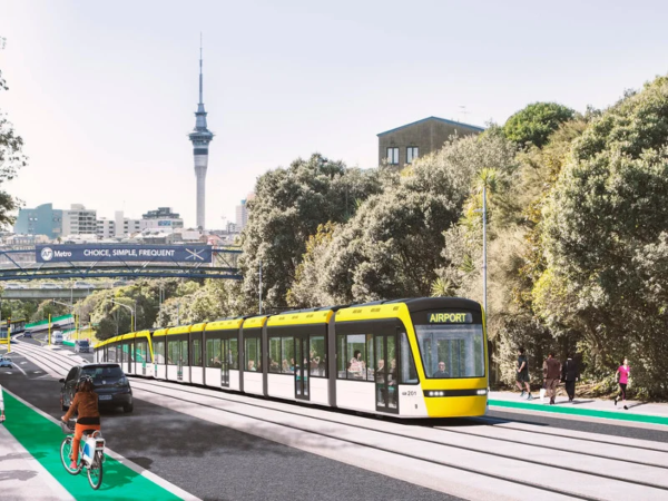
In late January 2022 the government announced that it was building a $15 billion light rail line from the Airport to the City Center via Mount Roskill. The line would be tunneled for about half it’s length.
The response from the Transport community was not positive. The price tag was extremely high especially on a per-kilometre basis for what it delivered. The likely result seemed to be further years of planning before cancellation when a pro-road National Government is elected.
This article will cover one alternative. It is a fairly low cost surface light-rail line that can be built quickly and expanded later.
Overview of the alternative line
The idea of the line was sparked by this twitter thread:
The entire extent here would be about 3km. This would only require ~5 LRVs, so could use an empty lot somewhere in Eden Terrace as a small depo.
This entire stage should be deliverable for $100m in capex – very realistic that this could entirely be covered by revenues from TOD.
— scoot! (@ScootFoundation) May 23, 2022
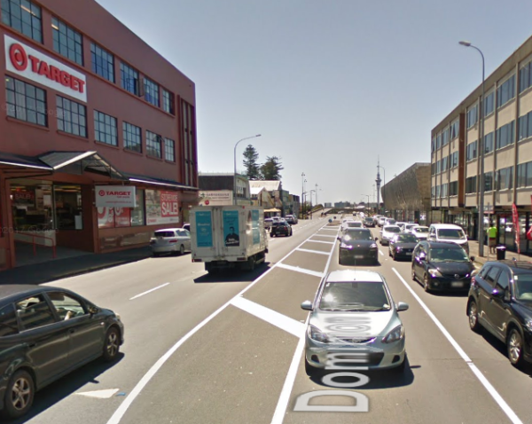
My expansion on Scoot’s proposal would be a short version of the street level Light Rail line originally proposed by Auckland Transport. It would be cover just 3.3 kilometres from The Civic Corner to Eden Quarter along Queen Street and Dominion Road.
The system is a simple two-line surface running light rail. In the inner section (north of Mayoral Drive) it would run on two reserved centre lanes at street level allowing pedestrians to easily cross. Further out in areas of lower pedestrian volume the lanes would be raised or fenced to discourage traffic further and allow higher speeds. In the innermost sections cars would be limited while in the outer sections they would have a lane on each side of the road but parking would be largely removed.
Vehicles would be 33 metre low floor (or 70% low floor) vehicles like the CAF Urbos 3. Overhead power would be used.
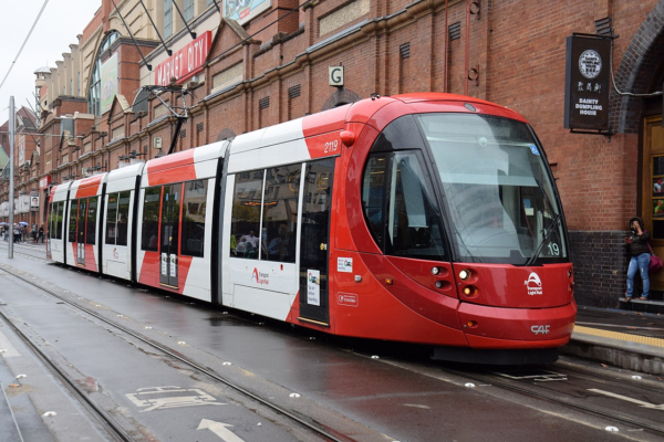
A 5 unit CAF Urbos 3.
The Route
The line would start at the Civic Corner (near Te Wai o Horotiu rail station and Aotea Square) and run south to Dominion Road to the Eden Quarter shopping area between Bellwood Avenue and Valley Road.
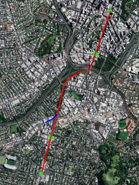
Route with stations
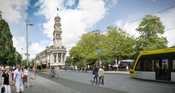
The Civic Corner is where the current Dominion Road buses terminate so it would be the same destination for most current riders (except those going to the Universities). Stopping the line here would also avoid the heavily built up northern 800 metres of Queen Street where there will be conflicts with local merchants.
Just South of the Civic Corner Stop
The line would go south across Mayoral Drive and then climb up Queen Street. At some point up the hill it would in into a tunnel under Karangahape Road. There would be a stop near here. This could be on one side of the tunnel or perhaps even inside it.
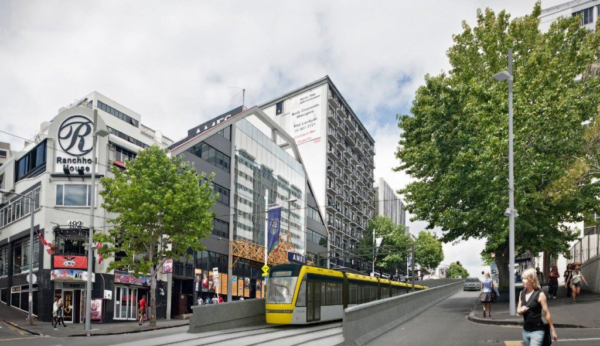
A train goes through the short tunnel under Karangahape Road
The line would then continue along Upper Queen Street before turning into Ian McKinnon Drive and following it to Dominion Road. Along this section we should future-proof the line for a future branch along New North Road.
Heading up Ian McKinnon Drive
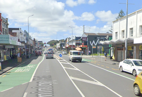
The next stop of the line would be on Dominion Road near View Road. This area is a mix of offices, light industry, apartments and houses and is ripe for increased density.
The rough location of the View Road Stop
The line would then continue south down the hill, across Walters/Valley Road and terminating before it reaches Bellwood Avenue at the Eden Quarter stop. This stop would be placed to allow passengers to easily transfer to and from Dominion Road buses. It is also a short walk to Eden Park.
The location of the Eden Valley stop
At the final stop the driver would walk to the other end of the train for the return journey.
Operation
Making the conservative assumptions that each train averages 15 km/h in the inner city section and 30km/h in the other sections with a wait of 30 seconds at each stop we get the following travel times:
| Stop name | Distance from Civic | Average speed | Travel Time |
| Civic | 0m | n/a | Depart 00:00 |
| Karangahape Road | 800m | 15 km/h | Arrive 03:15 Depart 03:45 |
| View Road | 2600m | 30 km/h | Arrive 07:20 Depart 07:50 |
| Eden Quarter | 3230m | 30 km/h | Arrive 09:00 |
This would be an average speed of 21km/h which possibly could be increased, especially along the southern sections where there are fewer conflicts with pedestrians and cars.
Assuming we allocate 2 minutes at each end for turnaround then each vehicle would takes just 22 minutes to completed the whole route. This means that just five vehicles should be able to maintain a headway (interval between trains) of 5 minutes in both directions.
Line Capacity with a train every 5 minutes and using 33m light rail cars carrying 210 people (as in the Auckland light rail proposed) would be 2500 passengers/hour in each direction. This comfortably exceeds what the current double-decker buses carried in peak mornings during 2019.
The line should be designed to allow two cars per train bringing length to 66m. If these were brought in and headway was reduced to three minutes then capacity would be 8400 passengers/hour.
Buses coming towards to the city would drop off passengers at a stop just before Bellwood Avenue. They then turn left down Bellwood Avenue to Eden Park and then return along Walters Road before making a right-hand turn back into Dominion Road and stopping to pick up passengers before heading south.

Route for Dominion Road buses
Currently buses at peak hour take 11 minutes via Queen Street and 18 minutes via Mount Eden Road and Symonds Street, so this would save time for most passengers even with the transfer between bus and light rail.
Service Facility
The line would need a small service facility for vehicle storage and maintenance. This would eventually be replaced when the line is extended but would be needed to serve the initial fleet.
A property would need to be purchased and built. Probably near View Road although there are other options such as public land on Ian McKinnon Drive.
Building it
Total distance would be just 3.3 kilometres which should be build-able for perhaps $300m including around seven vehicles. The cost of nearly $100m/kilometre reflects the fairly short line in a built-up area but is actually quite conservative. Costs of similar systems overseas are usually less.
In his original twitter thread Scoot suggested a price of $100m and that a large part of the cost could be covered by a special rate on developments in the area.
Construction should be possible in 3-4 years especially with best practice of working 12+ hours per day. A comparison might be the 5.5km Lund Tramway which was built for $250m (NZD) in 3.5 years.
Future Extensions
Extensions should be planned as soon as possible to allow a continuous stream of work. I plan to detail these in a later article but they could include:
- North along Queen Street to Customs Street. Probably with a stop around Wyndham Street – 750m
- North-East from Queen/Customs to Wynyard Quarter. 1-1.5km
- South on Dominion Road to State Highway 20 – 4km
- South along New North Road and Sandringham Road as far as SH20 – 5km
- A replacement maintenance facility will also need to be built. Probably near SH20
- Further extensions south of SH20.
Questions
Q: What about the Airport and Mangere?
A: We should not try and serve these areas with the same line as the Dominion and Sandringham Road. Instead a high capacity Light Metro line though Mangere Town Centre, Onehunga, Manukau Road, Newmarket could serve them, See Matthew Beardsworth’s article If we’re going to tunnel light rail, do it right!
Q: What about going to Britomart?
A: Britomart would be the natural place to terminate the line. However I think there will be strong opposition to any disruption from the local business owners that would delay the project. Building the line only as far North as the Civic Corner avoids the most heavily built-up shopping stretch of Queen Street.
However I think the link to Britomart should be a priority and should be built as soon as possible. Building it later avoids it delaying the initial build of the line.
Q: Won’t this line eventually fill up?
A: The line should handle several times the peak 2019 Dominion Road and Sandringham Road demand. If demand eventually exceeds that then there are options ranging from lengthening the vehicles to building new lines to take demand (e.g. along Mount Eden Road.) Part of the problem with the Government’s current proposal is that one line is expected to cover all requirements.
Q: Won’t this reduce car capacity into the CBD?
A: Yes it will. But currently there are only 900 people in 800 cars using Dominion Road during the peak hour (fewer in Queen Street.) The initial capacity of the Light rail will be 3 times that. The line will also reduce the numbers of buses going into the City Centre.
Q: Would the overhead lines be unsightly?
A: Most of the photographs above include overhead lines. They tend to be fairly inconspicuous. Systems that do away with them cost more and are non-standard.
Q: What about University Students?
A: The line would unfortunately remove direct access to the Universities. Students would have two main options:
- Get off at the Karangahape Road stop, walk to Symonds Street and catch a bus further down Symonds Street.
- Get off at Civic Stop and walk up the hill.
If you’re curious, this is Greater Auckland’s post about how we would build light rail.

 Processing...
“Conflict with local merchants” makes me think of galleons stacked with cutlass swinging pirates, rather than just miserable NIMBYs who should be ignored
Mind you, we haven’t tried using cutlasses in NIMBY’s.
You mean like the Crimson Permenant Assurance crew from Monty Python https://www.youtube.com/watch?v=aSO9OFJNMBA
What is the purpose? It seems that only a small number of people will be able to use this line without transfer, the rest are transferring from bus which would probably be slower than just running buses along that route instead of the current Mt Eden Road detour. If people want to transfer from Dominion Road buses, why not do so at Mt Eden to the CRL (which also will have more destinations such as Britomart).
+1
What is the goal of any light rail project? Increase capacity, reduce journey time, provide services to new areas?
Is it a small number or is Dominion Rd a bit like Mt Eden Rd where a huge number get on at the fare boundary?
The line should be extended to eventually go along Dominion Road at least as far as SH20. Every extension means fewer people are transferring.
The initial build is (as per the title) a minimal line that is useful from the start and can be extended later.
Why not build all the way to SH20? The funding is available, would it actually take much longer?
I probably should have explain “Minimum Viable Product” a bit more.
The idea with this is we build just enough to be useful for people to use and be worthwhile building. People can then be using it as soon as possible. The project can then be expanded in stages from there, hopefully straight after the first stage is build so continuous stream of work.
It also means we only have to find $300m up front. A huge project is going to be harder to fund and get approved (are you sure the funding is available for the whole thing?).
It’s a bit like how we build roads. Bite sized projects, continuous streams of work for contractors, regularly delivery of improvements to the public.
Proof of concept and building capability. Would make further projects far far easier to implement.
Light rail needs runs on the board in NZ.
+1, it also acts as a much better distributor in the city centre (CRL stations are too deep and too widely spaced for trips within the city centre) and unlocks development potential at the Dominion Road Interchange
I agree. The more I think about it the more sense it makes. This is a fairly easy part to build and is probably always going to be the busiest part. The sunk cost effect makes extending it in either way a much easier project.
I’m not sure it is the busiest part. There really isn’t much along Ian McKinnon drive.
Oh my goodness, Miffy is agreeing to some LRT plan.
Who are you and what have you done with the real Miffy?!?! 😀
I’d agree that the city end of the route is too close to the CRL, when considering the current PT system options and demand in the city including catchment. Running adjacent to the CMJ means catchment is halved.
I’d like the following:
Wynyard,
Fanshawe – incl transfer to/from N Shore buses,
Britomart – incl to/from train / ferry,
Anzac Ave – university,
Symonds St – K’Rd, grafton bridge & hospital,
Newton Rd intersection,
NNRd with transfer to/from Mt Eden station,
Dom Rd.
Sidney’s example of efficient airport-city rail/motorway system shows it can be done.
Makes getting to circular quay effortless and very well priced
Long term it would benefit Auckland city
*Sydney’s
blasted auto spell correct
The difference is its Sydney where they are actually able to build transit systems.
That’s probably debateable, particularly in terms of cost
The George Street tram is 12km and eventually cost $2.8 billion AUD, which is over $200 million/km…
Although the headline cost for Sydney’s George Street seems high, I wonder how much of that funded the general beutification of the wider area with trees, new pavements, pedestranisation and new road layouts etc?
Nothing to debate, theirs is built and running. Auckland will never have it. I love light rail but it’s just to hard to do anything like this in NZ. Have given up on ever thinking it will happen here. Will enjoy riding on it in Sydney, Melbourne, Canberra, Newcastle, Adelaide and the Gold Coast.
Sydney would have to be about the worst example of competence on the entire planet to follow for Light Rail… first with the aborted Darling Harbour monorail and then with the most expensive metro ever… (well, Edinburgh might win there) – but I agree with you in terms of Sydney integrating well with the ferries. Seamless.
Still a long way ahead of Auckland, Sydney actually got a light rail system built and operating. NZ just goes round and round circles with zero construction.
Hilariously, heaps of ALR staff previously worked on the Sydney light project….
Imagine if we had built this in 2017. Instead we have had 5 years of dithering which has completely undermined the credibility of the government.
Unfortunately five years too late. Now you have a mayor who doesn’t want to spent money on PT, since it is more important to spent money on roads, since most Aucklanders are driving, since there is no good PT.
And next year National gets into power and they will increase road spending (though difficult to top the current government in that regard) and lower taxes, so they will reduce the spending for stuff no one wants like PT and bike lanes.
Maybe in ten years time you get another constellation of a Mayor who wants to build PT and a government who is willing to spent on PT. Of course in ten years time Auckland will have reduced their emissions by 50% without PT, so that will prove PT is not needed (yeah, right).
Light rail should complement heavy rail. Take advantage of flat, straight scars between our maungas. Mangere has loopy buses, and to go to Puhinui to then the airport, is ridiculous for half the city. Light rail from Onehunga to Airport via Mangere Bridge, Mangere Town centre ish. Northwest should skip the bus silliness of the North Shore and go direct to light rail. And eventually the underserved multimodal folk of the North Shore should get a beautiful network of trams, given how many straight lines are available through Lake Road etc!
Light rail from Onehunga to the airport would be crazy, given that there’s already regular rail at Onehunga, just crying out for an extension through to the airport and a connection to the southern line near Puhinui. Take that existing dead-end line and make it much more useful.
+1 plus make that line much more useful for the many industries along its current and potential future lengths. Would get many many trucks off the road around that part of Auckland.
Billions for fewer stations and terrible frequencies.
HR never stacked up economically compared to LRT…..until the 15bn pricetag. It still doesn’t stack up, actually. Build proper surface light rail or run a busway.
There are three buses being 36 38 and 209 making the trip between Mangere Town centre and Onehunga over the motorway bridge each take a different route through Mangere suburbs each crosses the bridge with a small number of passengers. It just doesn’t seem right to me could rail fix this. Or would forcing a transfer just make life harder for Mangere passengers. I have envisaged extending the Onehunga branch over the harbour on a new bridge with a new Station at Mangere Bridge with a bus interchange. The branch line could be upgraded to allow for more service’s.
I use the 309 sometimes, and although it doesn’t look well used at a glance. Many people use it from the mangere town center to favona, and nearly empties before it gets to mangere bridge, and mangere bridge ppl get on to onehunga.
Patronage figures show it’s one of the highest used non-frequent routes.
Onehunga line could be upgraded, but would cost ~half billion dollars to do so for a dog leg of a route to Mangere/airport.
I only suggested extending it to Mangere bridge but agree upgrading the Onehunga branch would cost plenty. Maybe we could have a crossing loop somewhere to enable better frequency. I don’t see much point on an airport extension. Puhinui is adequate. However for the people who can’t understand the transfer model for public transport I would suggest 309 which runs right into the city should only run between Mangere Town centre and Onehunga and the 38 could run Airport, Mangere Town centre, Onehunga then into the city centre. One bus to rule them all. That would pickup a few more airport passengers.
I love the planning effort but I’m not convinced this is the place to build Auckland’s 1st light rail.
How about surface light rail on Sandringham, Dominion, Mt Eden, Manakau roads. All terminating where they meet up with heavy rail stations/bus transfers (Kingsland, Upper Queen walk to K’Rd, Mt Eden, New Market). They simply go back using a scissors crossover track.
The Southern end would need track to join in Mt Roskill/Onehunga (the experts can decide where best for this).
No expensive stations, no tunnels, just cheap and easy with many options for future expansion.
Yes, wouldn’t a transfer at Mt Eden be fairly painless, with higher frequency trains?
You mean like the original AT plan where they also go down Queen St? Or are you talking about 4 separate lines all needed a different depot?!
4 lines with a depot at the Southern end where the tracks join at Mt Roskill/Onehunga. Build the easiest first then use the tools and skills to move onto the next.
Easy transfer at CRL stations would be key for success.
Very low cost/km
Options for future expansion
More reliable than the bus (lower opex than the bus?)
To me rather than in the typical Auckland way of continually reducing the scale and reach of fa project and ending up with something that simply needs to be enlarged at considerable cost, we/they should take a more simplistic approach.
We all know that something needs to be done about the congestion within the city and adding more and more car capacity is no longer even an option.
The major problem here is everybody is being scared off by the enormous cost involved and a lack of confidence that having spent this money it will end up being a white elephant.
What is needed, apart from waiting for another city doing it first and several more reports, is to create an comparatively inexpensive test system.
To me such a system would be to introduce a so called trackless light rail system to operate on the proposed original road route.
This would give the much needed increase in PT (bus) capacity and reduction in bus numbers on the at capacity routes.
The big advantages with this sort of approach is we can have the system up and running very quickly and can alter the routes to refine them before digging up the roads to put a full light rail system in, plus it means that we would have a backup system for those times that line maintenance is needed and also the ability to test new routes.
It would also mean that the proposed North Shore line can be introduced quickly using the infrastructure we already have.
To me it’s a total Win-Win option.
So… more buses? The answer to more buses is just… buses?
Seems like a giant waste of time when you could build actual Light Rail like every other city seems to do without a massive stepping stone that seems like it would add little benefit.
Lets find a way of reducing the amount of rubber that ends up in the harbour rather than increasing it.
The most sensible comment by far. Much much cheaper option than light rail which will end up as another expensive CTL.Brisbane has just ordered trackless trams to use on their dedicated busways. A city that does things rather than Auckland where all we have is expensive people talking about it.
Could just see it failing in the rain, when they can’t read the guide line.
You have to dig up the roads anyway right? If you run trackless trams on a regular road surface they will literally sink into the road. You see this even right now with plain old buses on Symonds Street.
Light can be built incrementally. Can be staged in sections. Makes sense & good politically – no matter what Local or Government is in. CRL is a good example.
Love it. A small fast easy win project around light rail is desperately needed in Nz.
The only issue I see is the hill/ bridge. Can simple light rail climb that?
You mean K Road ridge? Yes, yes light rail can very much do that gradient. It’s not heavy rail, and greater flexibility with gradients is one of its advantages. The “lets go under K Road” was always mainly driven by the feeling that staying on the surface would affect cars too much. After all, we know how important K Road is as a motorway on-ramp, and ware changing that!
Cool. From Mayoral drive to K road is 35/40 meters of elevation in a few hundred meters. That’s fairly steep.
Trams drove up it once before in Auckland’s history. They have not gotten less capable!
It’s not about ‘affecting cars too much’, it’s about all the other traffic not affecting the Light Rail at all – and avoiding the time/energy loss of going over the summit. And AT already designed the short cut-with-bridge to do that.
As someone who goes from the eden quarter to Aotea everyday for work – this seems like a massive waste of time and effort when you have a service that could be cobbled together by more bus drivers and better cycling facilities.
The route for Dom Road buses Bellwood & Walters are closed all the time for Eden Park, not to mention the probability of having to get rid of the traffic calming measures that have finally happened on Walters.
Yeah, not for me.
Terminating Dominion Road buses at Eden Quarter will hopefully only happen for a year or two while the next extension south is built.
I’d expect a temp setup can be managed on game days. Possibly a different route or even a multi-point turn on Bellwood.
What? Wait, so you wouldn’t want a higher quality ride service with the first stage that stops and starts exactly where you need it?
For me, these suburbs are already pretty well served. The whole point of LR down dominion road is for the suburbs which are critically under-served.
Just like how you should never by a product on the promise of more useful updates, unless it is a big project which has the whole lot planned, costed and budgeted – i dont believe it will fully happen. Conversely, start at the other end.
No, that’s only one point. Another point or two for LRT is to reduce bus congestion in the city & increase capacity (provide but also drive patronage).
Yeah, thats cool bro, but i just think there are better uses of time money and political capital than doing LR from a fifth of the way down queen street to a fifth of the way down Dominon Road. With the hope that more will happen at some point in the future.
Sure do it in stages if you want to, but that sounds like a plan for it getting done over 30 years. And even if you wanted to do it in stages, start at the airport and connect mangere to onehunga and the rest of the network. Then go through into town.
I dunno mate, i’m really jaded by the idea of LR in Auckland and if the idea now is to just connect a place with a train station 5 minutes cycle away with another place with a train station right there (with no suburbs inbetween!), then i think coming up with a different plan might be best.
Starting at the airport end sounds tempting but it is wrong.
Transport has so serve people’s trips and very few people will be travelling between the airport and Mangere town centre or even Mangere Bridge. Few of the relatively poorer people in Mangere and surrounds are going to be frequently flying somewhere. Some will work in the airport precinct in logistics, hotels and travel-related jobs but I suspect not too many.
If the first portion is built there the naysayers will point to it being a largely unused white elephant and never support expansion further towards the CBD.
Simon’s portion is guaranteed to get patronage by replacing existing heavily used bus routes and has little risk of looking empty.
Yeah bro, just going from Mangere to the airport doesn’t make sense – Airport to Onehunga via Mangere is what I’m talking about.
but all good – we have different views. No biggie.
I think the leaders of Auckland currently have the right strategy, make it as unlivable as possible so people leave for the regions or overseas and they don’t have to invest in the infrastructure they should have done years ago…it’s not a bad plan to be fair.
“it’s not a bad plan to be fair”
Its a plan by people who will be dead in a few decades, for people who will be dead in a few decades.
A city doesn’t need to *grow* to be dynamic and good to live and work in. But a city that makes stasis a goal… well, screw that indeed. The people most important to keep it worth living WILL leave.
Yes, Joe I agree. The ever-increasing congestion & cost of living factors living in Auckland will force people to make life decisions for the regions or overseas. A plan of doing nothing by the Peoples in charge – simple & free of cost strategy by our leaders.
“A plan of doing nothing by the Peoples in charge – simple & free of cost strategy by our leaders.”
Yep, that was the strategy that our Councils have engaged in for decades on our water networks. Now they are breaking down, especially in places like Wellington, because nobody invested in even basic maintenance.
Sure, you can live nicely in a house for a long while, despite stopping maintenance and renovations. But at the end, it will be on TradeMe as a “Fixer Upper needing a lot of work”. You better hope at that point whole city isn’t a slum.
I think it would make much more sense to still run the Dominion Road buses to Aotea, but go via View Road, Mt Eden Road and Symonds Street. That covers the universities off and still gives you a good transfer. You would be able to reduce the frequency a lot at peak though
They already go that way (except the express)
“You would be able to reduce the frequency a lot at peak though”: I doubt it, when heading to the city I don’t think the section between Bellwood and View Road has that many people getting off. There are probably only 2 or 3 stops that the LR would cover, everyone else still needs the bus.
I’m obviously meaning that you would run down view road instead of terminating in Walter’s Road as suggested in tge post. You would be able to reduce peak frequencies because a lot of people are likely to transfer for journeys to the Queen Street Valley.
Good plan. But we all know it would take at least 10 years for AT/Council/Government to complete consultations on consultations on business cases etc etc….
Ditch LR entirely, and focus on building light metro along the NW then AWHC.
This idea isn’t terrible, and returns back to the basics. I agree with OPs logic about splitting the project from trying to do everything to just solving smaller problems for far cheaper, just don’t think LR is needed rn ahead of the strategic PT network.
Dom Road light rail IS strategic. There’s maybe an argument that as things stand now, other projects may be more viable. But “hard basket” doesn’t mean “it is not needed”.
Its just so bloody sad – I think if National wins next year, they will just fully cancel it, and start yet another (bus-focussed) planning process (they don’t care for PT, so a new planning process makes it look like they are doing something while they actually don’t plan on doing something – whereas Labour WAS planning to do something, but is useless in actually doing it).
Meanwhile, Dom Road has been sitting in Limbo for a few decades now, and bus congestion in the city centre (once we have drivers again…) will stay un-fixed for another decade at absolute minimum.
When I refer to strategic I’m meaning the rapid transit routes across the region, not transit routes serving areas. Trams/non grade seperated LR are great for replacing overcrowded bus routes, but that’s not strategic PT, it’s just upgraded PT.
Bus congestion in the CBD can be mitigated by any major project going to the CBD, Dom Rd was just picked as it was a busy route and they thought they could do it relatively simply before the project morphed into trying to fit both a strategic PT route and upgrading a local PT route.
If Dom Rd actually wanted it, they’d have fought for it. They didn’t, and many even fought against it, while many other communities are fighting for just as important projects. Why waste resources there when the same resources could be spent better off in other places? Dom Rd will be fine with buses for the next while, with more priority measures etc. The CBD needs less buses, but it doesn’t care which buses are removed.
Eventually there will be a need to replace those bus corridors with trams again, and there will be a need for a strategic PT route across the isthmus, but neither project is particularly more important than other relatively easier projects in Auckland.
NW doesn’t need Light Metro. It’s total overkill. Light Rail would be fine at a fraction of the price. It would just involve some decisions around motorway space that no one wants to talk about right now.
Likewise AHWC would be better served by an active mode bridge than tunnels that costs tens of billions in building and enabling works that sucks up the transport spend for the entire region for decades to come.
I fully agree about it being overkill for NW by itself. Just I’m sold on that the mode for AWHC should be the mode for NW – for through running, and as stated in all the business cases. NW can have almost any mode, but it’s the AWHC/North Shore which has the mode specific constraints, and whatever mode NW chooses should be based on that.
I’m expecting NW to be mostly surface beside the motorway with parts being elevated. The light metro bit is more just what is running on the corridor. Personally, as long as it’s fast, grade separated and reliable, it could be a conga line of elephants for all I care.
+1, AWHC should be a PT and active modes Bridge.
Totally agree that metro makes no sense right now for NW or north. Build it as light rail then tunnel the city centre in 50 years when we need more capacity
If we want a test case for surface light rail, let’s do Airport to Botany along Te Irirangi Dr, and eventually through to Parnell or even Ellerslie.
There can’t be that many planning/community/NIMBY obstacles, surely. Its a PT wasteland and would give a massive swathe of Auckland direct or one-transfer access to the airport, CBD and lots of things in between. It will be a raging success and everyone else will want one.
This is pretty much the original AT plan for Light Rail, with some really good thought on how it can be accomplished in stages. I like the idea of the Town Hall terminus for starting. Interim depot arrangements could go along with site compound space, before that moves on to the next stage.
It would just be Stage 1 of a full planned project, so expect civil works occupation of the roads for extension phases as soon as it opens – feeder buses to the south end of Stage 1 may need to come via other roads.
The whole point is getting more people onto less buses in the city centre, so that bus capacity is not exceeded. Out-of-centre transfer may be a good and easy start.
And I could never quite figure out how ALR didn’t choose this option, which can support housing intensification as soon as Stage 1 is finished, rather than a moratorium on housing until the tunneled option is ready to open (whenever, if ever).
Because cabinet told them to change their advice and choose the other option instead. Why, who knows?
The original plan looked great but I don’t think there is a single politician in either central or local government keen to sell the significant changes to vehicle movements along Dominion Rd.
Its why I would have started A2B first. Show them what they are missing out on and if they want it, then they need to trade car capacity.
I would have done NW myself. I can’t see A2B being anything else other than a busway, it doesn’t have the space constraints that make light rail worth it.
I chose A2B because it’s the easiest. Its literally the minimum viable product this post talks about and the one that could be built soonest.
Once it’s built you can show proof of what works and what doesn’t, objectors start to see what they get for giving up road space and parking, why tunnelling isn’t the best option, etc.
NW probably has a more pressing need, it’s just much more of a difficult build at this stage. We need a winner up and running ASAP.
University students: Civic Stop and walk up the hill.
Maybe could combine that with the idea of reopening the tunnels under Albert park?
So instead of climbing that hill you just walk Victoria street under Albert park then lift/escalator to the university of Auckland at least.
I like the idea. I wouldn’t use such optimistic costings for NZ though in the current construction climate like all these transit line ideas seem to use. Don’t forget the costing for the depot too. I think you would want to get on with the extension to the bottom of Queen St pretty quick.
I also like the idea of via Manukau Rd for the line through Mangere and on to the airport. Makes sense and is 5km shorter. If you did this without tunnels I think would be about 3kms less.
“Q: What about the Airport and Mangere?
A: We should not try and serve these areas with the same line as the Dominion and Sandringham Road. Instead a high capacity Light Metro line …”
Yes as per this video from a Canadian critiquing “underground LRT”. he is suggesting that Auckland to separate out these projects:
https://youtu.be/i-9sLvdqcJY
This plan is the worst of both worlds. It doesn’t add anything to the network by having a proper transfer station with any of the heavy rail stations around, and also stays close enough to the heavy rail to cannibalise some of the patronage.
There are plenty of places in auckland this could go but I don’t think that’s a good one.
How about crosstown to intersect with te Wai Horotiu? That would at least create a network to complement the heavy rail rather than compete with it.
The fact that it doesn’t exactly intersect a heavy rail station means it will pickup some patronage not served by the HR. Isn’t that a good thing? Sure some may swap to this line but so what as it will also feed to the HR line.
A crosstown to intersect with Te Waihorotiu could be another more expensive line to Manukau Rd and on to the airport.
No I think it’s a bad thing. We need to build one interconnected network, rather than a series of individual lines.
Matthew and Ben’s post about Light Metro etc makes much more sense – especially exciting is their proposed CFN3.0!
https://voakl.files.wordpress.com/2022/03/lrt-gp-14.png
That would be amazing and is something I’ve dreamed of for Auckland for a long time.
Time for people to get off their high horse and support elevated LM – just like Vancouver and other similarly “horrible” cities have. :/
wow! this is a dream! AT would never let that happen
22mins to eden quarter? The existing 252/253 bus goes further to Mt Roskill Shops in 15 mins.
Honestly this whole ‘symonds street’ is congested thing can be solved by making the 25B and 25L take the 252/253 route that it’s proposed LRT take.
9 minutes to Eden Quarter. It is 22 minutes to go there and back (with 2 minutes turnaround at each end).
“Currently buses at peak hour take 11 minutes via Queen Street and 18 minutes via Mount Eden Road and Symonds Street”
Minimum viable product is to transport the people to their destination. Not to assume LR is essential.
I would have thought that hooking the route onto Symonds St (terminating perhaps at the Wellesley St overbridge) instead of Queen St would provide a better initial patronage. Midtown is a bit of a dead zone currently, and that area will be well served by the CRL. Passengers who need to go to midtown can hop off and the walk is downhill (alternatively they can jump on the CRL via Mercury Lane).
AT spent $33m lowering speed limits. Is it really believable that they could deliver a rail line — of any length — for $100m?
$33m on 6,000km of roads is about $5,000/km. Given that a single sign post costs about $500-$1,000 once you pay for traffic management, and consider that they had to do extensive analysis and consultation, that seems like a bargain to me.
OMG I cannot think of a deader horse to flog.
Much of Auckland has now given up on public transport and you guys are still in the bargaining phase of your light rail grief. Rail is fucked for years and thousands of bus services are cancelled. The business case has collapsed already, such as it was.
Light rail is an Undead project like the Waitemata Cycleway, AMETI, East-West Link, monorail, free public transport or hovering skateboards. Give it up.
Focus on stuff that’s going to happen and that you can tweak a bit.
How is AMETI undead? It’s literally under construction as we type.
The old AMETI
How does increased working from suburban homes rather than city centre offices affect the minimum viability?
Is it a useful route for residents of the city centre (including office conversions) departing it rather than arriving?
NZ is about a year behind the rest of the world. People are returning to offices and in many places, you wouldn’t know there has been a pandemic.
It might not be 9-5pm, 5 days a week ever again, but more time will be spent in the office than at home and the CBD will regain its glory (relatively speaking). With possibly more residents due to re-purposing of some office space.
Great concept and approach.
Has consideration been given to a similar approach from Mangere/airport towards CBD and/or Manukau City Centre
There needs to be a big rethink on the Auckland light rail project which has morphed into an incredibly expensive half tunnelled light rail line running to the airport along a dubious route via Sandringham Rd.
More sensible and useful rail projects could be built instead which would benefit far more people across not just Auckland but neighbouring regions as well, such as a heavy rail line from Onehunga to Puhinui / Manukau via the airport, along with the Avondale-Southdown line.
A conventional street level light rail line running from the CBD along Customs St, Anzac Ave, Symonds St, Dominion Rd, Stoddard Rd to Mt Roskill would be a much better and cheaper light rail option for serving this part of the city.
For the sort of money they are talking about spending on one single half tunnelled line to the airport, more street level light rail lines could be built to serve other parts of the city where light rail is needed along Queen St, K Rd, Great North Rd, SH16 to Westgate, along with a central city loop through Ponsonby along Customs St, Fanshawe St, Halsey St, Victoria St West, College Hill, Ponsonby Rd, K Rd, Queen St.
Together with the City Rail Link tunnel currently under construction, the best means of providing a rapid transit link which covers as much of the Auckland urban area, including a link to Auckland Airport, would be with a heavy rail loop line utilising a fully double tracked Onehunga Branch line, extended to the airport, then onwards to connect with the NIMT and Manukau Branch line at Puhinui.
This would then enable the current Onehunga Line and Eastern Line through Panmure to be linked together in a large central ‘teardrop loop’ running via the CRL tunnel and Manukau station, serving most of Auckland with a simple ‘one seat journey’ on one train.
The Southern Line and Western Line could also be linked together running via Parnell and the CRL tunnel, to form another ‘one seat journey’ across Auckland running from Pukekohe to Swanson – or to Helensville if the double tracking and electrification were to be extended.
With the extent of work being planned with shutting parts of Auckland rail network for months on end to rebuild the trackbed formation, this opportunity should be used to increase the capacity of the rail network with triple tracking the North Auckland Line between Newmarket and Westfield Junction, quadruple tracking the North Island Main Trunk between Westfield Junction and Pukekohe, and double tracking the Onehunga Branch.
Doing this will enable greater frequency of services to operate, as well as enable freight trains to operate clear of suburban EMU services and would enable new express EMU services to operate between Pukekohe and Newmarket / CRL which would make rail services immensely popular verses driving for getting in and out of the city.
“More sensible and useful rail projects could be built instead which would benefit far more people across not just Auckland but neighbouring regions as well, such as a heavy rail line from Onehunga to Puhinui / Manukau via the airport, along with the Avondale-Southdown line.”
Or they could build 3 transformational surface level LRTs in the NW, East and the original CBD-Airport line. That sounds more sensible.
And Avondale-Southdown should be a busway tomorrow.
Should be able to ride from Constellation, down UHH, intersect NW busway, intersect with western line (that looks challenging), down SH20 to Onehunga for a change to the airport. Busway terminates at Otahuhu for southern/eastern change.
The Avondale-Southdown designation is not straight and cuts through Onehunga suburbia.
So we have existing heavy rail on one side at avondale and existing heavy rail on the other side at southdown and you want to build a busway in between?.
Why not do the simple thing and build rail?
Cool I vote for papakura multilevel terminal/station with parking 1st, auck city has had more than enough at too high a price.
A sensible concept.
Start from the centre of the CBD and then continue to add stages extending the periphery.
Whether the first extension is South, North or even West, along a couple of lanes purloined from the Western Motorway is a decision for the future.
Don’t mix the LRT with vehicles on the roads. Build the Auckland LRT the same as the LRT in Calgary, Alberta, Canada.
Its not planned to mix, even if at surface level all the way. It would have its own right of way and I would guess eventually, intersection priority.
Cars would have separate, reduced, lanes.
Reduced? Dominion Road is already only 1 lane in each direction in peak times
The photo here shows Queen St with a car and light rail at the surface on shared road space with no marking for cycle, so I guess they also share that lane? https://www.lightrail.co.nz/media/gybn5r3e/lrt_village-centre_perspective.jpg
I guess they will remove buses, or else they will be stuck in the only lane contributing to the problem?
Surface stations should be close enough to replace buses.
Here is a tunnel section with 1 vehicle lane (each way). So I guess buses will be replaced by light rail even on the tunneled route? Will the stations be close enough?
https://www.lightrail.co.nz/media/jj3jt2kc/alr-sandringham-rd-lo-res.jpg
Also that ‘cycle lane’ looks dangerous. eBikes interacting with foot traffic is a fatal accident waiting to happen.
Photos of the town center with a light rail train in the distance, so it’s a postcard with no details of the design.
https://www.lightrail.co.nz/media/0yidxift/alr-mangere-town-centre.jpg
How is the layout of road space in non-tunnel parts? It almost feels like that’s in the too hard basket.