There are three key areas that many cities all around the world are investing significantly in to deliver outcomes for people, the economy and the environment. These are:
- Improving public transport
- Improving active mode and micro-mobility infrastructure
- Improving the public realm, often by reclaiming space from vehicles
The downtown area of Auckland is currently in the midst of a significant transformations that will deliver on all three of these, changing the area to much more people friendly and attractive place. Within the next few years we’ll see
- The City Rail Link works (in this part of the city) completed
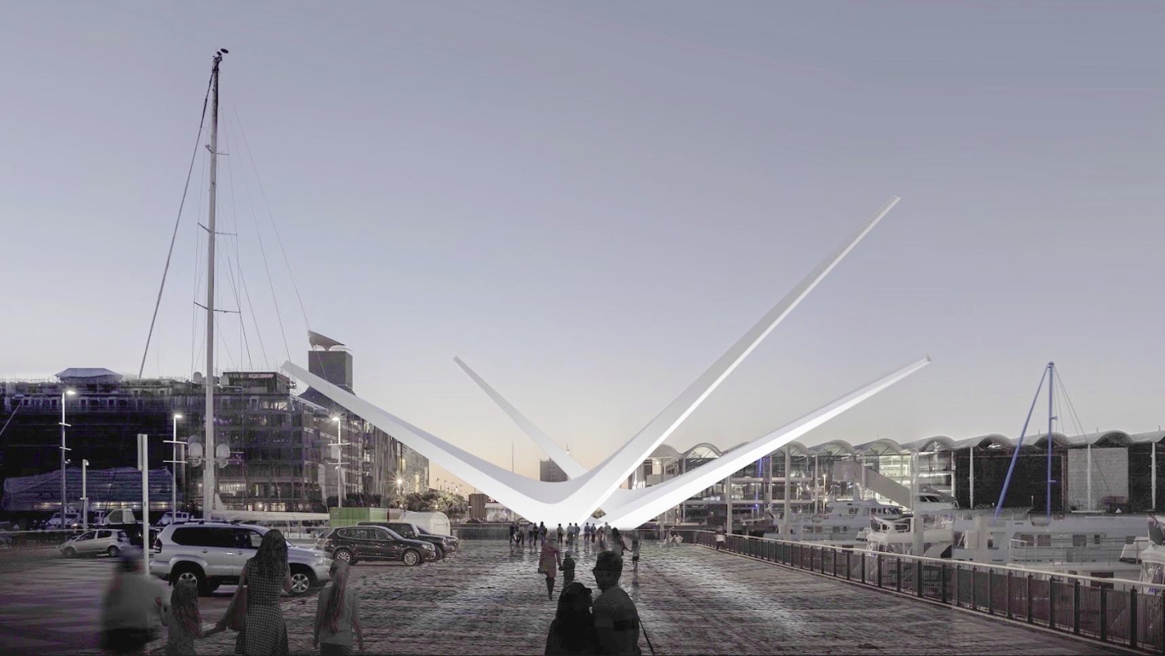
- A new public space on Lower Queen St between Customs St and Quay St
- Commercial Bay opened, including new laneways through it. Importantly an east-west lane will connect Britomart to the Lower Albert St bus interchange
- The Lower Albert St bus interchange will be upgraded
- The Quay St seawall will have been strengthened and Quay St redeveloped into a more people focused space.
- There will also be new public space built out over the water in the ferry basin.
- New ferry berths built along Queens Wharf
As part of the upgrade, Auckland Transport have put out a new video about it all.
I like the way AT are front footing this and how the works are needed now to cater for all the growth in people that will be in or passing through the area in the future. Also that they make it clear the traffic lanes, which were reduced to two late last year, won’t be going back to four lanes when the works are complete.
That the car lanes won’t be coming back is something I think increasingly people are getting the message about. My anecdotal observations from walking between the train and the bus is that already things aren’t as bad as they were when the works started. This will likely see the trend of fewer cars in the city continuing – ATs data shows that in just over 3 years, the number of cars entering the city in the AM peak has reduced by over 5,100. My guess is when we get the data for April to June we’ll see the trend continuing downwards. It will drop even future once Access for Everyone starts to be delivered.

Of course, if you’re someone who thinks the city centre should be designed so you can race through it you’re not likely to be happy about this but my guess is that once the works are completed, like with other improvements in recent times, most people who oppose the changes, like the MP Pippa refers to below, will vanish into the woodwork.
I've been asked to "stop the madness on Quay St" by an MP who wants to continue using downtown as a thoroughfare. This vid is excellent at explaining what's coming to create an amazing destination #loveAKL https://t.co/GYD3FxRZLb
— Pippa Coom (@pippacoom) July 1, 2019
I asked him about his vision for Quay St when Americas Cup is on and he had no answer. Just wants to keep driving the same route he has always taken.
— Pippa Coom (@pippacoom) July 1, 2019
As a daily user of NX1 buses, one project I’ve been keen to get more information on is what is planned for Lower Albert St. That’s because while the busway stations themselves are high quality, the city end is far from it, for example you can’t even top up a HOP card there, and yet the Albert St stop is possibly the busiest bus stop in all of the city. I asked AT what features would be included in the upgrade Here’s what they said the bus interchange would include
- 4 stop locations that cater for 11 busses loading/unloading passengers
- 6 bespoke shelters
- Seating and furniture
- Digital PIDs, information boards and ticket machines
- Wayfinding signage
- Public toilet (located on Commercial Bay land in front of AMP)
- Signalised mid-block connection between the two sides of the street.
I’m glad to see there’ll be a mid-block crossing. One thing I had feared was that there would be some silly attempt to force all pedestrians to use the over-bridge between the PWC tower and the new Commercial Bay shops.
AT also say that construction of the bus interchange is scheduled for late 2019 however that delays to the CRL works on Lower Albert St might have some impact to this.
Further along the waterfront, on Thursday Panuku announced they were “pushing pause” on the new Wynyard Crossing bridge. This was to replace the existing lifting bridge which was only ever meant to be temporary. In pausing the project, Panuku cited the need for additional works and not likely being able to get it completed in time for the America’s Cup. Simon Wilson also suggested that cost was a significant factor with it rumoured to be costing $10 million more than the $27 million initially expected. This is not the first time the permanent bridge has been delayed and personally I hope that the pause is used to come up with a wider design to cater for all users. What was proposed by Panuku was an improvement, but only adding 1.4m to the width was simply not enough for what is such a crucial crossing.

 Processing...
Your comment about not being able to buy a HOP card at one of the busiest bust stops in Auckland is interesting. When I visit most major cities, I can buy a transport card (London, Sydney, Brisbane, etc) from a machine at a bus/train/light rail station, etc. Last year, my HOP card cracked and wouldn’t register, and it wasn’t possible to buy a new one at Newmarket Station because it was 7.30 or something on a Friday evening. Is there a reason why we can’t buy HOPs from a machine? I mean a decent reason?
Yes agreed, even strong paper temporary / 10 trips AT HOP card would be a good idea.
I also think we should also have a confirmed Auckland resident – (maybe postal confirmation) that allows a little cheaper public transport rate.
Why?? Totally object, don’t use our money to subsizde. Those live there shall even pay more as they have already enjoy a lot from us as tax payers.
Um… Aucklanders are taxpayers as well.
I find people who get their backs up about funding things in Auckland tend to come from backwaters who don’t have the population base to man a lemonade stall, let alone fund their own infrastructure.
E.g. Wellington
Sick burn 😉
That’s a bit harsh, I like Welly. But Hum’s comment was pretty ignorant.
Here is a simple proposal I’ve borrowed from Seoul, where my question of ‘how do I buy a transit card’ was answered very easily.
At all major and many minor stations there are vending machines. So put hop cards in the vending machines.
Have a little box this size of deck of cars that costs $20, inside you get a Hop card pre-loaded with $10 credit, and fold out map of the regional network with basic timetable information and travel/top up advice on the back side, and directions for how to register your card online for a bonus $5 credit.
The vending machine folk top them up as per their other products, and make $1 per sale or whatever. It requires no separate machine, no modifications to hop machines or whatever. Anyone with cash, eftpos or credit can buy one anytime of day or night. Simple and effective.
That’s a great idea… so simple for customers.
Until ferryboat transport ti Waiheke and Devonport is totally included in the public transport act and as Waiheke people are made to pay the Auckland public transport levy then it is not a truly Auckland wide model. We on Waiheke pay high fuel costs and have very little benefit from public transport.
Lol – choose to live on a little island then moan about fuel costs and transport options.
Lol. Yes, that’s a very adult response.
I mean it kind of is? Like there’s a bunch of places on *the mainland* which have poor access to public transport. Are we going to suggest that congestion is as bad on Waiheke at peak as it is in, say, West Auckland?
If we are getting into the bowels of a climate emergency, then funding sort of has to go where it has the most effect. As strung out as Auckland is, West Auckland suburbia is a far more dense proposition than the people who have made a choice to live on an Island a 40m diesel ferry ride away.
PS: Also when I was last on Waiheke I saw some people playing hackey sack unironically and the rage has never left my body.
It’s not a public transport levy Karen
I imagine Karen is complaining that Waihekeans have to pay the fuel tax levy (which is indeed not only spent on public transport – Mill Road & Penlink for example). And that the levy is being spent elsewhere, whilst Waiheke has very limited public transport (the ferries being privately-owned and operated). One has to pay $6 a day to use Waiheke’s park and ride, and AT even takes a bit more than $1 from each return ferry ticket in tax to pay for wharf infrastructure. Would you support being charged an additional 50c per bus trip to pay for maintaining the bus stops? I’d suggest either not charging the levies, or preferably using them to support and improve public transport for Waiheke.
I’m pretty sure AT takes 100 % of my bus fare (certainly more than 50c) and uses to cover a variety of costs probably including bus shelters.
Aren’t bus shelters funded by Adshel, who run their billboard ads on the shelters
Some are, but most aren’t.
With advertising, there’s no free lunch anyway. We all pay in the end.
Maybe they need to get Adshel involved with the Waiheke wharf to help ease the burden on long suffering Waiheke residents.
I’m pretty sure your bus fare pays for about half of the cost of operating the service and Auckland ratepayers pay the other half. Anyway, Waihekeans just want to join the same deal you’re on, thanks, given that we’re paying into the pot.
And it sounds like you would like AT to take all of the ferry fares rather than 50c too, so I’ll count you as a supporter of AT managing the service. Could be a nice little earner for them/you. Maybe you could sign the petition to cement your support, cheers:
https://www.change.org/p/transport-minister-hon-phil-twyford-let-s-bring-fullers-into-line
omg speaking of advertising and public transport, one of the worst things about the Waiheke ferries is the tv screens playing a loop of advertising.
Some of the boats it’s impossible to sit anywhere without having one of these screens in your vision blasting sappy ads at you.
You finally manage to put your mobile phone down and lift your head up for a bit, only to have these freaking televisions showing you an ad for tiritiri matangi for the bazillionth time.
What are they planning to do with lower Hobson street? It’s a quiet little street that is quite dingey currently. The fact that very little traffic appears to use it means it could be quite easy to turn it into a pedestrian / cycling friendly shared space. It awkwardly sits between downtown carpark and viaduct and is a bit of a dead zone… Would love to know if there are any plans to ‘activate it’. Cheap quick wins on offer me thinks…
Demolish that over-engineered flyover.
We tried that.
It can’t be done because reasons.
Please stick to the approved question list. Thanks in advance.
I appreciate for public transport enthusiasts that AT doing something slightly more than their current nothing with the temporary site that is Lower Albert is a celebration. In fact, there are already seats and some shelter and public information displays. And nowhere near enough room for buses, having got out on the road there on many an occasion.
But Albert St was never meant to be that. It is a short sort of out of the way zone that was only ever a stop in the journey or the start of the run for some of the more obscure West services back in the 60’s when Commercial Buses and Whenuapai Bus Co, etc. existed or the equally obscure Birkenhead Transport services of the day. In other words a PT sideshow and dumping ground for those private bus companies to operate through.
That AT is now probably spending 7 figures to turn this into some micro hub really says PT is still the same old same old afterthought and they are still not taking it or Auckland Councils climate emergency declaration seriously. Why is such a key termination point located so far from Britomart? Wheres the co-ordination? Why not use Queens Wharf as a start point rather than the current road it is?
It is simply continuing the horrible disjointed public transport modes system with a shoestring budget attitude that is difficult to navigate for the non-enthusiast and by virtue a turnoff.
I think its a stretch to claim 130m is “so far from britomart”. As the video also explained you’ll have 10,000 workers based in the buildings immediately fronting it + untold more within 400-500m.
It is currently 300m and crossing 2 major intersections, enough to be seriously annoying. Not everyone is a fit yuppie.
And if you’re a casual user good luck finding those stops at all. I never noticed any way finding.
From the shape of nearby buildings I guess Tyler Street used to be longer than it is now. How unfortunate.
I don’t think anyone is suggesting the current arrangement is good. AT should certainly improve way finding, but other than that the arrangements are hamstrung by a large amount of construction.
This post is about Albert St in the future once there is a walkway through Commercial Bay that connects up Britomart and Albert Street.
It may seen closer once we can again get off the train and walk out the front of the Post Office – that’ll be just a wander across the square into the connecting lane way through Commercial Bay and to the Lower Albert Street interchange. How convenient!
So your criticism is that AT are building a bus station that will be 130m from a train station the day it finishes, but that during construction, the construction site will be too far from the train station?
I don’t get it?
Also, how is Queens Wharf, which is a similar distance from Britomart and further from the nearby office blocks better?
My criticism is always our mainstay of PT has the most unplanned sporadic random linkage to rail and ferrys.
If you have noticed ferrys are right next to Queens Wharf and pretty much adjacent to the Britomart building. Buses are…wherever the wind takes you on any given day. It’s not just a very critical service like the NEX, that’s just for starters, its every other service.
We want people using PT,
apparently, especially in the Auckland CBD but AT give them this shoddy amateur shit to either work out like a treasure hunt or most likely not and remain wedded to your car.
Get it? Because what I don’t is why would any person support the current mess we currently have rather than demanding far better!
AT could, but they know they can get away with 3rd best.
“Because what I don’t is why would any person support the current mess we currently have rather than demanding far better!”
I don’t get that either. Although I’ve never seen anyone supporting that, so I don’t need to understand that. Everyone here demands better than the current layout.
“My criticism is always our mainstay of PT has the most unplanned sporadic random linkage to rail and ferrys.”
Yeah, the current system is unplanned. We want a planned system. However, by definition, if we have a planned network, there must be a lag between the plan and the execution. The draft plan was laid out in the City Centre Future Access Study and the supporting infrastructure is now under construction. The Lower Albert Street bus stop is part of that plan.
But by all means come here and complain about AT enacting the plan to rationalise bus stops and routes, even though that is exactly what you claim to want. /sarc
P.S. once the new laneway opens and the ferry terminal revamp is completed the ferries on Queens Wharf will be further from Britomart than the Albert Street bus stops.
Waspman – in five years time we will have two new CBD rail stations and all buses linking to at least one of them, which will then allow passengers to connect with ferries at Britomart. How on earth is that an ‘unplanned sporadic linkage to rail and ferries’?
It sounds suspiciously like a plan to me.
Not everyone works in the city, its a passing through point to using another mode. AT know that of course.
But my point is if we want to make PT attractive and practical integrate the 3 modes as seamlessly as possible. The ferry building was supposed to be linked to the Britomart train station by a tunnel, but this is Auckland and we are short-sighted and cheap. But having departure/termination points all over the grid is utterly counterproductive
On the other hand, if we want to remain in the bad old days and marginalise PT then continue to use the “she’ll be right”, “number 8 fencing wire” model and keep planting the bus start points randomly just the way we are and keep patting AT on the back for it!
I am currently in London. It is common to have to walk further than 130m within stations and plenty more between them. Usually with lots of stairs. Using PT involves walking.
Am beginning to think if the above is considered a big problem in Auckland then we really are starting to get more things right.
Well… no. The sequence of events here is:
— The council announces improvements.
— People call BS on it actually happening.
The glossy plans are meaningless unless something actually happens on the ground. We have unlimited skill to make a 130m walk feel like an eternity. You can cut the disdain for pedestrians here with a knife. Something like that doesn’t go away in a few years. Objectively speaking 300m is not that far either… and yet here we are.
Will it happen? Fingers crossed… maybe the Americas Cup will tilt the odds a bit more favourably. Plenty of other such plans have come and gone without consequences.
You’ve missed a few steps, I don’t blame you, the first studies were released in about 2011. I’ve filled in the gaps for you:
“The sequence of events here is:
[-The council commisions and receives the city centre future access study.
-The council uses that to develop the city centre master plan
-The council identifies many improvements needed across the city centre including this specific improvement
-The council makes relevant improvements to an adjacent site a consition of consent
-The council funds the specific improvements]
— The council announces improvements, including the specific improvements.
[-The council packages the specific improvements with other nearby improvements to coordinate work and minimise disruption
-The council releases new materials updating the public on the ongoing nearby improvements.]
— People call BS on it actually happening.”
As a quick check. Can you name any project in New Zealand in the last 30 years that was funded, designed, advertised, consented, and scheduled to start within 6 months that hasn’t been completed? If not, is it fair to believe that council won’t deliver this?
It’s not just this mythical 130 meters, which it isn’t by the way. Trying to find your next bus service, to wherever means searching all over the CBD.
That is not good enough because AT cannot be Eff’ed setting up proper infrastructure terminal for our major PT mode. Honestly picture it if the trains all terminated/departed all over the city, or the ferrys. What a farce that would be but with buses its sweet as.
And just because London has a poor aspect to PT does not make it an excuse for us to have to follow it. Why is is so difficult to accept providing seamless or as seamless as possible mode links is too hard?
By infrastructure terminal you are referring to a bus terminal. The sheer quantity of metro buses in and around the city centre makes this idea completely impractical – the size of such a facility and funnelling all those buses through a handful of junctions combined with moves to improve walking or cycling in this area would be a nightmare. Its also worth remembering that Britomart will no longer be a terminus station so its role within the network will be significantly changed. Transfers from Aotea to bus services in particular will also be important moving forward.
Sailor Boy, I think you’ve also highlighted that our processes are unfit for the necessary rate of change. The many steps involved and the timeframe would be acceptable if stability was a goal. It’s not. It’s been happening against a backdrop of increased car ownership, increased wasteful consumerism, increased carbon emissions, increased traffic danger, especially for vulnerable road users, decreased physical activity, and climate change.
The question is how to pare back the process for projects that are people-focused and sustainability-focused.
I’ve just gone through and double checked. It’s not 130m, it’s 150m, fair play.
*Currently*, “trying to find your next bus service, to wherever means searching all over the CBD.” Yet again, you refuse to acknowledge that AT already have a plan for city centre bus transfers. Why are you continuing to repeat this despite having been repeatedly shown the plans?
Have you considered that it may not be that AT can’t be ‘Eff’ed’ to set up a terminal? Have you considered that AT may have (correctly) decided that that would be a terrible arrangement. We want buses from the North Shore to go to the University, we want buses from the central isthmus to go to Wynyard Quarter, and we want most buses to go past Aoeta or Britomart. That isn’t possible with a single terminal. Even if you could get 500 buses an hour to and from a single terminal. Instead, AT have proposed terminals at Britomart, Wynyard Quarter, and Grafton Gully, with all buses crossing eashother, except for the eastern bays buses. A really sensible, practical solution that means we don’t have to waste an entire city block on a sbpar terminal.
I can’t see how running NX1 buses onto Queens Wharf would be an improvement over using Albert Street. At best the walk to Queens Wharf would still be about 2/3rds the walk to Albert Street.
For this relatively small gain we would have to run NX1 buses through an area that is being designed for an increasing number of pedestrians and also commit Queens Wharf to having buses on it for years. Presently we could remove vehicles from the wharf tomorrow if we had the will.
It is indeed very close to Britomart, through the laneway being formed in Commercial Bay.
It’s also going to be both sides of the street, arriving and departing in loops up Albert and out to the North.
It partners with a yet to be determined similiar interchange out the back of Britomart.
It doesn’t make sense to get all those buses hurtling around the Queens, which is already under too much vehicular strain with the tour buses and supply trucks for our oh so fragile cruise ship industry
Time to ditch the stupid bridge plan and build something with capacity for crowds. For that money they could have a basic Blues Brothers style of lifting bridge. If they want art just dump a big bouldery thing at one end and say it is inspired by Maori anchor stones like the Bledisloe building thing. You’re welcome.
Casual racist remark.
Could you point out the part where I am being racist please so I can modify my behaviour in future? https://teara.govt.nz/en/photograph/44468/russell-clark-anchor-stones-auckland
I am not the dude that appropriated someone else’s culture to sell a shit sculpture to the public.
Cheers for the explainer on that Miffy. There seems to be an attitude now that active modes infrastructure must be beautiful, which is nice. However, there is no understanding that something can be useful or even utilitarian and be beautiful for that so everything is made decorative.
Yes. And there’s nothing uglier than something made at great expense yet unfit for purpose.
I think the swank elements of the bridge design probably required the narrowness, and therefore made it unfit for purpose. I would’ve hoped the public would only get excited about swank designs if they are a result of solving the design challenges most elegantly and innovatively.
Given the preference for an east-west bias over north-south corridors across the city, I do wonder whether Wellesley St should once again allow non-public motorised transportation to run west between Kitchener St and Queen St. You can drive east, and can legally turn left out of the Lorne St shared zone by the Library to the Queen St intersection (attracting “that can’t be legal” surprised looks from bus drivers). If the plan is to route remaining cars and service vehicles via Mayoral Drive, then AUT needs an underpass rather than a crossing with a set of lights. But with Britomart and surrounds dedicated to public transport, Lower Albert St as a tack-on, how many chunks of the city will be reserved for stinky idling diesel buses? Or is it time to turn the Wynyard Quarter depot into an actual terminus, as Britomart once was, on several levels, and park buses outside the CBD?
On the contrary, east/west private traffic crossing Queen St at Wellesley should be the first to go as it becomes bus only at least from Elliott to Lorne St.
Mayoral Drive is overengineered already, the crossing should be raised to lower speeds not separated to raise them.
It’s time to make the city the terminus, and park stinky idling cars outside it.
+1 the crossing at AUT should be widened, raised, and give more time to pedestrians. Private cars should be totally banned both ways Elliot to Lorne and the one way on Elliot reversed.
Is AT still planning to run buses up the western side of Queens Wharf or have they decided to drop that mad idea?
Tour buses and supply trucks for the cruise ships. Yes.
Only temporarily though – as is the same for the bloody great bollard they’re putting in the water – while Captain Cook wharf is cleared of cars and readied to take the ships.
Shouldn’t be more that 15 years according to the reports and resource consent that was approved recently.
Wouldn’t it be great if the Ferry Terminal had that awful domestic-style tiled roof removed?
This is a great video, especially for those not familiar with what is happening around downtown. Interestingly it’s not publically listed under their YouTube channel from what I can see? Had just tried to find it to show someone else.