It’s Friday again and here are some of the things that caught our attention this week.
This Week in Greater Auckland
Unfortunately with the long weekend and various personal challenges we haven’t been able to publish as many posts as we would have liked but yesterday Matt took a look at how public transport ridership and cycling numbers are tracking since the fuel crisis kicked off.
Lake Road
Auckland Transport appear to be abandoning their long running plans for Lake Rd in favour of a short term sugar hit and hoping that one more turning lane will fix some of the problem.
Auckland Transport (AT) is proposing much needed improvements to Lake Road through the Belmont Shops, to unbuckle this often-congested intersection from bumper-to-bumper traffic.
Anyone driving along Lake Road to or from Devonport or Bayswater has likely endured the pain of a long wait at this notorious choke point.
The road network around the Belmont Shops hasn’t been improved for decades, and AT believes the time is right to modernise this area and install a fit for purpose roading design.
…..
What are the improvements that are so urgently needed?
At the Belmont Shops intersection, cars struggle to merge from two lanes back to one lane after the intersection, with not enough space provided on the road to keep the queue from stopping in the middle of the intersection.
There are also issues such as confusing layouts, busy pedestrian crossings and cars moving in and out of parking spaces contributing to congestion and safety concerns.
Chris Martin, AT Group Manager of Road Network Operations, says the proposed changes will improve the accessibility, reliability, and availability of travel choices to and from the Devonport peninsula.
“We’re proposing low-cost, high-impact changes that will help keep this section of Lake Road moving safely and efficiently for everyone,” he says.
“They’ll include a morning clearway, clearer lane layouts and road markings, safer pedestrian crossings, and some bus stop and route changes.
“It will be easier and more convenient to travel to local shops, parks, beaches, and community centres.”
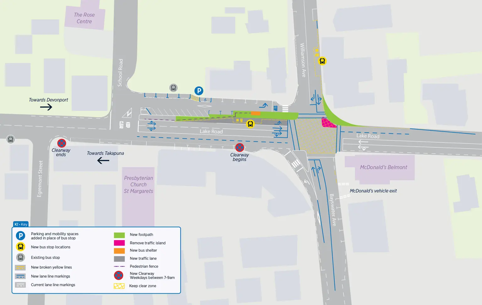
It’s notable that improving travel choices doesn’t seem to include any bus or transit lanes or any bike lanes, like previously proposed.
Consultation on these changes is open till 21 June.
Pedestrian Level Crossings all gated
AT say that all pedestrian level crossings in Auckland now have automatic gates
All pedestrian level crossings across Auckland’s passenger rail network now have automatic safety gates, part of a city-wide rail safety programme to be ready for more trains when City Rail Link opens later this year.
The final pedestrian safety gates were opened this week at O’Neills Road in Swanson.
To be ready for City Rail Link, 26 pedestrian safety gates have been installed and 15 level crossings have been closed or replaced with a safer connection over the past 10 years. Across the network, a programme of about 250 other safety improvements at rail level crossings are close to completion – including footpath improvements for pedestrians, lighting and signage upgrades, tree trimming and median island treatments.
…..
Between 2013 and mid-2026, there have been 415 near misses at pedestrian level crossings. Pedestrian level crossing near misses peaked in 2017 and since then have reduced by around 80%, a testament to the ongoing safety improvements across the network.
O’Neills Rd was originally planned to be closed and would have left locals needing large detours to account for so it’s good to see that AT have found a way to keep it available.

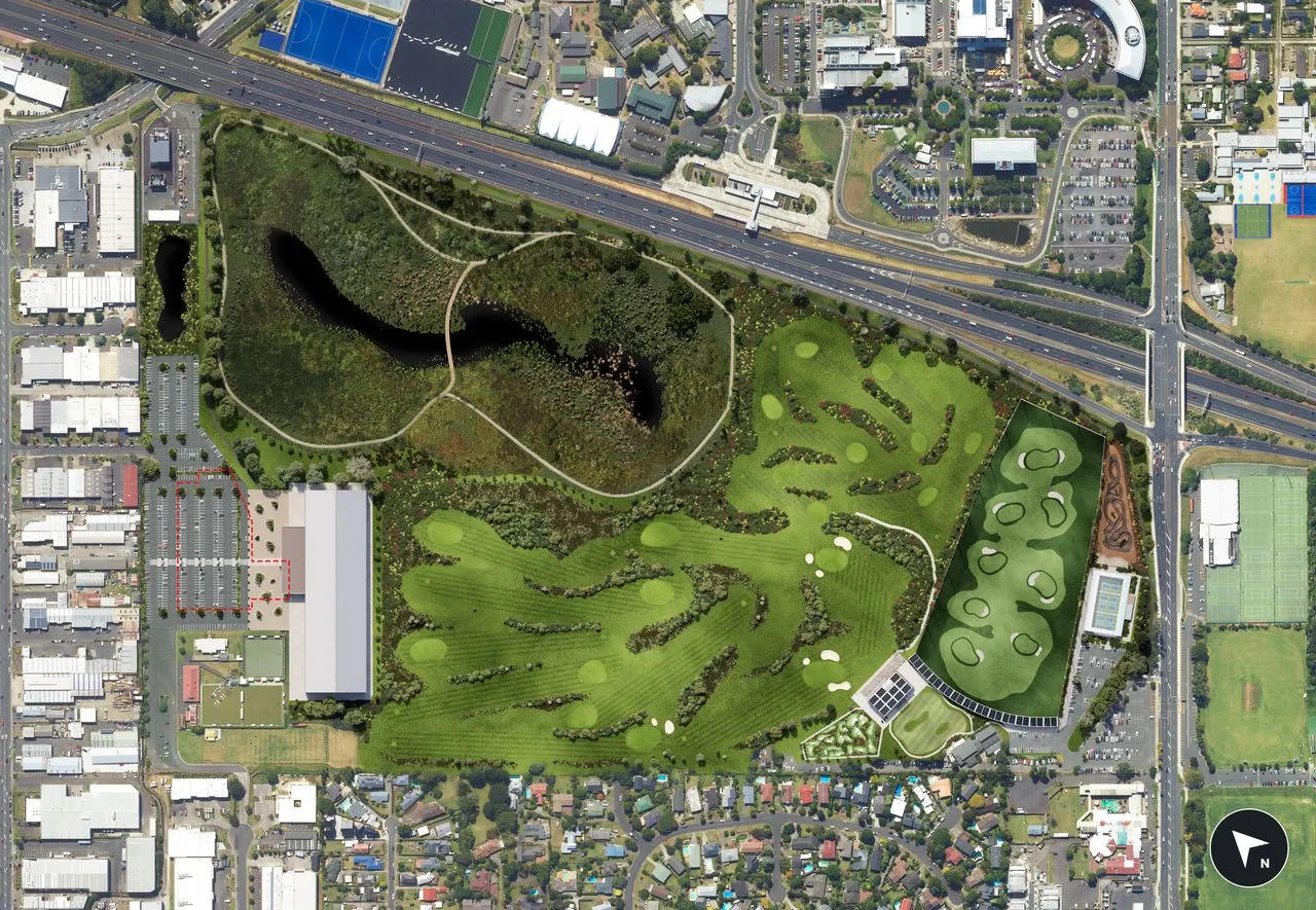
Golf before citizens?
Simon Wilson has an astonishing story of a local board overriding consultation & a deliberative citizen’s assembly
Council officials engaged in good faith, with considerable expertise, seeking good outcomes for the city. Iwi were well consulted and the government was kept in the loop.
And something remarkable happened. Despite all the feuding, the final recommendations of the officials aligned with the core demands of the golf community, and the stadium, and most other park users.
They also aligned with the preferences expressed in the community consultation process. The two local iwi, Te Kawerau ā Maki and Ngāti Pāoa, were also on board, as was the neighbouring Devonport-Takapuna Local Board.
And, critically, they aligned with the recommendations of the deliberative forum. Consensus. Super-consensus. Everyone agreed.
But at that board meeting, Grant proposed a motion that effectively rejected the consensus advice. It passed unanimously. What happened?
Great, now do cities too
The Rotorua Daily Post reports:
The Government is funding 42 new e-bike charging stations in the regions, including 12 in Rotorua and one in Taupō.
Tourism and Hospitality Minister Louise Upston said the stations, which charge and secure multiple bikes, made cycle trails more accessible and attractive for tourists and locals.
Build it and they’ll come
While our government are pushing ahead with a new harbour crossing and providing nothing for walkign and cycling, here’s the results of Sydney’s newly opened ramps connecting to their Harbour Bridge
https://bsky.app/profile/urbancyclinginstitute.org/post/3mm532rxauc2x
Car Blindness in action
A classic case of car-blindness, perhaps they should ban general traffic entirely, or make it one-way but two lanes, if it’s that critical a route? Cars can block anything, and nobody will notice.
A controversial in-lane bus stop that blocks an arterial route to Waikato Hospital “has failed the common sense test” and is being reviewed.
Hamilton City Council replaced a bus shelter in 2023 with in-lane bus stops, and built a separated cycleway and a raised pedestrian crossing on Pembroke St, a main route to Waikato Hospital, airport, and SH3.
…..
“The reality is it’s an arterial route to the hospital… for fire engines, ambulances, and all that sort of thing,” Hamiltonian Stuart Aitken, who uses the road often, said.
“The reality of a bus blocking a lane when there’s possibility of an ambulance flying through in an emergency to me seems a bit of a no-brainer, as a potentially daft decision.
“It’s just an impedance to very important traffic to me and to a lot of others.”

A certain Greater Auckland member has clearly been moonlighting as a sign model in Japan:
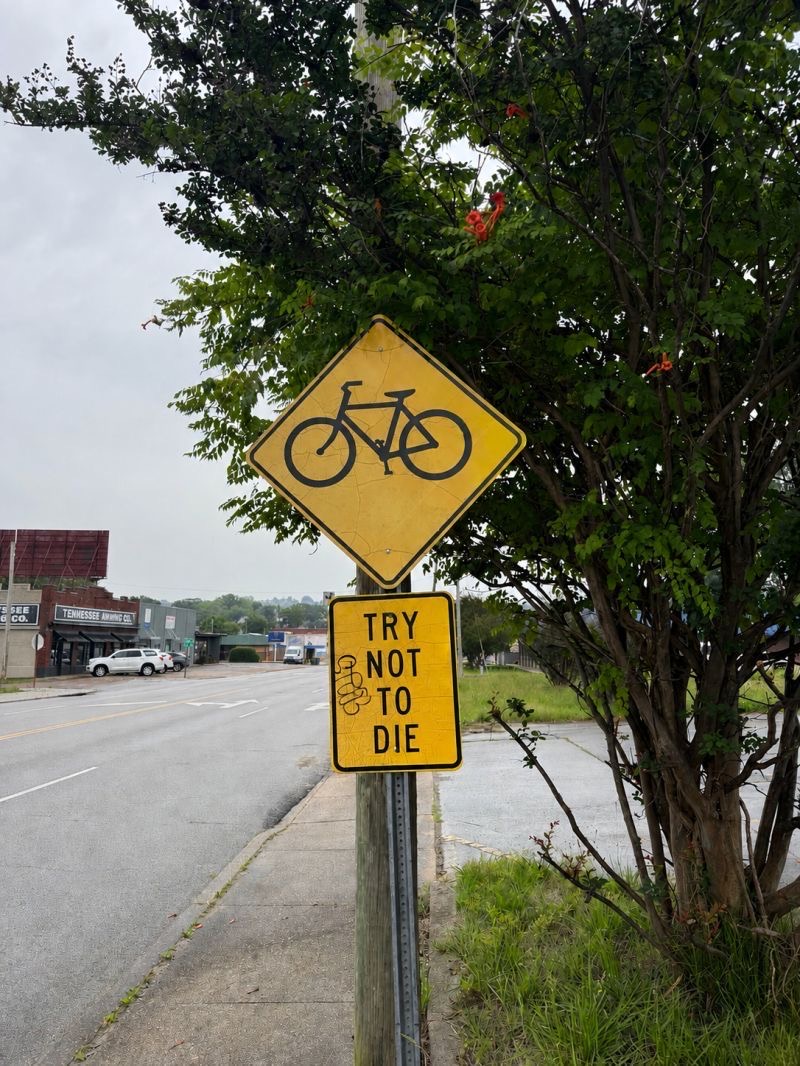
Truth in road signs, what we daily face in Auckland due to the woefully incomplete safe cycling network:
Some videos to keep you busy
Fixing the London Underground’s heat problem.
Stations can be more than just places to pass through.
On the Athens Metro
This one is particularly relevant to the politics around road pricing and includes a great interview with Mayor Sadiq Khan.
Sensors to improve the streets

 Processing...
Lake Rd, yep that will help!
1hr 44min from Devonport to Pt Chev, Friday last leaving 2:30pm! Most of that was Lake Rd, and the jam extended well past Belmont
No signs of accidents or other hold ups
Lake Rd is the Gordian Knot of transport issues in Auckland.
Fantastic argument for using public transport: Journey Planner suggests around 45 min from the ferry terminal to Pt Chev shops. Plus a bit either end for actual origin/destination. And easy and stress-free. Not picking on you personally, but why don’t all those people stuck in congestion around our consider the alternatives before rushing into print to demand road upgrades which might save them a minute or two at best?
Apart from the fact the the actual bottleneck around there is the Bardia intersection and this proposal does nothing for that – the clearway along there is only in the AM peak so it won’t be any different for that trip at 2.30/3pm
The big picture solutions are cycleway/bus lanes for PT/emergency vehicles and possibly for heavy vehicles.
For those intersections the solution is to simplify them by removing all right turns, then building roundabouts on the side streets, which allows all movements, just makes right turns turn left, U turn at roundabout then piggyback the sidestreet phase.
For more than 20 years, the Bardia/Winscombe intersection has been well known to be the problem. The proposal for Bayswater/Lake doesn’t require buying any land. Bardia/Winscombe still sits in the Too Expensive ‘Pending’ tray. Anyone want to start a Go Fund Me page?
The one good thing about the traffic on Lake Road is that it acts as a deterrent to future residents who would move to the area who would need to drive on Lake Road. I know heaps of people who would love to move to the peninsula but don’t because they can’t face Lake Road. That’s awesome. It means that the only people who do move there do so either
1 – knowing it’s bad and suck it up (you can see this on the comments on the Local Facebook pages i.e. someone whinges about traffic and everyone piles into them saying it’s always been like that, move away if you don’t like it) or
2 – are happy to use PT, bikes, walking, travel off-peak, to get around
That Belmont proposal is dinosaur thinking. AT really do not get it. Even if this intersection were the actual problem (it isn’t) this ‘solution’ would make it worse.
Ironically, taking away some of the space given to traffic lanes would actually help.
– Much quicker cycles
– Less time given to the Pedestrian Barnes Dance due to shorter crossing distances
– Less merging issues
– Not sure why they even bother providing a right hand turn into Bayswater Ave, most locals know to just go straight through and turn right onto Roberts rather than wait for the right hand green at the intersection
– less traffic lanes for queuing provides space for cycle lanes (to allow the people to actually opt out of their cars rather than be forced to share with multiple lanes of traffic (often speeding at more than 60kmh).
– allows more parking to be kept for some of the local businesses
The Motu Move website is now showing an updated schedule https://www.motumove.govt.nz/about-motu-move#where-can-you-use-motu-move Wellington Q2 next year and Auckland Q4 next year. Could this finally be the achievable go live timelines?
Nice.
eScootered to the start of Te Are Tapua path in Wellington last (perfect) weekend. Our Flamingo eScooters flamed out 20m short of the start. Sunny day so we walked to Petone, grabbed a pie and coffee then walked back.
The short eScoot cost us $35+ for not very long so we walked back to the CBD. Starting to run late (we did cover more ground on the scooter than i realised) a very flash 2 story eBus stopped just in front of us. Kind driver said yep- just hold up your credit card, and tag off at the end. No fuss, no drama, no find the right card for the moment, it just worked. I didnt check the fare, probably peanuts. A couple of students behind us were lamenting the state of public transport, and the economy. One had to switch busses to get to somewhere. Seemed like living the future compared to my part of busless til recently Auckland.
Motu move – can we have our $1.4B back please. Its really not needed.
The limits of available space and further modification of the road network around Devonport makes it a good candidate for targeted congestion charging to encourage modal shift.
Zimmer frames are increasingly popular in Devonport
Not very fast though. Very basic form of transport.
pretty sure the devonport upgrades have been timed to just after the pedestrian and cyclist upgrades across the harbour.
Its been known for years that allowing city side cyclists into rider hostile north shore is inviting death and serious injury. Wellington are just keeping the hospital admissions low, and the traffic slow.
As someone who walks the route between Takapuna and Devonport semi-regularly and knows all the roads somewhat well, my solution to the problem of the traffic flow there would be to resurrect the tramway that used to run between the two in the 1920s. The pathway the trams took is still there in the widened roads. Why not re-lay the track, use battery-powered trams, and they could take on a good chunk of the passenger load? Of course, this is wishful thinking, but it would be much easier than the proposal being put forward there.
not to be anti-light rail, but you could achieve much the same effect for lower capex with bus/T3 lanes, electric buses, and by upgrading the 814 to a frequent route
True but the world generally views trams as better then buses so will generate a farhider ridership and this less congestion then buses everywhere will.
I’ve got a few issues with the Lake Road proposal but it starts with the basis for it on the AT website which says:
“Why changes are needed. Your city is growing fast, with more people choosing to live on the North Shore and in Devonport than ever before. Lake Road is already heaving, and with more homes being built and more people moving into the area, pressure on this road will continue to increase.”
Which is just basically incorrect:
– The Devonport Peninsula population south of this intersection has grown by 0.2% over ten years, and this growth was almost exclusively as a result of the Rymans retirement village (so little impact on peak hour traffic).
– It is also not expected to really grow, with council’s current growth projections predicting under one hundred extra people living south of the intersection over the next 30 years.
– And in line with the population reduction, Lake Road traffic, all day and in peaks, has reduced at this intersection according to AT’s public traffic counts.
I (pretty obviously) live in the area and would love to see changes to Lake Road, though not necessarily these improvements. But whatever your view on the proposal it’s always best to start from an accurate understanding of the problem rather than parroting generic justifications and looking to ‘optimise’ for optimisations sake.
Not knowing the area well, it is good to hear this local perspective. For me one thing I think AT fails to do well/at all is evaluate trip start points and destinations and work from that basis on what can be done to support other modes to reduce car dependancy.
That is an excellent post Al C and really interesting information. If only AT looked at the data and then got out in the community and communicated a bit better.
Valid points, and definitely have called out AT on some disengeniuous explanation here. It honestly looks like they have just taken a generic template for the text. I understand most (all, if one excludes the Ryman village) of the growth is happening from Belmont north (especially in the area between Hauraki cnr and Esmonde Rd). If traffic is ever going to run smoothly then there needs to be a major intervention in the form of an alternate arterial route from Belmont to Takapuna. Idk if this a viable or even a good, but not sure how such an intractable problem will be solved by tinkering with an intersection.
So inspite of a near current, and predicted, stable population, we have growing congestion.
Simply, we have more of the spacially grossly inefficient low occupancy cars cluttering the limited available road space.
Like the harbour bridge two decades ago, the answer is not to create more lane kilometres, but to create the conditions to get people into spacially more efficient modes of transport. Like the harbour bridge create more bus infrastructure and services, but here also, more cycling infrastructure.
On this peninsular, car mobility has reached saturation. Alternatives to car transport are required for further capacity gains.
Need to differentiate between human population and vehicle population. Clearly, if human pop is staying constant, and car pop is growing, then number of cars per person is growing – and this needs to stop and be reversed. Best thing ever therefore is that petrol prices keep going up, taxation / congestion charges are applied and keep going up, and that parking costs keep going up. Make it way too expensive to drive your children to school. Install cycle paths everywhere, restrict the amount of space on the roads for cars, force children to walk or cycle and effectively: ban unnecessary car use. Ban use of Utes by those that are not farmers or construction workers.
Or: make public transport better, faster, cheaper, and more convenient for the public to use.
Hamilton bus-stop bust-up: Standardisation can play against success. Probably the wrong place for a Goteborg choke-stop. Using different component mix, traffic flow could probably be maintained along with adequate bus shelter, boarder, footpath and cycle path. Next to Hamilton Lake Clinic, if you want to explore Streetview.
Democracy in question. If Local Boards can make decisions like this, where has devolved decision-making ended up? With a scattering of Road Controlling Authority governance under the new Act in Auckland, a strong policy commitment on how decisions are to be made should be expected from each Local Board, to defend their members from partisan lobbying and vitriol. Being able to say “We committed to deliberative democracy” before applying it to the AF Thomas Park decision would perhaps have enabled support for a different decision.
Exercise of RCA responsibilities is now going to be widely tested.
local board RCA’s – a brave new world, followed by “its time to centralise decision making to save costs, and duplication and improve co-ordination”
These things are tidal.
Time also to get onto the local board, if you need that special decision…
The AF Thomas park decision by the Local Board to save the golf course at all costs I’m sure has absolutely nothing to do with golfers being the type of people who vote in local government elections and know how to pressure politicians.
Same as I’m absolutely sure that when the Local Boards take over from (the politically neutral and unaffected by voting patterns) Auckland Transport there won’t be any car drivers above all else bias in their decisions going forward.
Deliberative democracy would solve alot of our problems and get us better results for things like transport and transit solutions, etc.
Even as an avid golfer, the board’s decision to override the process p!sses me off, big time.
I’m impressed they are actually get rid of a slip lane on that Lake Rd intersection. They are also using parking space for more footpath & for more lanes going east.
I like the look of what NYC is doing with the monitoring cameras. It would be great to get something like this set up here, starting in key problem areas as a starting point. This will give us some better data to use to make better transport decisions that balance the needs of all road/footpath users.
AT do have similar camera tech, seen some vid on it – using it for some crossing etc.
True but the world generally views trams as better then buses so will generate far higher ridership numbers meaning less congestion then buses ever will.