The last week has seen not one but two important additions to Auckland’s cycling network, a positive sign of what’s possible in otherwise stressful times.
On Tuesday, a dawn karakia marked the official completion of the Great North Rd improvements.
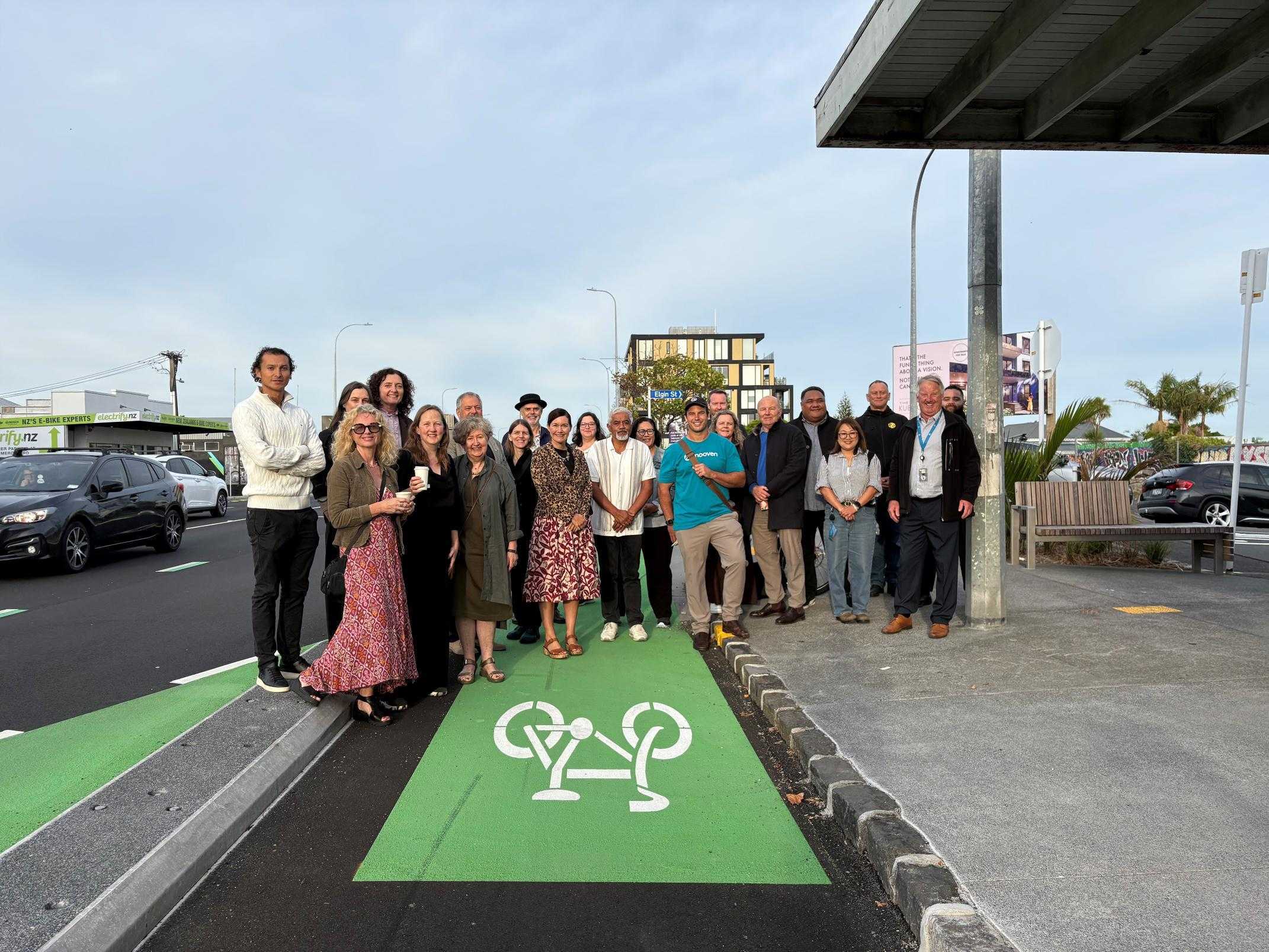
Some of the many people who contributed to getting Great North Road’s glow-up over the line – a task that for a while there, felt impossible. Image: Tammy Flavell for Auckland Transport.
The bike lanes along the ridge have already been open for some time, and they have made a huge improvement to both the corridor itself, and all ages access to and around adjacent neighbourhoods.
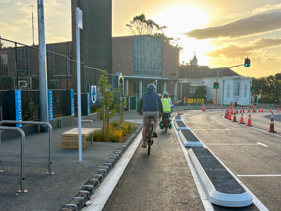
December 2025: Just after the tim-tams went in on Great North Rd, early riders trying out the lanes. Image: Jolisa Gracewood
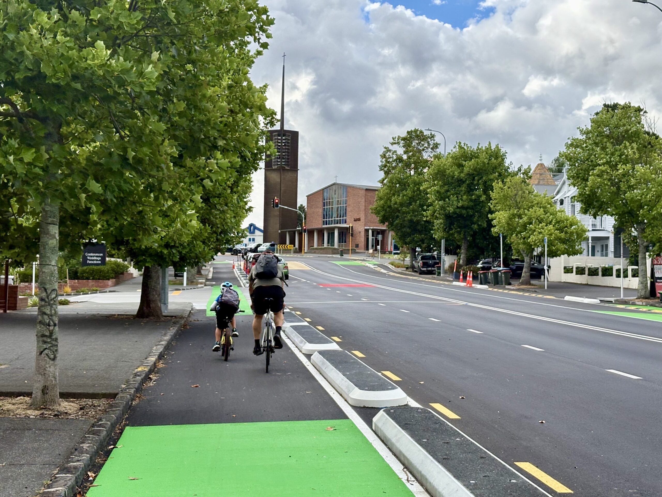
January 2026: parent and child using the bike lanes on Great North Road. Image: Jolisa Gracewood
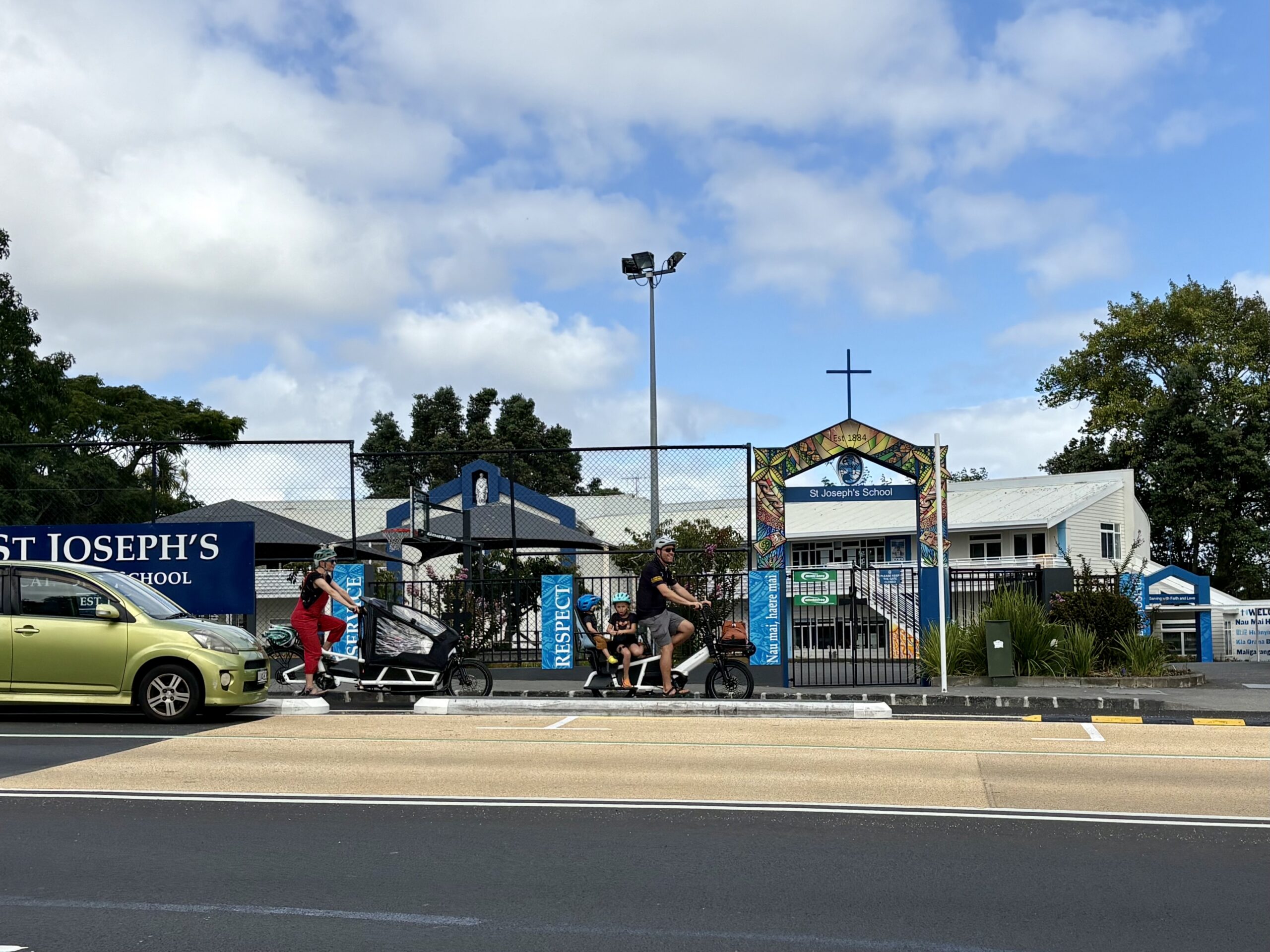
March 2026: cargo bike family using the bike lanes on Great North Road. Image: Jolisa Gracewood
Meanwhile, last Friday the long-awaited first boardwalk section of the Te Whau Pathway was officially opened to the public.
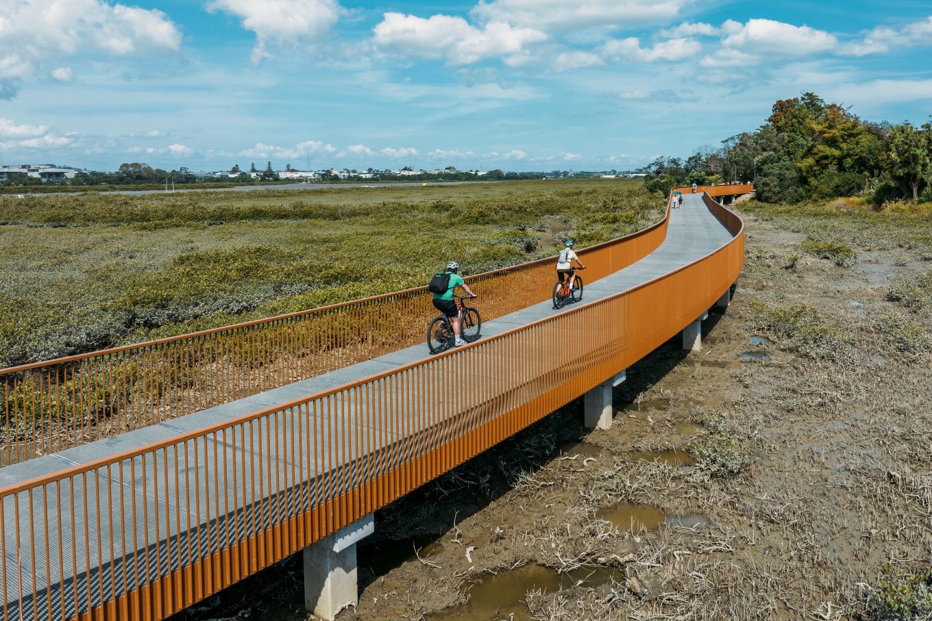
People enjoying the new boardwalk section of Te Whau Pathway. Image: Auckland Council
The event was covered by Our Auckland:
How would you like to walk or cycle alongside the Whau awa? A key section of Te Whau Pathway is complete and open for Aucklanders and visitors to use and enjoy.
The Northwestern Cycleway to Horowai Reserve section in Te Atatū was completed earlier this year.
More than a hundred people attended the opening ceremony on 20 March, mostly from the local community.
Councillor Shane Henderson has been involved in this partnership project with Te Whau Pathway Environment Trust since it began in 2014. He says this major milestone is an asset for Tāmaki Makaurau, especially those in the west.
“The new boardwalk stage of the Te Whau Pathway is a major piece of infrastructure ready for Aucklanders to walk or cycle on, doubling as a new sustainable transport route or place to exercise.
“The pathway will particularly benefit the West Auckland community, and is a vital connection between the northwestern cycleway and Horowai Reserve.
This project has been such a long time in the dreaming, planning, and arriving – kudos to all those who have clung fast to the vision! – with a vital boost arriving via Crown funding from the last government for this critical section.
While the completion of the full project (which will run from Te Atatū to New Lynn, linking the Waitematā and Manukau harbours) is still some way off, this new section of pathway is a really useful addition.
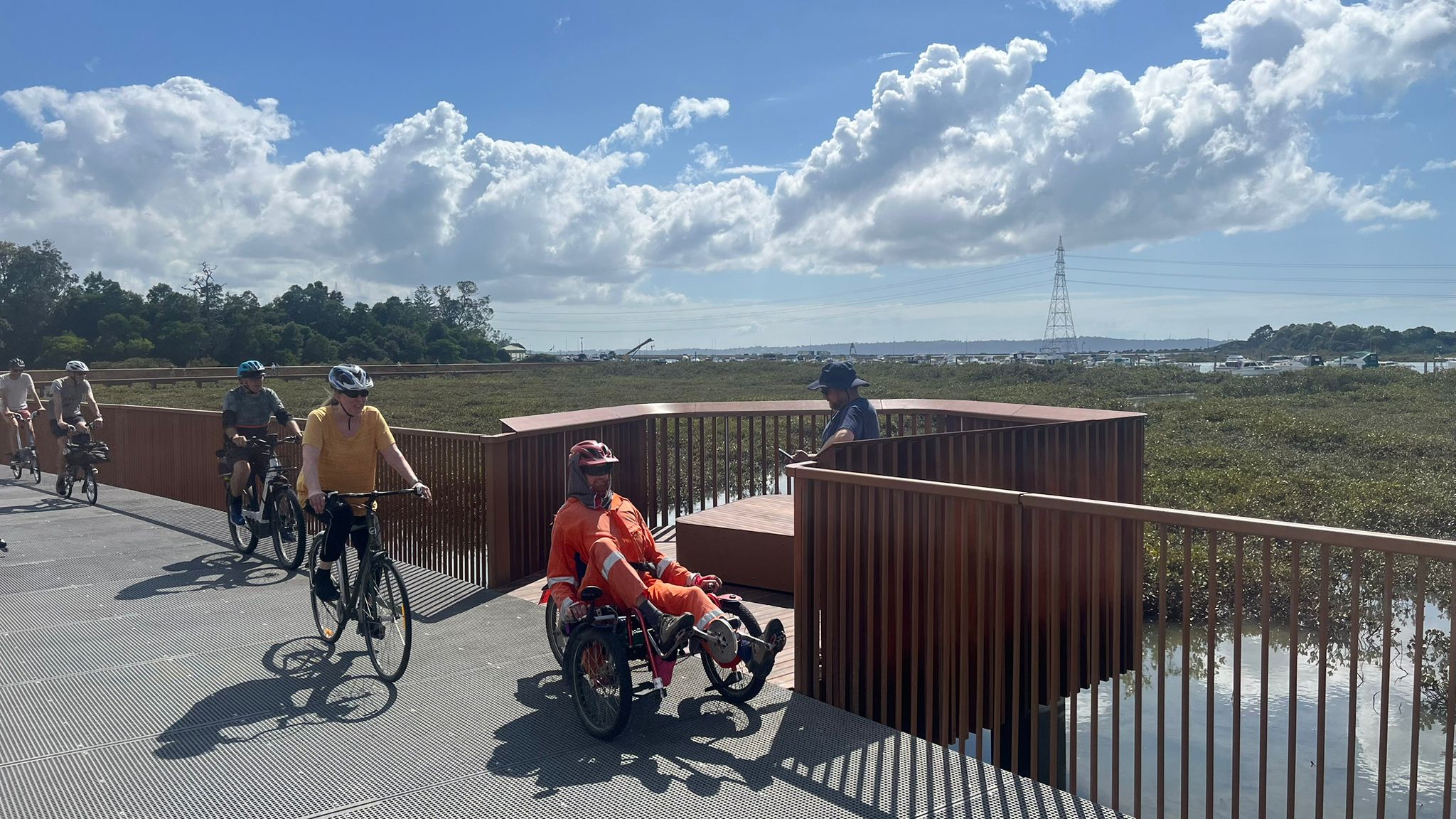
Bike Te Atatū organised a group ride along the new path, which features pop-out observation decks for pausing to enjoy the views. Image: Jane Clark, via Bike Te Atatu
As well as giving people access to – and a fresh perspective on – the Whau River and its environment, the path also gives many people in Te Atatū South a great, safe, scenic new way to connect to the NW cycleway. Very welcome in the current context, especially as the other main link from south of the motorway, Te Atatū Road, remains pretty hostile for cycling.
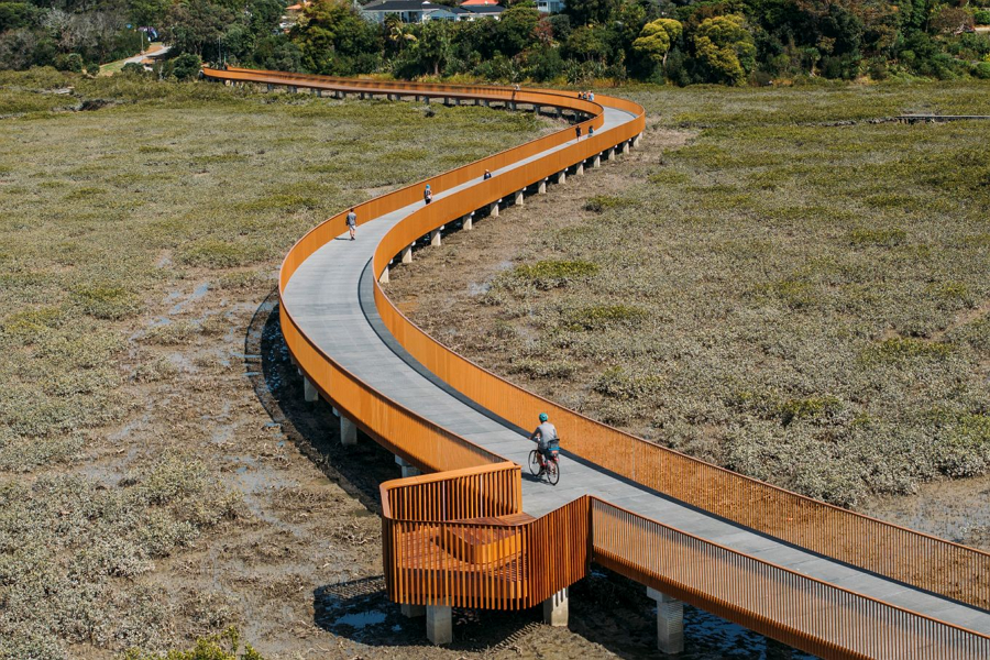
Not a render: an aerial shot of the new path in action. Image: Auckland Council
It’s also not often you hear of a project – especially with design and engineering like this – coming in under budget. In fact, it came in far enough under budget for an extra 400m to be built:
The shared path is 1.3km of 4m wide boardwalk sections and 3m wide concrete paths connecting the Northwestern cycleway and Horowai / Roberts Field in Te Atatū South. The build went well, delivering ahead of original planned time and under budget.
…..
In September 2025 the government confirmed funding for the next stage of the pathway – a 400m stretch linking Ken Maunder Park and Rizal Reserve via a new bridge. The funding was prioritised from savings on the original planned section of the pathway that opened on 20 March. Construction on this additional section is due to start in April and be completed before November this year.
The section just completed is the green section at the northern end of the project on the map below, while the freshly funded section is in blue. (The orange sections are currently unfunded, and the other green sections have been completed.)
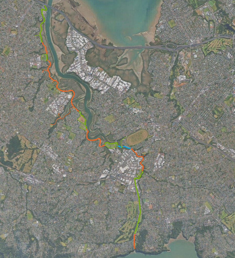
Map from Te Whau Pathway project, showing the completed sections in green, and unbuilt sections in orange. The latest section to be funded is in blue.
This does raise the question of what next…
Of course it will be great to see Te Whau pathway continue to develop towards completion. It already has resource consent, and much of the design work is now done. Plus there’s bound to have been a lot of knowledge gained in building the boardwalk that would enable other sections to be built easier.
That got me thinking: what if we could take what’s been learned about construction and design from Te Whau, and replicate it along the nearby Henderson Creek – linking up Massey, Royal Heights, West Harbour and Hobsonville.
This would open up more options for people in how they travel for work, education and recreation. For example, it would make it much easier – and shorter, and safer – for people living near the path to get to the NW cycleway, or the future busway station at Lincoln Rd.
Or imagine someone living in Te Atatū Peninsula being able to cruise up to the Hobsonville Markets, or many other types of trips.
I’ve also previously suggested a path from Triangle Rd south along the water to expand the catchment of the Lincoln Rd station.
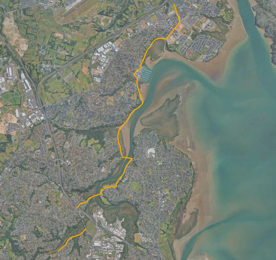
Map by Matt Lowrie, showing the potential for additional waterside paths along Henderson Creek, Te Wai-o-Pareira, in the neighbourhood around Te Atatū and westward.
We’ve seen – and will continue to see – some other similarly impressive off-road paths around Auckland. The Eastern Path from Glen Innes to Tamaki Drive, Te Ara ki Uta ki Tai is one prime example, with the boardwalk currently under construction to complete the full pathway.
I’m sure there are other locations where this kind of design could result in some more iconic and useful paths for Auckland, maximising access to and enjoyment of the natural beauty of our location, while also expanding travel options.
Where else should be considered?
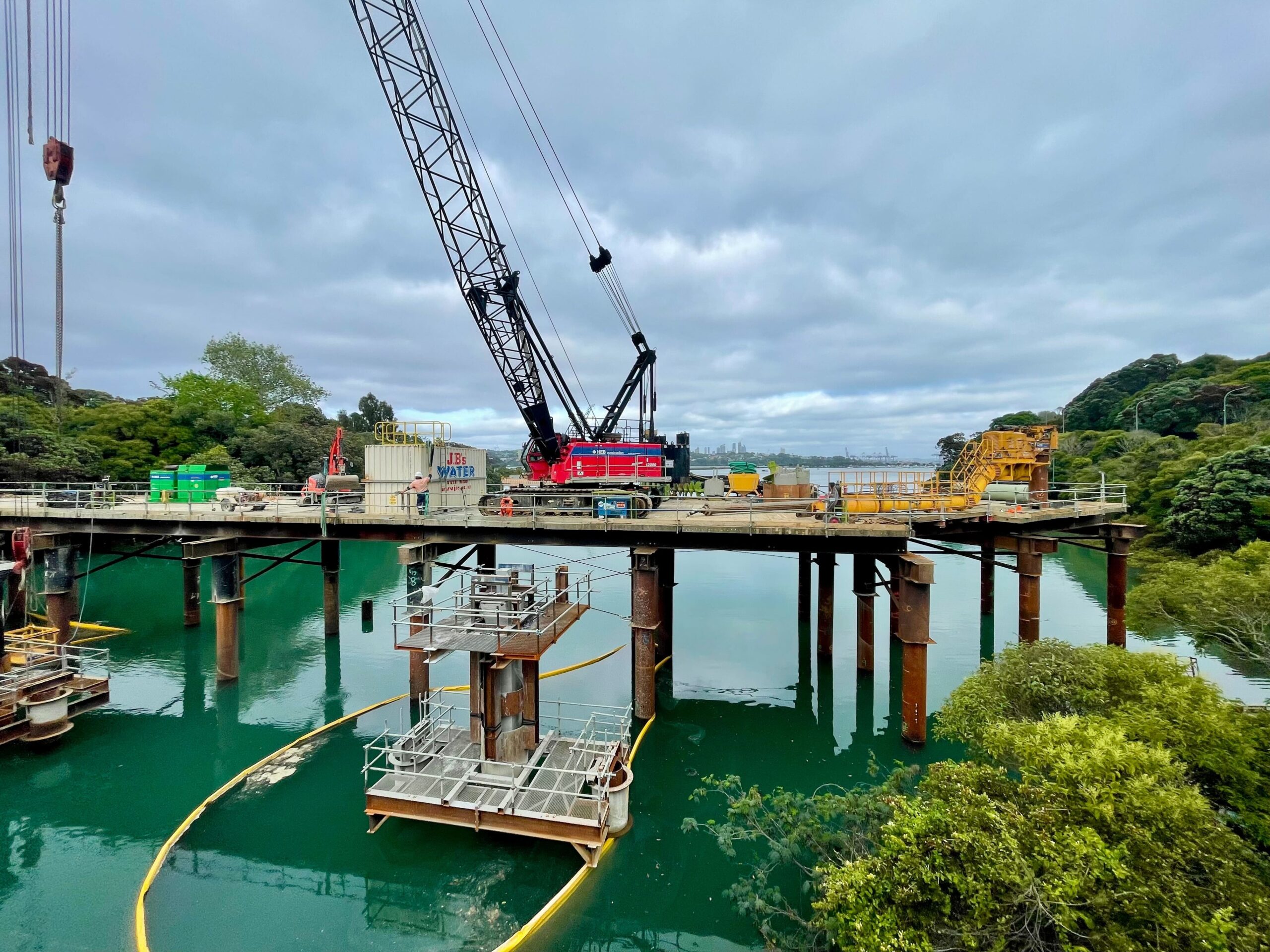
December 2025: final section under way of Te Ara ki Uta ki Tai/ Glen Innes to Tāmaki Drive pathway. Image: Patrick Reynolds
And, while these spectacular and well-engineered off-road paths are great, let’s not also forget all of the humble, straightforward on-road connections we need to be adding.
For example, with Great North Rd now completed through to Crummer Road, it really highlights the gap though the Grey Lynn shops to Surrey Cres – and then along Old Mill and Garnet Road.
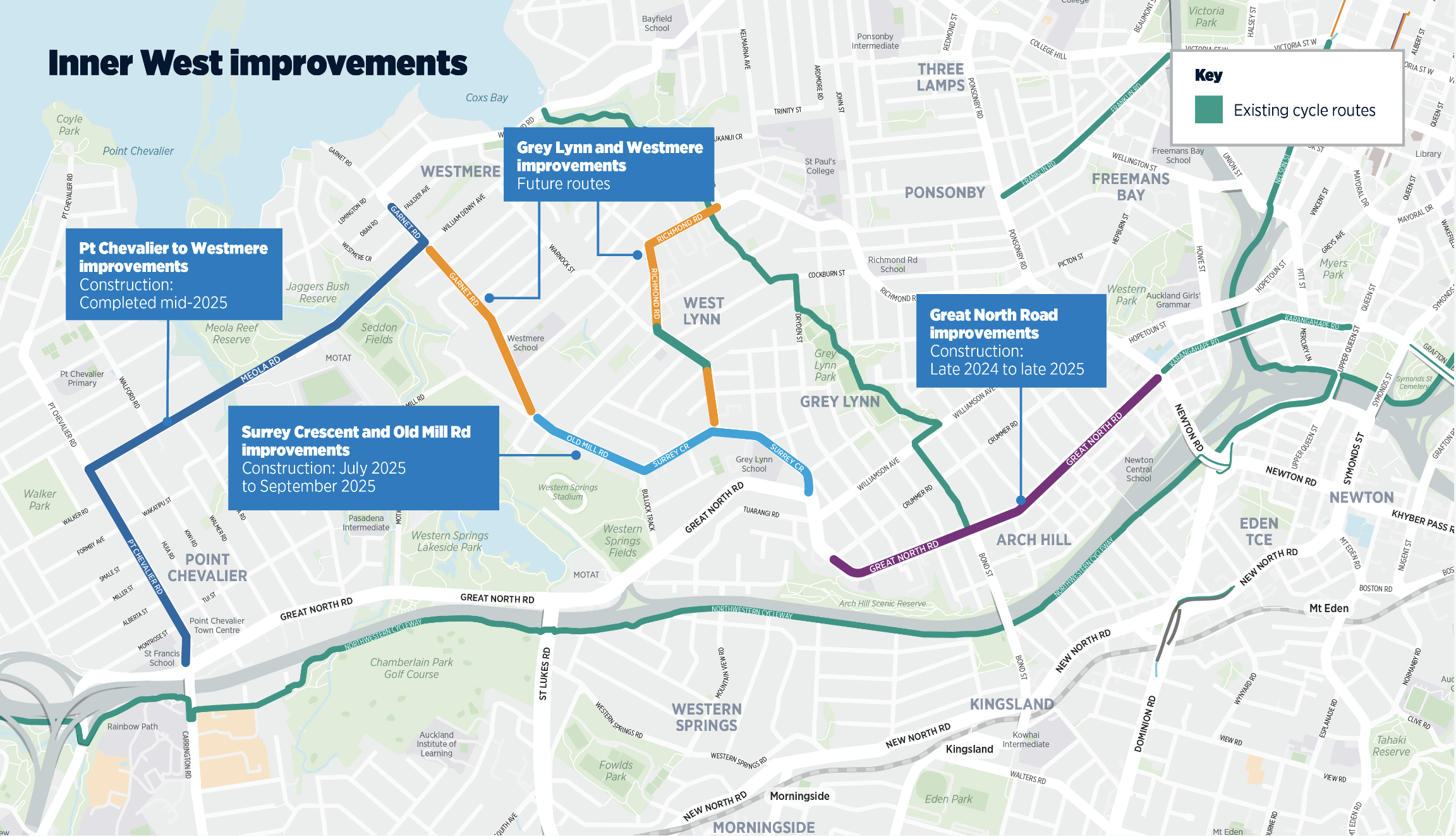
The inner west network taking shape, linking neighbourhoods to shops, schools, work, each other – and the wider cycle network. As yet incomplete sections are in orange. Image: Auckland Transport
To their credit, Auckland Transport has also recently created short stretches of protected cycleway on both sides of Surrey Crescent around Grey Lynn School. This was done as part of a road renewal project, always a smart and budget-friendly way to expand the network.
(It ties in with a stretch of off-road path towards the Bullock Track, which then connects to the existing but somewhat neglected off-road path along the south side of Old Mill Road, where a repaving is somewhere on the near horizon, and will logically include a safety upgrade for all modes.)
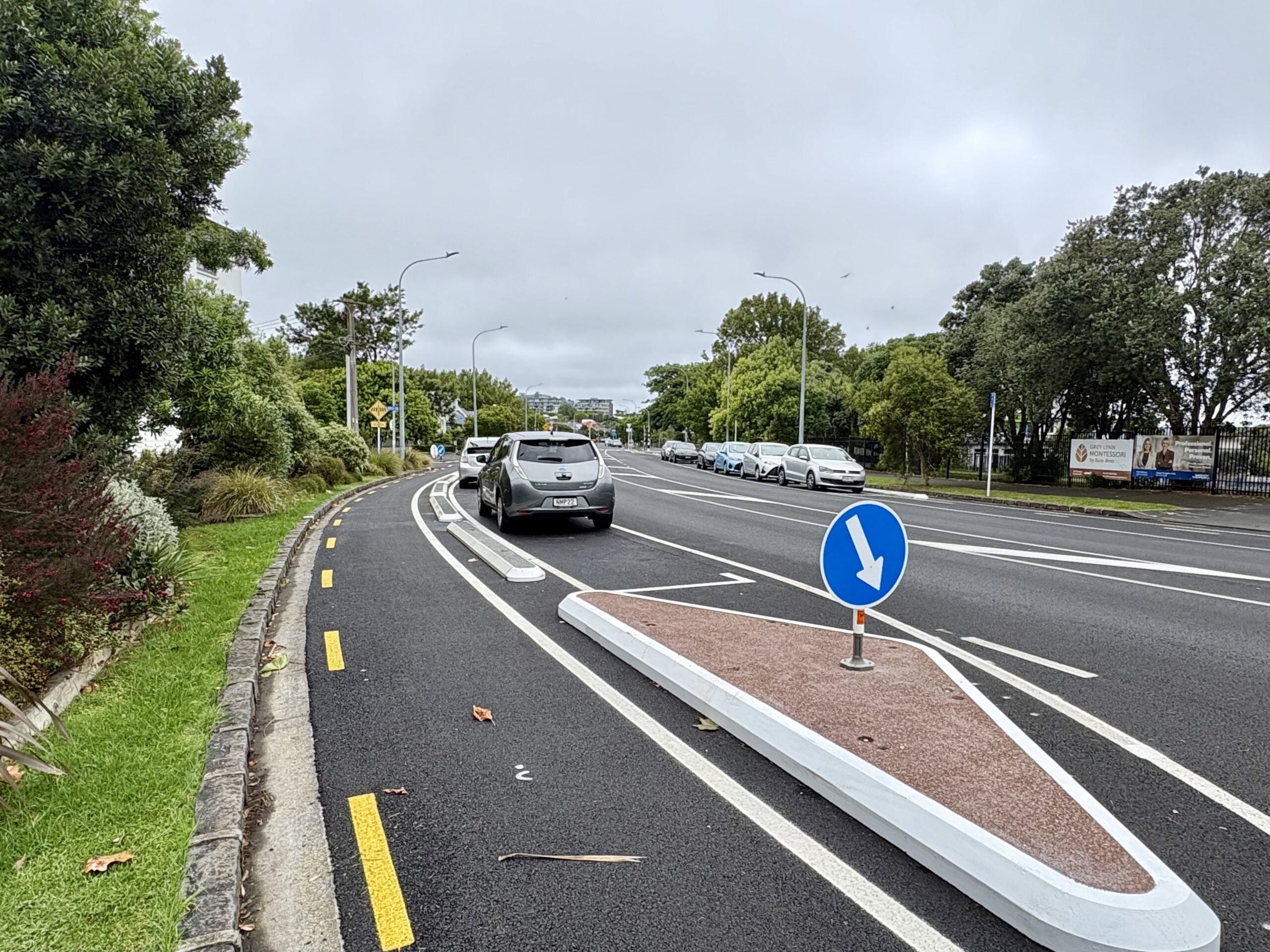
A snippet of safety: looking east along a brand new protected bike lane on Surrey Crescent, built to tie in with road repaving and the installation of raised crossing outside Grey Lynn School. February 2026. Image: Jolisa Gracewood
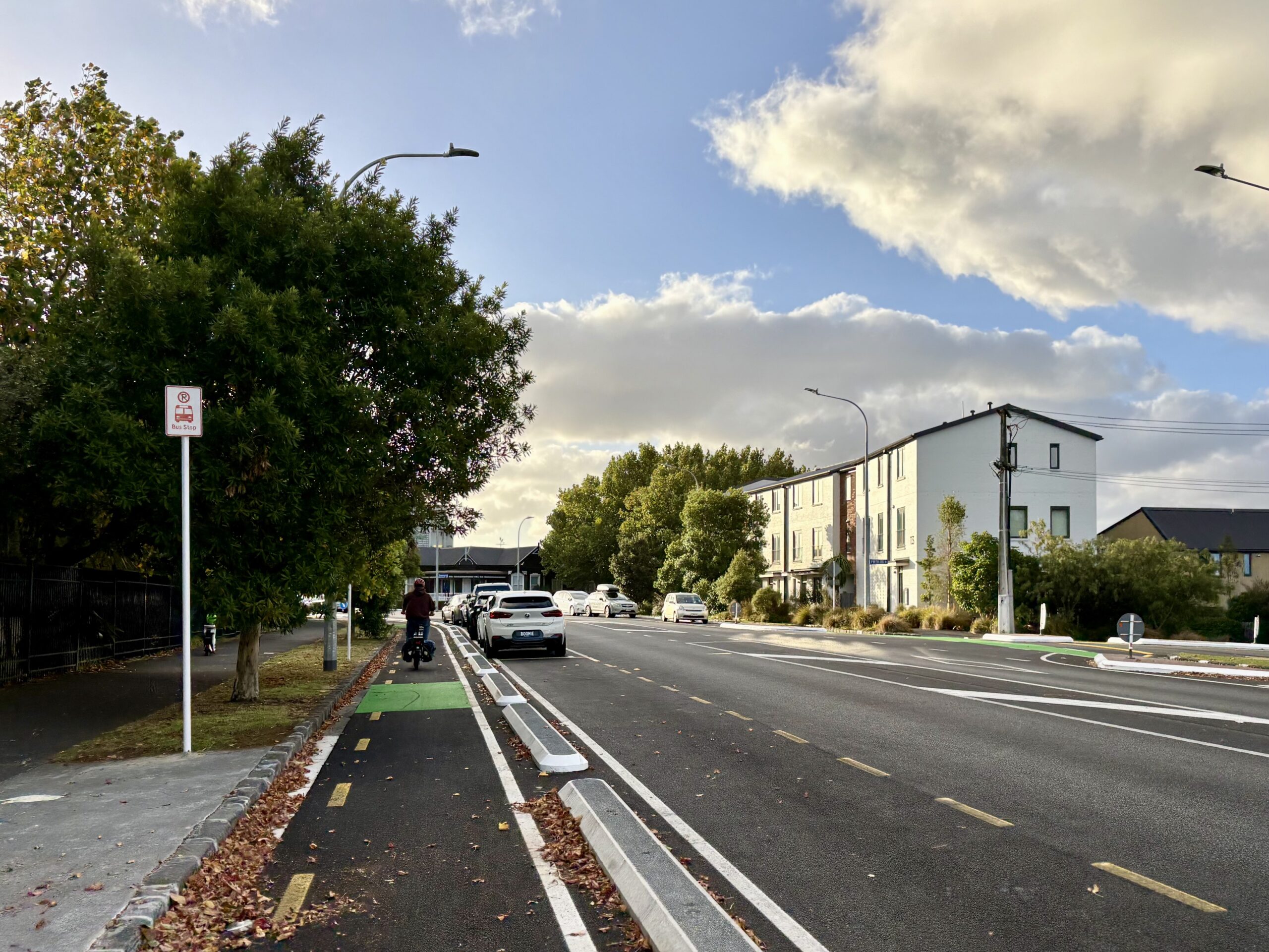
Looking west along the new protected bike lane on Surrey Crescent, built to tie in with a road renewal and raised crossing outside Grey Lynn School. March 2026. Image: Jolisa Gracewood
There’s also of course Green Lane West, where we are awaiting Auckland Transport’s updated design for safe cycling and walking along this critical connection in the heart of the isthmus.
And AT and Waka Kotahi/ NZTA have long had plans in hand for the city centre – including a safer design for Cook Street, and designs for Wellesley Street East that will give people a direct link to walk, bike and scoot from Queen St to the Domain.
And whatever happened to the plan to fill in the gap to link up the Glen Innes end of the Eastern Path to Panmure and the long-distance and local cycleways being built as part of the Eastern Busway project?
This was to have been funded from the cancelled Northern Pathway and proposed bridge but the project and the funding seems to have disappeared into the mists of time. Despite this promise in 2021:
“Another project we want to bring forward to give East Aucklanders more choices is a 1.9km link between Glen Innes and Panmure to connect the new Eastern Busway cycleway with the Glen Innes to Tamaki cycleway.
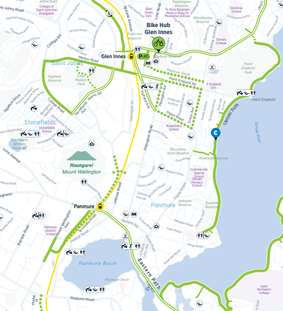
In short, there’s plenty of opportunities out there to fill in and expand the network. Especially with fuel prices soaring and people searching for easy, immediate alternatives, now is surely a great time to trial some quick, affordable, pop-up installations to give people options to avoid driving for every trip.
What’s top of your list?
No need to fret about the political popularity of such a proactive response. As well as the growing local ridership and demonstrable uptake whenever the network is added to, you only have to look at Paris, where Anne Hidalgo’s successor Emmanuel Grégoire has just been enthusiastically elected on a platform of doing even more street transformations and continuing to expand the city’s cycle network.
Plus it’s always nice to see local leaders on their bikes, rightly enjoying kudos for their productive investment in freeing up choices about how we get around.
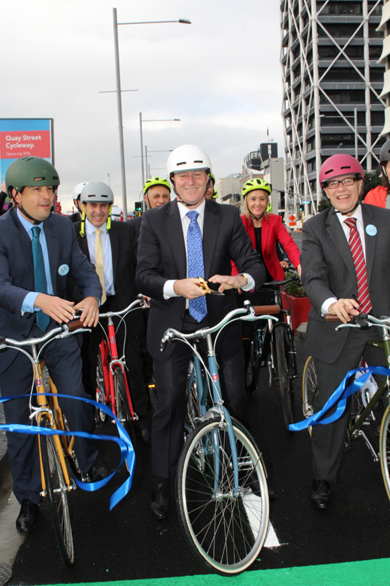
Simon Bridges, John Key and Len Brown opening the Quay St interim cycleway in July 2016 (Image: Auckland Council)
Greater Auckland’s work is made possible by generous donations from our readers and fans. We’re now a registered charity, so your donations are tax-deductible. If you’d like to support our work, you can join our circle of supporters here.

 Processing...
It’d be GREAT to connect Ponsonby Road to the NW cycleway, the Franklin Road cycleway, Karangahape Road, the Herne Bay and Westhaven cycleways. It’s such a BIG GAP in the connectivity of some really good cycling infrastructure. Also it’d make the CRL more efficient for these surrounding suburbs ⭐️
Yes, this connection is one I’m needing frequently. Without it I’m having to take very long ways around via the pink path and Nelson St… As well as silly up hill and down hill zig zaggy routes through back streets of Grey Lynn.
Always an opportunity, of course, to remember the unnecessary long distances we have to ride to find safe routes, while drivers complain about the tiniest detour around a modal filter needed to deliver safety.
Grey Lynn’s “Darien Gap” is the Surrey Hills shops, so much space too…
Ideal for a single lane Dutch roundabout, with lots of new trees…
Please….
heh, ‘Darien Gap’!
heh, ‘Darien Gap’!
Its possible to get a bike over the real Darien Gap,
This “none shall pass” auckland challenge is greater
https://www.google.com/maps/dir/-36.8353871,174.7414281/Northcote+Point,+Auckland+0627/@-36.8165343,174.6390296,15510m/data=!3m1!1e3!4m16!4m15!1m5!3m4!1m2!1d174.747533!2d-36.8259552!3s0x6d0d386dd0d77473:0xcc2efdce62dfd589!1m5!1m1!1s0x6d0d3869198a45a3:0x500ef6143a333b0!2m2!1d174.7454945!2d-36.8160469!2m1!3b1!3e1?entry=ttu&g_ep=EgoyMDI2MDMyMy4xIKXMDSoASAFQAw%3D%3D
Yes, just been around that area on the weekend for the CANDo event & couple of weeks before checking out the Gt Nth Rd improvements after powering up on a Bike Auckland’s bike breakfast free coffee on K’rd!
Seapath and lane reallocation pls
Kia ora Matt, wonderful proposal for the Te Atatu/Massey boardwalk! It would complete the walkway around the peninsula (a stated aim for the Henderson-Massey local board), give another means of access/egress for the peninsula in a state of emergency (or just any afternoon, eek), and bring people on both sides closer together. Love it!
On the Whau Pathway, the width is just incredible. As a bicyclist, I thought you would be very much hampered by pedestrians, people with dogs on leads etc – but the width is so generous, you can really ride with ease. I must go back on foot some time soon to really get to know all the nooks and crannies!
The next priority should absolutely be linking it up across to the next bay, McLeod Rd, where it would connect with so many more people. It would be a game changer for that whole area, which is currently a bit stuck at the bottom of a long feeder road – they would have such easy (and lovely!) access to the bus stops and cycleways. I hear this would be about 15 Million, and we already have the machinery etc ready to go. But from Council’s annual plan, it’s not looking like there will be any funding any time soon – unless we can tap into some new source of funding, like a targeted rate or recovery funding or similar.
Can’t help asking myself though, if that Whau pathway had less ‘over-mangrove/swamp’ boardwalk sections then it might be able to be funded quicker and built for a more economic price tag!
Yea. It is absurd that the project build with “ waves” when has so far to go.
It’s always been my one bugbear about this great project. Meanders instead of being the quickest route from A to B.
I think that is because the project was and isn’t only about transport. It is also about reconnecting the community to the awa and providing opportunities for cultural and environmental activity. The number of locals who were out enjoying time on the whau over the weekend, whilst others rode through to destinations was wonderful to see.
I agree, Vinny. There are just too many social and mental health benefits from this kind of infrastructure to dismiss it.
Vinny. The initial request from AC is linked below, they wanted 4 km of path, they got 1km and the cost doubled. Of the 68 million how much was spent on the path? The vast majority of it.
Personally I would feel a substantial greater connection if it actually connected parts of the Whau. There was a bid that planned to build the entire thing as a boardwalk. This would have been far more useful.
Vinny for the win.
Some paths are commutes, this one is more, and both. If you cant take a moment here to enjoy it, change something.
I think the issue with private land is firstly land acquisition, but also that all that land is quite erosion-prone (this is certainly the ssue in Te Atatū peninsula, I expect it’s similar here).
This was a novel concept for the area, and I think it has been a huge success (I hope it has good longevity!!). It opens up possibilities for other areas that are currently in the “too hard” basket.
I think the issue with private land is firstly land acquisition, but also that all that land is quite erosion-prone (this is certainly the ssue in Te Atatū peninsula, I expect it’s similar here).
This was a novel concept for the area, and I think it has been a huge success (I hope it has good longevity!!). It opens up possibilities for other areas that are currently in the “too hard” basket.
How else do you propose doing the sections that have been built over the mangroves though? They’ve been built that way because there’s no other option. They can’t build on land for those sections without dozens and dozens of property purchases.
I guess you could reclaim land at the base of the banks but that probably costs as much, has a higher environmental impact and probably exposes the path to risks of land slippage from the banks above and inundation.
Sure, the curve design adds slightly more distance, but not as much as hugging the banks would and adds attractiveness and a bit of flair.
+1
If it were dead straight, you’d fall asleep before you got to the end of it. And it does need to respond to the ground beneath rather than the ruler on the plan.
It wouldn’t be dead stright, it would be stright from park to park. There was literally a bid to do this and build the entire thing like this as board walk.
Awesome to see Great North Road finally constructed … that saw some ups n downs over the years!!!
Beach Haven to Greenhithe (and a possible link up that estuary) has to be looked at!
A link there would connect thousands in Kaipatiki with the path on UHB
Yes. Would provide great transport connections for residents. Also nice for Aucklanders from further afield visiting friends or on a recreational day out, starting, perhaps, with a ferry trip.
An easy to achieve and comparatively cheap connection that has failed to get funding is the connection from Francis Street to Esmonde Road in Takapuna. It would link the Devonport Eco route which avoids the hectic clogged Lake Road and the Patuone shared path to central Takapuna.
It’s a scenic route with only one disadvantage, a long hill in Francis Street
Te Whau as it has been built is meaningless. 30/50/68 million should have at least connected the path existing bit at Arichabald park, but no they needed to build hyper inefficient waves to looks cool.
How many km of on road bike lane could have been built for that $68 million? 150km maybe, but instead west Auckland gets nothing and Auckland overall get sub 10km new bike infrastructure year after year.
Worse, this is going to be a new money pit, needing probably half a billion to be completed.
I’m sorry but describing the Whau pathway as coming in ‘under budget’ is a real stretch.
You can actually see the original Tender for this here: https://www.gets.govt.nz/AC/ExternalTenderDetails.htm?id=23491234
the funding that Government gave under ‘shovel ready’ was for 4KM. Instead we got 1km.
The pathway is lovely but the budget was originally given for the entire 4km, we got 1km – you could very well argue this is on rack to blow the budget by 4x what it was originally vien
Instead
Luckily we can save much more money stopping intersection widening and state highway projects that are far, far more expensive and that will worsen, rather than improve, our city.
This one is a goodie, so let’s celebrate it.
And then get busy campaigning to stop the ongoing road building insanity.
An absolute must-complete is the pathway in Favona – Connecting up Norana Esplanade to Otahuhu Station. My understanding is the Mangere Otahuhu Local Board was presented with designs for this back in 2020 but budgets were so tight at the time and it has kind of fallen off.
Yes that be a good one, Favona Rd dangerious too.
Also agree with Heidi’s comment above about saving money that way.
Nice to see some solid bike paths coming to fruition. I would like to see an east-west crosstown route through the middle of the isthmus. Hopefully the Greenland Road proposal can be the start of that. Then, could a bike path be constructed on Marua Rd? It seems to have lots of space. And connect that somehow to the Greenlane path at the western end and the Panmure and Glen Innes paths at the eastern end…
Perhaps Ascot Road & Orakei Road for a north meet up with the Eastern path at Orakei station, then Marua, Lunn, Ellerslie Panmure Highway for a south end meet up at Panmure station.
But is there a plan to continue west along Balmoral Road?
These would get my top vote:
– As mentioned in the post, create a link between Te Atatu Peninsula west to Massey and on to Hobsonville- that’d unlock the peninsula from its one-way in and out. It’s 350 metres from Wharf Rd to Colwill Rd yet a 10km/40 min ride the current way.
– Fill in the missing link from Waikaraka Cycleway to Mt Smart Stadium and Penrose train station (up Hugo Johnston Drive and O’Rorke Rd). O’Rorke is wide and far safer than the parallel Great South Rd one block over. Or even up the railway to Penrose would work.
– Overlapping the same area, up Hugo Johnston Dr towards Sylvia Park.
– A full redesign of the Upper Harbour Dr & Albany Highway intersection, plus between there and the Albany Highway shared/cycle paths.
– Still waiting for the harbour crossing, can’t forget that!
AT has some old maps showing a planned route from New Lynn to Titirangi, does anyone know if this has been abandoned? Titirangi Rd is currently not very friendly for cyclists and is especially narrow at the Titirangi village end.
AT will do about anything to not build bike infrastructure, particularly out west.
I suspect that what you are looking at is the old plan that had bike infrastructure planned for arterial roads? They created before they realised that they could just endlessly consult with the public and build nothing.
That would be a shame if there is no plan. It’s the only section that keeps me from cycling into the CBD – I am pretty confident on the road, but that length from Titirangi to New Lynn is too sketchy for me these days.
I think they’re going backwards on the GI to Panmure route. Jellicoe Rd is the most convenient route to get to Panmure station and the main road and they’ve recently put on-street parking into it, which really isn’t helpful if you’re a cyclist.
https://haveyoursay.at.govt.nz/jellicoe-road-mt-wellington-removal-of-clearway-restriction-sign
Here’s a timely piece of good news, speaking of filling gaps – AT will go ahead with bike lanes on Merton Road (even though the Local Board had voted against). Shout-out to the tireless efforts by good eggs Bike Eastern Suburbs, keeping this one top of everyone’s mind! https://www.bikeauckland.org.nz/news/a-win-for-the-east-merton-road-west-cycle-lanes-are-finally-going-ahead
It’s awesome that the cycleway is coming but it’s amazing that Merton Rd doesn’t have another zebra crossing. Fortunately it now have some close to the roundabouts but it really needs one further up towards College Rd. Lots of kids try to cross that road to get to the park and it’s a real speed trap.
@Jolisa Great news.
@Loxy Yes, looks a long wide road without crossing for that sort of environment. The loss of general traffic road width and the cycleway separators should slow traffic a bit though.
Unfortunately it can take decades of campaigning to get crossings where children (and others) need them. Inexplicable, given any argument against them is totally unfounded.
We need to find a way to shortcut the process, and above all, not have children or youth themselves have to advocate. It’s embarrassing and heart-wrenching having them witness adults at Council and AT performing at their callous worst.
Good luck if you decide to give it a try, Loxy.
Unfortunately evidence based practice is not a consideration with the current government. I got an email from ‘Hon’ Simeon Brown (then Transport Minister) in reply to one where I questioned raised crossings being removed (replaced by paint) from a Massey, West Auckland, motorway on-ramp upgrade near a school (& also between school & community sport centre) in response to his directions and the reply was:
‘Good to see’.
Then they put him in charge of Health…
It is important paths are kept narrow and are designed so that they cannot be converted to vehicle lanes. Otherwise there will be pressure to turn them into additional roads.
Further West there is potential to link Waitakere Village, Kumeu, Huapai, even Riverhead to Westgate (and then the current SH16 path) with a connection that avoids riding on SH16 Highway. Just a short bridge would be a good start connecting Henwood Rd and across the Ngongetepara Stream to Kakano Road.
See “An easy Kumeu Westgate connection to consider:” section of this blog post
https://www.robincapper.net/northwest-busway-fixes-for-the-sh16-northwestern-cycle-path/
It’s great to see Stage 4 of the GI2TD path coming along, but we still need the planned and promised connection under the railway to Gowing Dr completed to get the most out of this asset (the one that they were going to build on the long rail shutdown two years ago, but just didn’t bother with). It’s worth remembering it’s not only the ‘main spine’ paths that are important, but the local connections to them that really unlock the network and make all those short, everyday trips that can get people into cycling and take cars off the road possible. In this case it would be transformational in unlocking the half of the school zone s for both Selwyn College and St Thomas’ primary that are in this area and would be an easy walk or cycle across the valley if this route existed, but currently continue to be a long drive round the ridge in a car.
And Greenlane is in such desperate need of some work. I rode along there this week to an appointment (which i do maybe once a year, then remember how bad it is, and go back to driving our avoiding the area), and it’s dire – any improvement can’t come soon enough there!
Great post. Yes, what did happen to the Panmure to GI link?
I’m working on some ideas for Mt Wellington, humble road connections but also something more iconic with reaches to a natural beauty location or two. Might be a good blog post or two for here and/or Bike Auckland if it’s wanted.
Yes please. There’s lots of housing growth around Mt Wgtn, some crazy roads (EP Highway, Mt Wgtn HW, Lunn, Carbine, Waipuna, Penrose geez there’s heaps), lots of potential connections, and also not much investment compared to other suburbs
Yes, there is virtually nothing but the newer Te Horeta Rd and nearby short bits of shared path oh and the SE highway and a bit of paint here and there.
Penrose does my head in. Not just lack of safe cycling, it’s a death trap for people trying to walk. Even the distance between bus stops doesn’t work. Despite having a direct bus from where I live, as well as the option of taking my bike on the train, it’s basically a no go area for me. I’ll only go there if I can’t find an equivalent service elsewhere.
Deficient streets for workers, residents and visitors alike.
The whau is great. We need to figure out how to connect Henderson to newlynn to unlock more cycling out west and truly make a backbone for a connected west Auckland.
Had written up a doc about this a few years back.
https://docs.google.com/document/d/1pEigjNi2QfEPTKTtXGOMvs2VqKzMvWRxPV68KfCKh3s/edit?usp=drivesdk
Great to see this James – I caught up with a couple of others enthusiastic for opportunities for people on bikes in Glen Eden area last week. Would you be able to share this doc on the Bike Glen Eden facebook page ?
Great doc, I objected to the removal of the pop-up Capt Scott Rd shared path before it happened, seems nobody acknowledged it connected a huge catchment to the town centre and trains via the existing shared path. It’s also about the only thing that had been done for cycling in Glen Eden/Titirangi since the supercity was formed in 2010.
Then, a few months after it was gone, this happened (YT link below). I lodged formal complaint with AT but got ‘I cannot disclose the details of the investigation due to Privacy Act’ and a reassurance they would ‘take the necessary steps to ensure such a situation does not occur again’
https://youtu.be/MTJt9strgvA?si=KgN1Bcjrfj7Co1iF
Scary stuff!
To give you a reassurance it won’t happen again, they would need to have implemented the Vision Zero concept of moving responsibility upwards as far as is necessary to eliminate that risk – from that bus driver, to the bus company, to the RCA, the Regulator and eventually, the decision makers. They haven’t done that.
They would also have fulfilled all the relevant recommendations in the Road Safety Business Improvement Reviews. They haven’t done that either.
Their reassurance is a complete fob off.
As for taking out that Pop-up lane, that wad done in glee by some truly sick AT staff who were determined to prove there was no point in tactical improvements because the maintenance would cost too much. Using, of course, bullshit figures, that didn’t look at the while picture, and with no consideration of the costly car dependence it leaves people in due to the danger.
I ride with a glasses mounted mirror so was not startled, more annoyed and hoped it would stop at the Bus Stop around the corner so could have a word… but it didn’t. I ride with cameras front/rear but unfortunately had not noticed the rear one was low on battery. Normally get off at Sunnyvale and ride home, mostly off-road path/park, but that night the trains were not going past New Lynn for some reason so had ridden from there.
I commented at the time of the removal how their priority was private vehicle storage (on public space) over safety.
Please fix the formatting of these otherwise excellent updates, so that the text doesn’t bleed off the edge of the screen. Can’t be hard…