When the first stage of the Eastern Busway opens in the next month or so, it will mark the second addition to Auckland’s Rapid Transport Network (RTN) this year following the new AirportLink which travels via the fabulous new Puhinui Station which opened in July. These two additions are the first changes to the network since the opening of the Manukau branch and station back in 2012 and the addition of the NX2 via midtown in 2018.
But while there haven’t been all that many changes to the RTN over the last decade, there will be a lot in the coming decade with:
- the addition of the City Rail Link
- further extension of the Eastern Busway
- new stations at Rosedale on the Northern Busway and three new rail stations between Papakura and Pukekohe
- Bus improvements to the Northwest
We’ll should also see the addition of Light Rail and hopefully also progress on the Airport to Botany busway.
Recently Auckland Transport released a new Rapid Transit map, or maybe you could call it their first rapid transit map, previously it was just called the rail map and had the busway tacked on.
![]()
It’s good to see them finally starting to present the rapid transit network as a single entity, though I do have a bit of feedback for them on it for future versions – given an updated one will be needed when the first stage of the Eastern Busway opens.
- One of the beauties of schematic transit maps is they don’t have to perfectly match the geography, just do a good job of representing it. But I don’t think AT have done a good job here. The map is far too squeezed vertically making the Northern Busway and Southern line look tiny while the Western Line looks really long.
The map index in particular is something not normally seen on rapid transit maps and should be dropped in favour of stretching the map out a bit. It would also mean they could drop the battleship style gird which would make it cleaner. Perhaps they could even drop the blue bar at the bottom too given there’s plenty of white/empty space to put the ATs logo. - The Northern Busway should be presented more like the rail lines with the NX1 and NX2 each given their own lines. Especially given every low frequency ferry route, including tourist only ones like to Rakino Island, gets its own line on the map.
- It’s good that they show the greyed out Eastern Busway as being under construction as well as the Rosedale Station but odd that they don’t include the City Rail Link. Likewise they should also show the Northwestern Bus improvements and the new stations between Papakura and Pukekohe on there. The key reason for adding these future projects is to help show the wider public some of what’s going on to deliver better public transport in the region.
- There an error on the Western Line with Sturges Rd and Ranui around the wrong way.
- There are a lot of stations not shown on the map with easy connections to frequent buses, such as Mt Albert. Should they be represented on the map too instead of just the locations with larger bus stations?
On a slightly separate note, when did the completion of the Rosedale Station get pushed back to 2024. As far as I’m aware the busway extension from Constellation Dr to Albany is due to open in about a year’s time so why is it going to take another two years to add shelters, lifts and stairs. Is this another victim of AT’s funding priorities?
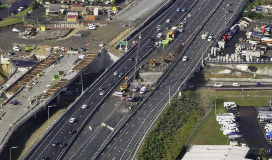
Progress at Rosedale from a Waka Kotahi newsletter in August
Line Names
While we’re on the topic of rapid transit maps, one other thing I’ve been thinking about recently is if we should change what we call each line on the map. The Western, Southern and Eastern lines make some sense now but are hardly imaginative and don’t really make as much sense once the City Rail Link opens which will fundamentally change the rail map. For example, the most likely outcome is that the Western Line will travel to Otahuhu and the Southern and Eastern lines will become one. Likewise, while light rail is currently known as City Centre to Mangere, I doubt that will be the name it will go by if built and it would be even less appropriate if it was eventually extended to the North Shore.
So what could we call them instead?
Looking overseas there are a range of options, such as:
- In some cities, particularly those in Australia, the name is based on the terminus stations of the line. Based on that we may have something like the Swanson-Otahuhu Line, Pukekohe-Manukau Line or the Hibiscus-Britomart line. They’re somewhat descriptive but not that interesting.
- In other cities they use letters or numbers to describe them. Paris for example numbers for its metro lines (1-14), letters for its RER network (A-E) and numbers prefixed with the letter T for its tramways. New York too uses a mix of letters and numbers. Seattle is this year moving to letters and numbers. If we were to go down this route, letters might be preferable to stand out compared to our bus numbers. Single letters or numbers have the advantage of being easy to have uniform signage to advertise the line, such as these new ones from Seattle but aren’t that descriptive or that exciting.

- Finally, some cities use unique names for their lines, such as the various underground lines in London or Vancouver’s Skytrain lines. This is most close to what we have now and of course we also have the likes of the Link buses, but surely we can do better. Could we get more interesting and name them after notable people from Auckland’s past? What about some Te Reo names?
What do you think, should we change our rapid transit line names and if so, what to or what kind of naming convention should we use and especially for the latter, what suggestions do you have?

 Processing...
Didbt they only just get consent for the Rosedale station a few months ago, suggesting is was very much at the back of the planning process for the whole project?
I heard something somewhere, dont remember all the details.
Two different entities designing the approaches and the bridge part.
The alignment in height is off.
They got well into construction before it was realised.
That is hard to fix.
Maybe the delay is because of this. But perhaps they had other issues.
I hate this city sometimes.
Considering normal bus lines are numbers, maybe the rapid lines should be letters, like the Subway lines
Matt, in your comment about Rosedale Station, it’s the last quarter of 2021 now, so 2022 is next year?
I think that’s a typo and it was meant to say 2024
Thanks Ian and Dion. It was a typo and it’s been fixed to say 2024.
If the Rosedale Station opening has been delayed till then, what does that mean for the opening of the busway extension to Albany?
Would that be delayed too, or will buses just run past Rosedale Station while it’s being completed?
Why are the ferry services on there at all? It makes a very infrequent (other than Devonport) service look a lot more available than it is. I guess it’s on a right-of-way unimpeded by other vehicle traffic, but still.
It does say: “Auckland’s Rapid Transit Network…” and then in smaller text “…and Ferry Services” – being an admission that they don’t meet the definition of rapid transit.
And of course Devonport and Waiheke services aren’t under AT’s control either. Anyone got any gossip about the PTOM review – e.g. whether that’s going to change?
Devonport is not frequent – 20 mins at peak and 30 mins off peak
The Devonport Ferry has been identified as a future RTN route in the ATAP.
How full are they usually between 7-9am for example on weekdays, are people turned away?
Of course it’s a rapid transit map only part of the time. 20-30 minute frequencies— which is what we get off peak and weekends—aren’t rapid transit services by any metric nor are many of the modes integrated in a timely fashion. Perhaps, after suitable modification per your suggestions, the map could more accurately labelled ‘Auckland’s Aspirational Rapid Transit Map’ and the jazzy little sign off next to the logo more accurately adjusted to a more accurate ‘Let’s go there eventually’?
Onehunga is currently coded as ONE so surely it becomes 1, regardless of what pattern we run it to?
I personally think that number designations should be left for the bus network.
My preference for the RTN lines would be either letter designations (A, B, C…) as in the CFN 2.0, or colour line designations (Red Line, Blue Line, Pink Line etc.).
I would also be partial to subtitle names for each line – e.g. Northern & Airport, Takapuna & Northwest, Southern & Eastern. Perhaps these subtitles could be in Te Reo; like Graeme Gunthorp’s suggestion last year for naming North Shore light rail the Tūāraki Line.
Cool so the 1% of the population that actually speaks Te Reo (who all also happen to speak English) can find their way to the inconvenience of the other 99% of the population (not including any tourists which bump that number even higher)?
No thanks.
Agree “Southern”, “Western” etc suffer from that Kiwi disease of spectacularly unimaginative names: North Island, South Island, Northland, Southland, Westland, North Cape, South Cape, East Coast Bays – and my personal favourite, the fortunately defunct North Shore City.
Renaming the lines gives us the opportunity to commemorate historical figures, as London has done with the Victoria line and the Elizabeth line.
Āpihai Te Kawau and Te Wherowhero come to mind. Without them the city would have been snuffed out at birth.
Similarly the iwi names could be applied (with their consent). The Ngāti Whātua line running through the eastern suburbs seems particularly apt.
Also: Robinson Line, Len Brown Line. That’ll get the trolls trolling.
Tim Shadbolt Line for the western line lol
Ah or like my favourite tea towel – Liverpool’s PT network with all stations named after a famous local. http://hubcapmap.com/acatalog/centre_of_the_universe.html
Those at least aid the customer/user in knowing where they’re going. Particularly helpful for tourists and visitors to the city. I know it’s trendy, but we have no shortage of Te Reo names in this country, so maybe for once we focus on practicality rather than wokeness? Less than 1 in 20 speak Maori, 20 of 20 will have functional English in understanding points of the compass or colours.
I agree with you regarding simplicity of names for rapid transit but you’ve completely undermined your argument by suggesting using Te Reo around the country is wokeness.
Incidentally the most common form of name around the country is one named after some completely irrelevant Englishman from 180 years ago.
We should rename things to Te Reo names just to annoy the people who think that trying to preserve our native language is ‘wokeness’.
“We should rename things to Te Reo names just to annoy the people who think that trying to preserve our native language is ‘wokeness’”
Try visiting Puhinui Station. The Te Reo names take precedence ovr the English nomenclature, thereby confusing tourists and visitors, who think that Tereina is another suburb or station on the Southern Line
“but we have no shortage of Te Reo names in this country”
We have no shortage of English names either. Swahili?
No thanks, keep it to colours/letters/numbers or places rather than meaningless names to almost the entire population.
“meaningless names to almost the entire population”
Moot point, after a while the names would gain meaning at those line names.
“Papakura” is meaningless to non te reo speakers outside of it being a place name. But like you said these place names are a decent option. New line names would gain meaning like any other significant name.
“All words are made up” – Thor, Norse God of Thunder
Surely they need a good slogan under Auckland’s Rapid Transit Network. I suggest “Almost as fast as steam was !”
Doesn’t the ferry go CBD to Hobsonville Point then beach haven, not shown like that on the map
T1, T2, T3 etc for train lines.
B1, B2, B3 etc for busways
L1, L2, L3 etc for light rail.
Taglines for all routes as well, i.e. B1, Northern Downtown; L1 City to Airport; T1 Western
I see a few advantages to this system.
-Clearly indicates the type of vehicle/track you should expect (this is important for users using a route for the first time)
-Allows up to 30 transit lines using names with only two characters
-Allows us to continue familiar numbering, i.e. the 70 bus becomes the B7 and then, eventually, the L7
-Doesn’t call light rail trams.
+1
Like Sydney?
That’s actually a pretty cool idea – plus it allows for any future modes or systems to be added with additional letters, e.g. metro (M1, M2, M3)
Trouble is if B1 gets upgraded to L but L1 and L2 already exist, it would have to become L3… Otherwise a clean idea.
But I prefer names. Preferably Te Reo names that can be shortened to a letter (so a different letter for each one).
It would require a bit of planning, but I think that we could make that work. I.e. we know that the northern and NW busways are going to be light rail, so we should just number them as part of the light rail network, but leave them with a B prefix for now. I also think it’s pretty unlikely that we will have more than 10 busway and light rail lines any time in the next 30 years.
We also know that we are very, very unlikely to ever get another heavy rail line, so we don’t need to worry about those numbers.
I like names too Heidi, but it makes station and onboard announcements really clunky. Hence why I prefer codes with named subtitles (I also prefer Te Reo, but I won’t do Te Reo the dishonour of my butchered attempt at translation)
Names sound great in theory but their relevance has to be really clear or they just become something that doesn’t inherently mean anything to most users.
I’ve just moved the kids from a daycare where the rooms are called Nursery, Toddler and Pre-school to one where the rooms are named after local features. I often find myself looking blankly at the teachers as they talk about different rooms.
Simple is good for rapid transit, it’s worked across the world. I think a combination of Sailor Boy’s letters and numbers and Jimbo’s colours makes the most sense.
Assuming L1 is the Airport light rail and B1 is the NX1, then when the Northern Busway gets converted to light rail the whole Albany-Airport route could become L1?
I’m still liking the “Albany-Airport” approach…
Still think that would work better as a subtitle. It’s a bit quicker to say “Catch the Blue Line to Albany” or “Catch the L1 to Albany” than “Catch the Albany-Airport line headed north”.
“Change here for L1, L2, T1, T2, and T3” or
“Change here for Albany to airport, Takapuna to Huapai, Swanson to Manukau, Henderson to Otahuhu, and Papakura to Otahuhu”
Have you ever been to NY? Totally confusing, SYD too.
Keep rail lines simple. Colour code or name
Eg Green line or Manukau line etc.
It would be nice to see some names that are representative of more then our British/Irish and Maori populations.
AKL is the capital of the Pacific, why not some Samoan/Tongan/Fiji names as well.
All of this colour and Te Reo chat just made me think of the old el paso meme ‘why not both’.
Just use Te Reo colours for the line names?
Ma is white, whero is red, kakariki green …. etc etc
“Ma is white, whero is red, kakariki green”
But that’s probably as much as anyone remembers of the song hah
I’d like to see the following names for the lines (with appropriate macrons):
– Southern / Eastern train line = Tamaki Line
– Western Train Line = Waitakere Line
– Northern Busway = Rangitoto Line
– Western Busway = Waitemata Line
– Eastern Busway – Pakuranga Line
– Isthmus – Mangere light rail = Maunga line (After the various tupuna maunga it passes on the way)
Rangitoto for the Northern busway routes could be confusing for non Aucklander since they go nowhere near Rangitoto.
And the Western line goes nowhere near Waitakere since they Electrified the system . Swanson would be a better name .
No thanks. Too confusing and completely irrelevant to 90% of the population and only partly relevant to another 5%. Completely irrelevant to anyone from overseas too.
Why not just use colours as the names? The green line, red line, etc. The icon could be an oval in that color with the colour name printed in it.
I think there’s a point where too many lines, and therefore too many colours, becomes a bit unwieldy? Or at least not that friendly for expansion, especially once all the single-syllable colour names are used up. Might have been one of the reasons the LA Metro switched from colour line names to letter designations.
In Auckland’s case I think colour designations would work for the 7-line system in the CFN 2.0, but any additional lines might become difficult to add with a colour-naming scheme.
E.g:
Red Line – Southern & Eastern (heavy rail)
Green Line – Western & Onehunga (heavy rail)
Blue Line – North Shore & Airport (light rail)
Orange Line – Takapuna & Northwest (light rail)
Purple Line – Crosstown (light rail)
Yellow Line – Eastern Busway (BRT)
Pink Line – Upper Harbour Busway (BRT)
Brown Line – unfilled
Teal Line – Devonport ferry
Silver/Grey Lines – FQTN bus routes
From that point on you kinda get into obscure or hard-to-pronounce colour territory if any new lines need to be added.
They will all have a colour won’t they? Or will we use one colour on the map? I doubt Auckland will ever run out of colours (unless they include standard bus routes).
Wasn’t the purple line going to be used for the Henderson – Otahuhu service when the CRL is finally up and running ?
@JimboJones True, perhaps, but there are a finite number of easily-said colour names. Plus there’s the visual readability to consider when it comes to line colours.
@david L – yes in the official plan the Purple Line is crosstown (Henderson-Newmarket-Otahuhu) heavy rail, but I’m not in favour of that as it seems like an inefficient use of resources plus prevents the Western+Onehunga & Southern+Eastern lines being run at maximum possible frequency long-term.
The lines in my comment are based on the CFN 2.0, with the addition of crosstown (Avondale-Onehunga-Penrose) light rail instead of a New Lynn-Onehunga busway.
Brown Line surely the Central Interceptor
Samfnz – Lol!
I know Seattle came under fire for their color names, “red line” and “blue line” because its associated with so called “red lining”. Although I presume people likely wont have heard of that terminology in Auckland.
https://en.wikipedia.org/wiki/Redlining
We might not have the same issues here though.
If the national soccer team is called the All Whites, and the rugby team the All Blacks, maybe such things will fly.
Colors also doesn’t help for people color blind, although I guess you could make the same argument about people who are illiterate for longer names. Or dyslexic people with repeating or similar looking words, especially Te Reo Maori words for non-speakers.
To do the naming and theming really well is not an easy task.
Not sure the Te Reo issue flies.
Its English lettering and people will just pronounce it as they see it, like they would overseas. And its not like Ian’s suggestions and some of the others are words no one has ever heard of. They are already place names.
I used the KL mass transport system a lot, and got to understand it very well to the point I used to occasionally help tourists find there way (in KL Sentral it wasn’t always obvious when busy how to get from one mode to another)
if you look at the map: https://www.klia2.info/rail/klang-valley-rail-system/
It is big, but the colour coding was consistent so if you saw light green – it was monorail.
The colours largely indicated what mode and what line. The lines also had numbers and names like Ampang or Putra Heights lines – which were mostly the end points but sometimes just the major stop on a loop.
Always seemed to be very clear how you could jump from one line to another to get places. Kl Sentral being like Britomart should be – a big transit orientation mall with work and apartments in walking distance
If we did go with colours could use Whero,Karaka,Kowhai/Pango etc. No harder for foreigners than me learning ‘Titiwangsa’ in KL
Thanks for this excellent article, Matt. It highlights some issues which I’ve long been concerned about. In particular, re branding, a consistent system on nomenclature is critical to the public seeing the RTN for what it is. I’m strongly of the view that the naming system should be “mode-neutral” – ie no prefix of T, L or B to designate whether it is Train, Light Rail or express Bus. That would just enhance the differences between the various lines, where the real objective should be to accentuate the unity of the network with a single nomenclature.
My personal preference is for letters to be used (ie the A-Line for City-Airport, B-Line for Airport-Botany, N-Line for the Northern busway (perhaps with N1, N2 and N3 as a second order of designation), etc etc. But I’d be happy with named lines as well, though it’s harder to use in written description etc.
I also think that the RTN network itself deserves a “brand”. I’d be open to something like “AT MetroExpress” to cover train, light rail and express bus services and to emphasise the unity of the RTN. But I’m sure there are other names out there which would be just as good, or better, at conveying the unity of the top-level network.
I hadn’t seen the revised RTN map before, and I have to say I’m not so impressed. I think a rule of thumb ought to be that you design the map just once, taking into account the whole future network, and then you remove or grey out the lines that are not yet operational. The map will need to be significantly redrawn anyway to account for the CRL, including significantly increasing the scale of the central city portion. And I’m not impressed with the errors which have crept into the map either – I would have expected better.
The map also shows how woefully inadequate our RTN “network” is. I’ve long been advocating a kind of “proto-RTN” using express buses routes along currently foreshadowed future RTN routes to create a proper network, rather than the current network which actually has almost no “net”. When I listen to non-PT users complain about the system, it’s mostly about PT “not going where I need to go”. That’s mostly bullsh*t, as PT reaches almost all corners of the region now, with a few exceptions, and even the FTN now has a half-decent coverage of the region, with more to come according to the RPTP.
The most urgent need, IMO, is for crosstown RTN routes to connect together the radial lines. This is where we can make big gains with relatively little investment by the implementation of “proto-RTN” express bus routes, serving limited stops only (eventually to become light rail stations, in some cases) and operating within 24/7 bus lanes, perhaps partially “protected” by rubber lane separators that can (like speed bumps) be driven over for access to properties when required.
Unfortunately, I see no sense of urgency from AT at all to expanding the RTN significantly. The focus is firmly on one or two new lines being constructed at huge cost, rather than seeing what can be done with a less-than-gold plated solution. Of course, we need light rail, but it’s not at all the only thing we need if we are serious about meeting the demands of a climate emergency. We could implement the entire RTN within two or three years if we followed this kind of approach; let’s do it!
“I’m strongly of the view that the naming system should be “mode-neutral” – ie no prefix of T, L or B to designate whether it is Train, Light Rail or express Bus. That would just enhance the differences between the various lines, where the real objective should be to accentuate the unity of the network with a single nomenclature.”
+1.
Another reason why they should also have all the planned projects added, to show how all together its a single integrated network, regardless of mode.
I agree with you on the proto-rtn.
AT could do so much with bugger all improving the bus lanes, especially through intersections, and extending the hours, and including weekends.
“One of the beauties of schematic transit maps is they don’t have to perfectly match the geography, just do a good job of representing it. But I don’t think AT have done a good job here.”
Thought the same thing when I looked at the loop beside Manukau. Imagine when they add the rest of A2B. Just have it aligned with Puhinui then hooking left stright up to Botany. Panmure should then be aligned with Ellerslie where the eastern busway should (will?) be extended.
And the curve on the Northern Busway as it crosses the bridge looks like a child added it.
“….and the Southern and Eastern lines will become one”
Does this mean we’ll have (for example), “Southern Line via Newmarket” and “Southern Line via Panmure”?
Waiheke looks like an Atari video game chicken. Rangitoto-Motutapu looks like K-9 from Dr Who. The inner harbour looks like a prancing horse. This is not a complaint.
Are there timetables out for the Eastern Busway? Like to see how many are gone to run And at what times?
Could be wrong, but I vaguely recall that the existing network or something similar would still apply once the initial stages of the Eastern Busway open. A separate busway corridor will allow more reliable & higher frequency services while retaining the present bus lines & routes.
Wouldn’t expect a dedicated “Eastern Busway” line until the whole Ellerslie-Botany section is complete.
In the interim, there should be a dedicated Botany-Ellerslie line.
Essentially a cross-town line linking East Auckland with the Eastern, Southern and Onehunga Lines and (after CRL) the Western Line.
Botany to (say) Eden park could be about 30mins with a single transfer.
Apologies – misread your last line. Saying the same thing.
Haha, no worries there.
Assuming a completed Ellerslie-Botany Eastern Busway, and a completed Airport-Botany busway, the operating pattern I would probably be thinking of would be:
– “Yellow Line” busway services every 5-10 minutes, Ellerslie-Panmure-Botany-Manukau-Airport.
– A variation on the 70/72 bus, from the city centre down Great South Rd to Ellerslie & Panmure, then via Pakuranga and Howick to Botany.
That would provide both the main East Auckland mass transit link and a single-seat CBD journey as an alternative to transferring at Panmure or Ellerslie.
This is a great idea to formally call lines with their terminus (or what were their terminuses at some point in history), but this should really be supported with good distinguishable colours, which one would describe easily as “yellow”, “pink”, “red”, “purple”.
Do you think muscovites bother to tell “Serpukhovsko–Timiryazevskaya line”? People would mostly just tell “grey line”.
I think Auckland Rapid Transport Network is just a bit odd. I do have a few suggestions:
Auckland Unified Transport Network Auuckland Supercity Transport Link
Auckland Supercity Transport Network
I made a quiz based on the new map. You have 10 minutes to name all of the stations and ferry terminals: https://www.jetpunk.com/user-quizzes/1303428/auckland-rapid-transit-network-map
The RTN coverage looks damn bare without the station names….
Mt Albert is show on the new AT Map
The design dept and way-finding person at AT had already played with some alternate naming/signage at one or two of the train stations on the Western train line, before being made redundant. ( From memory this was at Avondale Station )
Those experimental signs are still in place, thereby causing confusion to existing and potential PT users.
With all of the forced redundancies within the “Customer Experience” department at AT , there is probably no one remaining, who has any knowledge of that project.
AT used to have the “B Line” along Dominion Road. The signs were removed and the name was dropped as it was confusing.
PS . All of the planning for the naming conventions and the colours of the CRL and connecting rail lines, has already been done, ( prior to those people within AT being made redundant )