Tomorrow is the first Auckland Transport board meeting for the year and so I’ve had a look through the reports to see what stands out.
Closed Session
The closed session is often where the most interesting items are discussed. Though while there are plenty of items on the agenda, most of them don’t look all that exciting. The ones that do are:
Items for Approval
- Final Joint Southwest Gateway Programme Single Stage Business Case
- Meadowbank – Kohimarama Connectivity Project
- Future Connect – Indicators of Success for the 2021-31 RLTP
Items for Noting
- Auckland Transport COVID-19 Response Review
Workshop Items
- Parking Strategy Update
A few comments on each of these.
The Southwest Gateway programme is the name for the various improvements around the airport and includes the Airport to Botany Rapid Transit route and so I’m really interested to find out the outcome of that.

I’m going to assume the Meadowbank – Kohimarama Connectivity Project is about improving connections to the Glen Innes to Tamaki Dr path currently under construction.
Future Connect is supposedly meant to be a framework to link all of AT’s various plans together, though I don’t hold out a lot of hope that it’s not just another reshuffling of the deckchairs. What I am interested in is what AT see as their Indicators of Success.
For the COVID response review, there was certainly some good things they did around issues like enabling all door boarding etc. But I hope they’ve also benchmarked themselves against what agencies/cities overseas have been able to achieve – such as rolling out extensive and ongoing changes to streets to support more walking and cycling.
My understanding is Parking Strategy update is about looking at how AT respond to the removal of minimum parking requirements as part of the National Policy Statement on Urban Development. In particular this is going to see AT need to better manage how on-street parking is managed all over the city.
Business Report
The business report is a summary of some of the things going on within AT and tends to have nuggets of interesting information sprinkled throughout it. Here are the things that caught my attention based on the order they appeared in the report.
Safe Speeds programme – AT held consultation recently on changes to the speed limits on 26 roads in rural parts of west and north Auckland that weren’t able to be completed as part of the previous consultation in 2019. They say they received 336 submissions but there’s no word on the outcome of that yet.
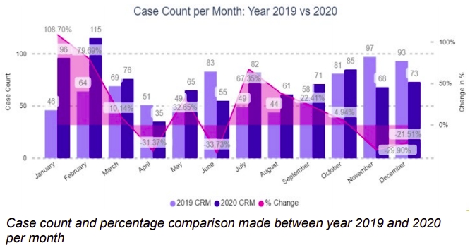
Footpath Injuries – AT say they’ve been doing some analytics on cases logged with them about footpath injuries.
The top issues were identified as:
- Footpath surface;
- Bee and/or wasp nest; and
- Surface cleaning.
A high number of the cases were related to ‘footpath surface’ and the Safety team wanted to examine this in more detail, using key phrase extraction. This showed the top themes for ‘footpath surface’ as:
- Trip hazard;
- Tree roots; and
- Uneven surface.
With so many more people out walking during lockdown I’d have thought March to June last year would have been much higher. Though perhaps with lower traffic volumes people felt more comfortable on the roads and avoiding the often cracked and uneven footpaths. Though I also imagine many people simply don’t report these incidents.
Aotea Bike Rack – We’ve asked before where the bike racks are, like those installed in Wellington and Nelson. It seems one is meant to be installed this month.
The 40-space double stack bike rack on Aotea Square/Queen Street was targeted for installation in February
Lantern Festival – this year it is being held on Captain Cook Wharf and was meant to be on this week but is now postponed to next week. It ends with fireworks display and it’s interesting to see they’re concerned about the impact it will have to the motorway network as it will be visible to drivers.
This year’s event will include the final night fireworks which will impact the Auckland motorway network more heavily than from previous venues due to the ease of viewing from the Northern motorway and Auckland Harbour Bridge.
Eastern Busway – It’s good to see the Eastern Busway from Panmure to Pakuranga is still on track to finish early. AT say the section from Panmure to Church Cresent will be completed by the end of this month and the section from Ti Rakau Dr to Kerswill Place will be completed by Easter. The remaining section, which is mostly the new bridge over the Tamaki River, is due to be completed in August, two months ahead of schedule.
Meanwhile the remaining sections, from Pakuranga to Botany, are planned for public consultation in May.
Gt North Rd – The Connected Communities team are currently consulting on New North Rd and the paper also notes they were due to start Gt North Rd earlier this month
The Great North Road project is looking to begin public consultation on designs in early February 2021, with construction potentially to be started this financial year.
Safety Dashboard
AT publish a safety dashboard at every meeting looking at safety across a range of areas. A few things stood out to me.
PT Customer Injuries
The graphs below show how many customers per 1 million trips have been injured on public transport. What strikes me is how much higher the numbers are than previous years. Here’s most of 2018 and all of 2019 and 2020. Note the there are three sets of graphs and frustratingly they almost all have different scales. Also you’ll notice they’ve removed the SOI target line of 0.9 in the 2020 version.

What’s causing buses to be more dangerous recently? Is it related to seemingly increasing instances of things like red light running by drivers?
And speaking of dangerous buses, it also contains this:
In Mangere, a child ran across the road and was struck by a moving bus. The child ran out in front of another parked bus, affecting the visibility of the moving bus. The driver was able to brake and swerve, and avoided a fatal accident. The child sustained some scratches and scrapes and lost some teeth in the accident. Police attended the event.
Thankfully the driver was able to brake and swerve. There seem to be many drivers who wouldn’t have been able to.
Deaths and serious Injuries
As you can see below, deaths had been heading in the right direction but as you can see below, that’s changed over the last few months. There’s also a bit of spike in the number of deaths of people on foot.

Serious Injuries have been going down which is good but AT say they’re not reducing as quickly as deaths are – though deaths are off a much lower number so small changes can make a big difference.

If you’ve looked at the papers, was there anything else that I’ve missed.

 Processing...
“Meadowbank – Kohimarama Connectivity”
They finally going to put some bridges over the reserve to link both sides?
Broadly speaking this is the plan. Quite likely under the train tracks on the southern side. The north south links to Stage 2 of the Glen Innes to Tamaki Drive are exactly what’s needed to maximise value from the project.
There is a rail overbridge going in on Stage 2 but it is at Tahapa Reserve towards the western end.
The proposed links however will be transformational, a simply fantastic game changer for local commuting for 100s of residents that also delivers huge amenity benefits from maximising accessing to the walking and running trails around Tamaki Makaurau’s unique and largest tract of estuarine native bush in the Pourewa Valley, that has been inaccessible as a result of over zealous developments 50 years ago building an impenetrable fence line right around the eastern and southern sides.
No wonder many locals including our Residents Associations, Local Board and Councillor have been advocating tirelessly for this for many years.
How often do you see those groups fully aligned in support of car-free transport in Auckland?
Very likely the north south links will be used far more than the end-to-end route east to west, because:
(a) St Thomas’s School and Selwyn College being on the northern side of the Pourewa Valley, yet with large parts of their zones on the southern side, in Meadowbank, St Johns, Stonefields, Ellerslie and parts of Remuera – allowing 100s of daily 2-way trips currently made by car around St Johns Road and Kohi Road to be switched to walking, scootering and cycling.
and
(b) Meadowbank Train Station, on the southern side, becoming accessible from parts of Kohimarama on the northern side – providing many commuters with a traffic free 10 min bike ride + 10 mind train trip instead of 45 mins by car or bus with no transit lanes.
As I understand it, the north south local links are dependent on the covid emergency budget being passed. Submissions are open now, please go to this link at the end of this article and have your say. By 22 March.
https://ourauckland.aucklandcouncil.govt.nz/articles/news/2021/02/local-input-on-budget-planning-vital-says-orakei-ward-councillor/?fbclid=IwAR3HC-wkkmpvOsiSbGTT1YfCLSwdI9XU633_XEBSvEvJnB02CfdLJf2EhPQ
You mentioned a bridge across the Valley , they could also build one from Purewa Rd parking to Coats Ave as this could give those that live in Orakei an easy way to the station .
I think a bridge from Coates Ave would be unlikely due to the sheer scale of the Valley which is wide and deep at that point. A simpler option would be to create a safe (i.e. segregated) cycle lane up Kepa Road to Orakei Train Station, which is almost the same distance.
Or there is another way , do what they have in Wanganui , a lift built into the hill with a tunnel and bridge lower down on the hill with a path leading to the bridge to cross the river .
It could be done especially after all the workers have finished digging all the holes that are being bored across Auckland . And it may keep them in work until such time as the next round of holes/tunnels are required .
As someone from Whanganui (Don’t forget the H please david L) who lived on Durie Hill and used the lift daily for years biking to school and around other parts of town, It’d be cool to see something similar in Auckland. Just make sure it doesn’t break down on the hottest days in Feb when you need it going upwards 🙂
Gt Nth Rd in Grey Lynn? To start consultation? We did that already years ago, 2018 maybe? Surely they mean start construction?
Or is it some other stretch of GNR?
I believe there were changes made to the design that AT believes required reconsultation.
I wonder if they really did. And I wonder if AT analysed whether the changes justified the delay, given the real risk to users for every day’s delay.
New Zealand always has more road deaths and injuries when petrol is cheaper. But the the oil market is about to fix that. Brent crude has risen five dollars in the last couple of weeks to sixty five dollars. I wouldn’t be surprised if we have another speculative bubble underway similar to what happened a few years ago. All that money that has being created has to go somewhere.
Eastern Busway from Panmure to Church Crescent finished in a week? Have you been down there recently?
Haha unlikely. I am sometimes tempted to think this blog believes Auckland’s eastern boundary is formed by Symonds St, New North Road and Dominion Road 😉
Progress is being made but yeah a week might be taking the mickey a little.
Are Eastern bus services re-arranged at all once Stage 1 & 2 are completed? Any indication on how much trip times are shortened?
I looked for the RLTP in the agenda. Can anyone find it?
I thought it would be going to the Board for approval, to Planning Committee next week, and finally out to consultation.
We need to see that before we can submit on the 10 year budget, which has consultation ending on the 22nd March. If the RLTP is not being approved until the next meetings, that means it’ll go out to consultation after the Planning Committee meeting on the 1st April.
Currently I can see there’s a ‘placeholder’ consultation page, allowing you to register your interest in the consultation: https://at.govt.nz/about-us/have-your-say/regional-land-transport-plan-2021-2031/
“What’s causing buses to be more dangerous recently? Is it related to seemingly increasing instances of things like red light running by drivers?”
Or is it the appalling driving around them (as evidenced by the graphs above) that causes buses to be involved in accidents? I passed a bus yesterday on Esmonde Road that had been rear ended by not one, but two vehicles. It is hard to imagine that this was the bus drivers fault.
I think any cyclist in the city could tell you the standard of driving on Auckland’s buses is shockingly bad
And of course, systematically unsafe speed limits don’t help.
and lack of enforced bus lanes, or just bus lanes in general which consistently sees buses ducking in and out of lanes.
I’m guessing it is also a pretty dumb idea to ride in a busy bus lane. These should be removed from the list of ‘completed’ cycle paths.
The driving around buses, for starters: I guess it is still not mandatory to give way to buses coming out of a bus stop? If even a simple thing like this is controversial enough to take years to implement, then we should manage expectations.
You sometimes see drivers swerve around buses that are already halfway pulling out of a stop. Which is a good way to get swiped by a bus and get a head-on collision at the same time. But it is not illegal, so…
In New Zealand buses pulling out have to give way to cars in the flow/queue of traffic. Obviously there is no logic to those single occupant vehicles having exclusive privilege over the multi occupant buses.
But the problem with privilege is, when you are currently experiencing an gross discrimination in your favor, removing it seems like a great injustice.
Yeah I can’t believe our current govt couldn’t at the very least get that legislation changed. It seems a no brainer.
Isn’t this literally about to change under the new road safety legislation?
I was hoping for GNR waterview. Its been flagged for attention for years with nothing being done except the short (and relatively useless as buses need to be in the right lane) section of bus lane by the motorway interchange.
It needs proper bus lanes and the cycleway needs extending west through Ash St
Has the footpath replacement program been put on hold due to Covid funding? I noticed they had marked out all our footpaths for replacement before Covid (they are so bad they are closer to gravel than concrete), but nothing has been done since.
Even worse is the dead end road to my daughters Primary School. The footpaths are close to non existent they are so bad, kids scooters are quite dangerous due to the potholes, no wonder everyone drives their kids there. My wife raised a ticket with AT and they wanted her to go take photos which she couldn’t be bothered doing.
Maybe spend less time and money on analytics and more on fixing the obvious problem!
It seems anecdotally at least that they often replace perfectly good footpaths while other paths in bad shape sit there with nothing done.
It’s one thing not to fix older damaged paths, it’s another entirely to waste money on replacing good paths.
Same goes for roundabouts and medians where they seem to spend days (at no doubt huge expense given our over the top traffic management system rules) replacing flowers and plants etc rather than planting suitable plants that don’t need replacing in the first place.
This spending on footpaths and road renewals is probably symptomatic of a budgetary process that seems to be almost completely broken. The starting point for the following year seems to be – we spent $x last year, and so we need to spend $x plus this year.
So if 5km of bike lanes were built last year, then 5km plus a small percentage means not very much.
Until AT starts with a blank piece of paper with Sustainable Urban Mobility written on the top and works from there Auckland is likely to have the same congested, polluted, dangerous and carbon emitting mess that over 80% of the population seem to enjoy.
Yes I see the same around me, there seems to be a rolling maintenance program on footpaths, even though many footpaths are in much better shape than what I’ve seen elsewhere in Auckland. I think it is the usual process of picking winners in action.
Even in the CBD you can walk past thousands of apartments, and you have to watch your step or you’ll get hurt, even if you’re fit.
Yep, some barely used road in Mt Eden with 20 people living on it has got brand new footpaths while a CBD road with thousands living on it hasn’t. And we are meant to be the least corrupt country in the world…
Very nice footpaths in Mt Eden near Eden Park, does anyone important live there?
At least you have footpaths.
It’s still a thing…but as usual it is half-baked, spending money but missing the easy and important wins.
https://twitter.com/tim12rob/status/1336853200515690498?s=19
From the Business Report on page 20…
“Normal speed operations and timetables are expected to be reinstated in early March 2021, other than between Pukekohe and Papakura with works continuing into March. Some isolated long term temporary speed restrictions will be in place pending infrastructure fixes.”
“long term temporary”
Quite common on roads these days too. At least on rural roads. A “temporary 50km/h” sign mounted on a wood pole, concreted into the ground. Intended to be there for a decade or so. I can imagine that it’s no worry for the managers for the same to be applied to rail haha.
‘Acting’ managers. 🙂
MattL
Does “Reduction in Carbon Emissions” appear in the open or closed agenda of every AT Board meeting please?
Could just be a moment of silent reflection where no one says anything for 20 minutes.
I guess the big safety crisis people were complaining in 2018 about a 77% rise (from 2014 using) in road deaths was a case of Chicken Little and dodgy use of stats. Meanwhile, the road toll continues its long term downward trend.
I recall complaining about those people cherry-picking data that suited them.
AT have done practically nothing in the last 3 years and we’ve seen a 40% decrease in road deaths in Auckland since 2018. Where are all the celebrations from road safety advocates about the good work AT and NZTA have done to achieve this incredible result?
In 2013 Auckland had 48 road deaths. In the last 12 months it was 38. Granted, being locked up in the home for several weeks helps a lot. Though when you add on Aucklands 15% population growth in the last 7 years, per capita we are probably doing better than we ever have in terms of road safety.
See, I can cherry-pick data too…
*Stats from MoT*
DSI numbers from last year were simply lower because of lower traffic volumes due to Covid, which was a global trend. https://i.imgur.com/vg4rip0.png
The higher number of people killed while riding bikes or walking compared to the five year average, despite the Covid traffic volumes, are the better indication of which way our safety stats are trending.
Yeah I mentioned that, but the point remains exactly the same if we look at pre-covid numbers. 5 years is far too short a period. The long term trend continues downward. Plus the absolute numbers don’t reflect the per capita rates. Per capita, one death 20 years ago is measurably worse than one death today.
The numbers also don’t always show the increase in active modes. More people walking/biking also means more deaths.
More people walking/biking also means more deaths. — that is the key point, we used to avoid DSI merely by avoiding walking and cycling. That is not a good long term strategy.
Very interested in the lower crash and fatality statistics – has there been any analysis of where these are distributed and the impacts (bad choice of words) of the lower speed limits in Central Auckland?
Some bits of Eastern Busway nearly completed, wow. One of those projects you almost think are never going to be finished.
Everything else interesting too.
Another item in the business report, good for international visitors once we get some again: Audio and customer testing on board the 380 bus trip from Onehunga to Manukau via the airport was completed. This included testing next bus stop announcements in Te Reo Māori and English, transfer information, safety messaging, a welcoming karanga and customer experience announcements.
fyi – our community blackspot has dropped off the radar – pretty much the day the speed limit was dropped from 100 to 80. People stopped driving off the road, and our community meetings stopped doing the “if you cant drive, you shouldnt be on the road” circular argument. AT/NZTA if you read these – huge thanks – the crap you endured to push this through is making a difference. nga mihi