This is a guest post from Nicholas Lee
I began commuting by e-bike, from Onehunga to Wiri, last year, around the time my 8 year daughter started cycling or scooting, to school with a group of neighbourhood friends, children aged 8 to 10, without adult supervision. For me, cycling is a personal action towards reducing greenhouse emissions. For my daughter and her friends, cycling/scooting is just fun. When my son started school last year, we could not leave the 5 year old in the care of middle-schoolers. I now often join them and again scoot or cycle with all the children. The distracted younger child cannot be trusted at this stage to look both ways when crossing the street, but in time with development and routine he will be able to join his sister.
As their competence and confidence grow, we hope, they will expand their range, this means: cycling to the pool, soccer practice, piano teacher, friends’ houses, and then intermediate and high school, on their own. They’d never need, and they’d certainly never want, to be driven around. They’ll become used to cycling in a way that some controversial pundits associate with a bygone era.
Yet while the route from our house to the school is relatively safe, this is not the case for most of Onehunga. I have lived in Onehunga for over a decade and worked here much longer. I know these streets well as a driver and a pedestrian; and I know these streets as a parent with a pram, and accompanying walking or cycling children. These experiences have made me very aware of the problems and dangers caused by the poor street design in Onehunga.
There is an overwhelming agreement that the biggest hurdle to increasing cycle usage in Auckland is not rain or hills, but a lack of protected and connected networks. Auckland is three years behind schedule and no new cycleway work has started in the last year.
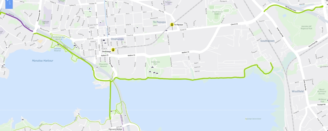
Existing Bike Routes around Onehunga source: AT Cycle network maps – S1 – Southern map
There are existing bike networks around Onehunga, but they are at the edges and of limited benefit to the community or our children.
In the absence of committed central action, what do we do? My answer is to lobby for cycling infrastructure on the neighbourhood level, the streets we know, in the expectation that these will then, in a not-too-distant future, connect into a larger network.
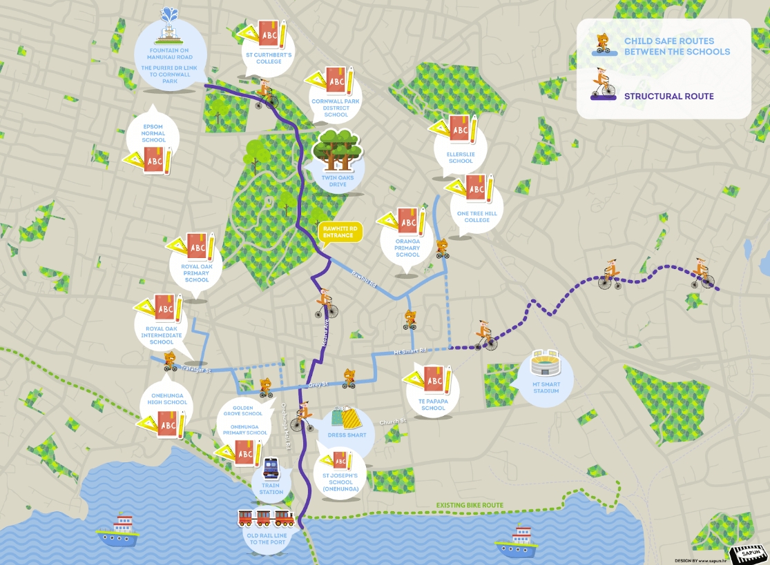
The following is an introduction to a plan for designated cycle routes that I’ve been developing for around Onehunga, as visualized in the map below. It has two main parts:
- Child safe routes (east-west) between the schools,
- Structural north-south route: integrating, in future, the Onehunga ‘spine’ with direct route from the City, connecting through Mangere Bridge to South Auckland.
This post is a starting point for a public discussion. The next step may be a kanohi ki te kanohi (face-to-face) meeting. I am grateful to everyone who has commented on the draft of this post or who have taken the time to discuss these ideas. Many of these comments have been integrated into the map, and all of them have changed my thinking for the better.
The plan has been presented to the planners in charge of Transform Onehunga at Panuku, local groups, friends and Bike Onehunga. In what follows below, I discuss the reasons why I chose the particular route, and then outline possible problems and challenges. Comments and criticisms very welcome!
Child-safe routes (east-west)
It has been indicated that a government target for the coming year is creating better access for active modes around schools. Child-safe protected cycle paths are a key element to achieve this goal.
Between Onehunga High School and One Tree Hill College there are seven primary schools and one intermediate. The best route to cover and connect all of these schools runs along Trafalgar Street, Grey Street and Mt Smart Road. It is a relatively level route and all roads are wide enough to allow a protected path to be created.
Challenges/problems: There are some challenges such as the afternoon peak traffic on Grey St as well as the morning and afternoon peak traffic on Mt Smart Road. The area around Jellicoe Park struggles with many vehicles visiting the pool and gym. A route through the park would be safer, but includes a slope; the route around the park conflicts with traffic and parking.
The precise route around Waitangi Road and Oranga Ave may depend on the HLC redevelopment plans.
Structural route
The structural route is based on the following elements:
- The existing 30 kph zone from Manukau Road, from Sir John Logan Campbell Fountain though Puriri Dr and Cornwall Park to Rawhiti Road.
- Moana Ave being wide enough to add a protected cycle way.
- Avoiding Manukau Road and the Royal Oak roundabout.
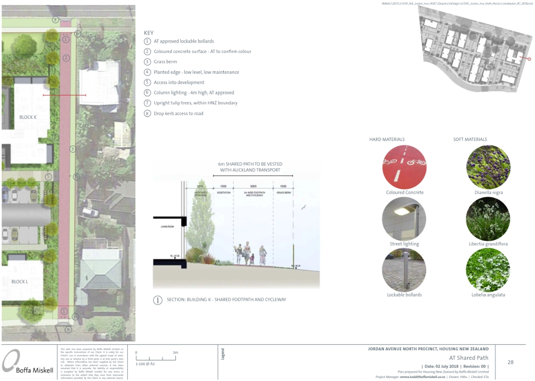
- HCNZ/HLC redevelopment of the Jordan North site allows improvement to the pedestrian connection to Wade Ave/Grey St.
Housing New Zealand – Jordan Avenue North Precinct – Landscape Statement And Design Package 02 JULY 2018 – page 28
- Avoiding Onehunga Mall Road due to the challenges of existing stakeholders (businesses) and removing parking. Also, the road is narrow at the upper end.
- The Galway St exit to Arthur St which should be closed to vehicles. This is also needed to improve safety.
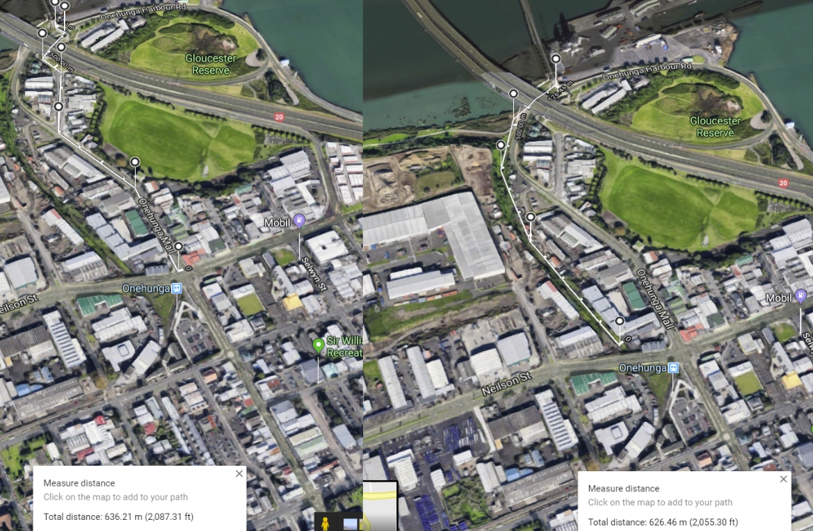
- The old railway corridor from the train station to the port which provides a safe way to separate cyclists and pedestrians from the heavy traffic around Neilson St and the lower end of Onehunga Mall Rd, especially the difficult right turn towards the Mangere bridge pedestrian/cycle crossing.
Some additional elements that need to be considered:
- Upgrading the Cornwall Park Rawhiti Road exit to allow after hours access by cyclists.
- Lighting along Twin Oaks Drive.
- Closing the Twin Oaks Drive section to vehicles – bollards to prevent though traffic.
- Crossings (new or upgraded) at various locations – Mt Smart Road, Grey St, Neilson St.
- Rearrangement of the traffic flow and intersections south of Dressmart on Galway St.
- Closing the bottom end of Rawhiti Rd and turning the area into a mini town center.
- Applying the principles of filtered permeability.
- Upgrading the street network into the 21st century.
If you wish to contact me directly about these plans, please do via twitter or email.

 Processing...
Great post. Thank you.
I live in Te Atatu Peninsula and we also use bikes/scooters to move to/from school (and other places). In my opinion removing on-street parking on one side of the road (through residential areas) and reassigning it to cycling (with proper separators) would be the best way in many places. Also introducing no-parking zones around schools and making sure it’s enforced. Crossing a road, when both sides are tightly lined with cars means absolutely no visibility from 7-8y old perspective as they’re simply not tall enough to see over the cars.
The other major one would be to reduce speed limits to 30km/h in and gradually modify the streets to reflect that. Currently many of the local roads are really wide, with extra width added for cornering at intersections which invites very fast driving.
Agree. Removing parking and lowering speed limits to 30 throughout residential areas would have a far-reaching effect on increasing safety and access.
Agree.. great post and I concur with the additional point of reducing the speed limit to 30 k on selected streets.. potentially many of the residential side streets in Onehunga. We will shortly get an opportunity to support that through AT’s consultation on a by law. That could be hugely signficiant… numbers count though – people must submit in favour. Also note that for it to be effective some physical streetscape treatments will be needed, otherwise speeds may not change that much.
Great to see local advocacy for local cycling (and walking) improvements. This is happening in other suburbs too. Often it seems to be the case that local groups like residents associations or informal groups of parents at local schools can be most effective in articulating the specific issues that need improvement. I’d recommend working with your Local Board to help get things done. Also don’t rule out informal solutions as well as advocating to AT.
“Also note that for it to be effective some physical streetscape treatments will be needed, otherwise speeds may not change that much.”
Changing the built environments in our residential areas is not a prerequisite – they already indicate slow speeds are necessary – it’s just that the culture has put pressure on people to aim for 50 and not hold people up. That pressure will go once the limit is 30.
Research shows a drop of speed limit by 10 km/hr will bring a drop of several km/hr in average speed with no changes in built environment or enforcement. I think with a change in enforcement and a change in the Driver License Test Guide, plus lots of education, we will see a big drop in speeds.
Several km/h — did that research mention whether or not that speed limit is enforced?
My impression, in the presence of enforcement, has been that a 20 km/h drop in speed limit = an almost 20 km/h drop in actual speed.
That research showed what was possible *without* enforcement or built environment changes…
I hope AT is documenting the process well, so we can offer our own stats. From almost complete lack of enforcement to effective enforcement, the results could be stunning.
I cycled to Te Atatu yesterday. Came away with serious underpass envy. I did not know you had an underpass on the North side of the interchange too. Very nice. Too bad about St Lukes Rd though. I think your suggestions fr suburban Te Atatu make great sense.
Not just double lined car parked streets. Also wide splays. Like Grey/Galway in Onehunga.
See https://youtu.be/MhUPQZ9N7NU?t=11
My proposal for Safer Streets in Onehunga is making the streets from Alfred to Queenstown Road and Neilson to Mt Smart/Trafalgar a 30 kph zone.
Excellent post thanks, Nicholas. I hope you will come back with updates showing progress, and if there are hold-ups in the process, I’d love to hear your ideas about what could be done to remove those.
Community-led development for children’s safety and opportunity. Wonderful.
Have you received any feedback from local board members about your ideas? They have funding for local projects, and may be more responsive than the Auckland Transport monolith.The Waitemata Greenways were a local board initiative for example, rather than an AT one.
I made a public forum request to the MT LB in November about Safer Streets.
The plan behind this map has separately been synthesised since the start of December. I’ve talked briefly to the council officers regarding this plan, but not formally to the board.
The first local board meeting for the year is today. It was scheduled for Onehunga, but is now in Panmure [1]. I can’t attend as I’ve got family commitments. If someone else is in the area and has time, I’m very happy for them to make a public forum request for the LB board to consider the proposal.
I intend to send the LB an email and ask them to discuss it today in their meeting. But it would work better if someone was able to make a request in person.
[1] https://www.aucklandcouncil.govt.nz/about-auckland-council/how-auckland-council-works/meetings-council-bodies/find-meeting/local-board-meetings/Pages/maungakiekie-tamaki-local-board-meetings.aspx
Would be interesting to see a traffic analysis of Twin Oak Drive, walking it most days to and from work there is definitely commuter traffic rat running through there, how much though? Its up to Cornwall Park Trust Board to make the call on closing it to through traffic, for that part of the park. Its not like they haven’t be proactive in this respect in the past.
I’ve seen (videoed) commuter traffic using this route. They often travel faster than the posted 30 kph limit.
Closing that route to vehicles at both ends of Twin Oaks would not have much impact. Vehicles could still access the archery range, etc from the other direction.
I still think we have got the methodology for reducing urban driving speeds are completely arse about face. On roads where 50 kph is clearly dangerous what do we do? Absurdly we leave the speed limit at 50kph but build expensive and noise creating obstacles to “calm traffic” Brake, Bounce and Accelerate, rinse and repeat.
Why is there a total institutional, and perhaps societal, illogical resistance to simply set a safe speed limit and enforce. Enforcement, is incredibly effective education, and could be made self funding if the fines were retained by the enforcing authority. Perhaps this method is just another example of “Not the Kiwi way”
Well this Kiwi wants a much healthier use of road space.
We have “Traffic Calming” humps and Islands on the top end of Selwyn St in Onehunga.
The Bad:
– Its now a point to point race track
– Cars entering the street now automatically swing in to the opposing lane to line up for the sprint to the first island
The good:
– The residents get to drive “real slow” between the islands and frustrate the hell out of the rat runners
– The Trafalgar St end one is a “Car killer” Usually at night some one speeding into the street ends up on top of it. Various broken bumpers, fluids from cracked sumps & radiators, etc is left behind.
Onehunga, and I suspect most of Auckland, hasn’t had any significant residential street in decades (80’s & 90’s). They were safe to bike, walk, scooter on then because there just wasn’t the volume of traffic. I think a significant number of residential streets need speed restrictions and traffic filtering at strategic points, to return them to an environment that encourages alterative personal transport means.
The speed humps not only damage cars but the noise and vibration is seriously detrimental to their immediate neighbourhood. Houses actually shake.
Wonderful to see a focus on local travel, particularly in this area where there’s barely any cycleway provision, yet high density residential population mixed with plenty of traffic.
It will be interesting to see which parts of this can progress quickly. I can see the disused rail path as being a quick win, and the east-west route from Trafalgar to Grey to Mt Smart as making the biggest difference to helping get schoolkids on bikes. A safe crossing of Mt Smart Road would help convince parents too.
i used to cycle on hugo johnston & church st east as they were pretty quiet, the footpath on hugoj could just about be shared as there wasnt many peds.
I liked your additional elements. I would add:
Upgrading the Cornwall Park Rawhiti Road exit to allow after hours access by cyclists.
Yes I agree – this is the main route from the Isthmus to East and South.
The same for Cornwall Park Onehunga Mall exit. This is the primary route for commuters from the Isthmus to Mangere Bridge, and having to lift your bike (or eBike) over the wall at 6:15 on a winters evening can be a drag.
I would add that the two roundabouts on Campbell Rd be tweaked somehow – they are really dangerous when trying to enter or exit Cornwall Park from the South as cars speed along Campbell Rd.
Lighting along Twin Oaks Drive – really? I love the dark section in the middle of the city. Maybe that’s just me.
Closing the Twin Oaks Drive section to vehicles – bollards to prevent though traffic.
Oh nice but I have not found cars too much of a bother there. Certainly no more than the stealth joggers on the road when there are 3 footpaths.
Crossings (new or upgraded) at various locations – Mt Smart Road, Grey St, Neilson St.
Rearrangement of the traffic flow and intersections south of Dressmart on Galway St.
Closing the bottom end of Rawhiti Rd and turning the area into a mini town center.
This sounds really nice. Oranga Ave is such a drag strip these days
Applying the principles of filtered permeability – Yes – all over the city please.
Lighting along Twin Oaks is maybe a safety issue. It is very dark. It think at that point women cyclists may prefer a route where the can see further than a bike’s headlights.
Creating this network in Onehunga lead from the community could be a model for the rest of the city.
I’ll be very interested to hear what they say about lighting, given that someone in Council seems to have a bee in their bonnet about removing lighting to make sure people aren’t lured into unsafe places on false pretenses of safety, or something. Fact is, good lighting makes an enormous difference to cycling, and in winter enables cycling on routes at times of the morning and evening when personal safety shouldn’t be getting up anyone’s nose at all.
A very common problem is on street parking. Many streets, even supposedly small residential streets are very wide. At 8.5 metres and wider, it becomes possible for cars to park on both sides, and still have enough room for cars to pass each other in between.
Now you get ambiguity — should cyclists swerve left between cars and let traffic behind them pass, or not? I learned in primary school to never swerve into a parking lane. For good reason, merging back into the traffic lane is quite dangerous. First because you may simply collide with a car behind you, but also because the swerving motion hides you from people in parked cars checking before opening a car door.
I don’t know how drivers will take it if you don’t go left between parked cars.
You get this situation on almost every residential street in Auckland. Slowing those down to 30 km/h will help a lot. Second step is removing the ambiguity in some way, either cycle lanes (simple painted lanes will work at that speed) or by making it clear that nobody is supposed to swerve into that parking lane (painted parking boxes, planters, etc…).
The few times I’ve been in Onehunga (in the weekend) the parking situation was quite gnarly. For some stupid reason nobody — AT or the mall — wants to charge for parking, with the predictable messy result. I’d hate to get into that mess as a cyclist.
(I also wonder how the local people like their weekly serve of mall parking every weekend)
Parking on Arthur St particularly is bad because of Dress Smart. I think a 30 kph Safer Street zone is important.
However, unless we can remove commuter traffic in Onehunga it is not enough for children. A protected child safe route with good crossings is vital.
For the structural route, there are some areas where a protected route should be built (Moana Ave), plus crossings (Mt Smart). Areas like Conwall Park (30 kph) and Galway (with filtering) may not need this.
Yes. I really hope those routes will materialize.
Seeing as we are talking about Onehunga is the light railway going to go in there or. Is .it just going to continue on the motorway and go over the motorway bridge
Also the cycleway along the foreshore need to connect to Great Sth road over the railway at Westfield.
Royce, that’s a good question and Nicholas can comment further, but it looks like the replacement for the Old Mangere Bridge–building due to start in March–has NO provision for light rail.
Still time (about 5 seconds!) for the authorities to intervene (JAG?) and rethink and commission redesign…
This is complex. I was at MHRS meeting yesterday and we were discussing the Old Mangere Bridge.
The existing consent for replacing the OMB is being used as a basis for the replacement tender. This tender closes in March.
There has been no provision for a redesign to carry LRT on this replacement bridge.
There has been discussion that getting a consent for third crossing will be impossible.
Even if a third crossing is possible, the best alignment thru the Mangere Bridge township will not be possible. Plus the alignment for the third crossing may have other restrictions.
While their is a provision for a heavy crossing under the SH20 bridge. According to rail expert the trains will cross a very slow speed. There may be other practical issues.
Basically NZTA are ignoring the LRT project.
It something that needs more attention.
I ride through Onehunga to get to work and it is definitely a mixed bag. Agree that Grey Street could be very useful, particularly if there is a safe way to cross Mt Smart Road. Also there are a lot of stop signs on Grey street which could potentially be turned the other way – but that might encourage rat running. I’d like to use Grey street but find I have to wait too long at all the intersections.
Realistically all of Mt Albert Road and Mt Smart Road should have cycle lanes. I notice they are currently doing work in various parts (e.g. replacing footpaths, safety improvements at three kings, etc) and not bothering to add cycle infrastructure. Some of the footpaths are very wide – maybe they could have been replaced with a something more narrow and a cycle lane. Or a wider footpath that kids can cycle on. They should have at least forced Vector to get their @&^%$ power poles off the footpath.
There’s three security guards on the shared way on the motorway bridge which is good for employment. But if Onehunga is to be effectively bypassed by lightrail then we might as well use the old rail alignment as a cycleway. Looking at the difference in height its possible to have a tunnel under Neilson street to give better access to and from the railway station. If the light rail is going over the motorway bridge would it be on the eastern or western bridge. Western bridge would be better for a Mangere Bridge stop and Eastern better for Mangere town center. Presumably it could cross the motorway further towards the airport if it needs to.
Short term upgrading the crossing and footpaths on Neilson/Onehunga Mall is workable. Alternatively depending on routing this could also be done on Neilson/Galway.
If the LRT is built over Neilson St. Then it should naturally include the cycleway. I think the cycleway and LRT can definitely co-exist down the old railway line.
A tunnel is also a good option and for a cyclist not as high as for a LRT line. But that could be a next stage development and it shouldn’t be a roadblock for setting up the route immediately.
I have come to the conclusion that a very simple and effective way to increase road capacity would be to abolish all on-street parking – everywhere, all the time. Accept that a road is a public thoroughfare, not a private parking area. This post suggests to me that the road space freed up in this way could be best used, not by allowing more cars to use the road, as I originally thought, but as cycle ways and foot paths. It is time to stop pandering to the car and those who insist on driving them everywhere, everywhen.
I often dwell on this, especially as more and more push their private cars off their private land and park them on the public street (I too am guilty of this, so am not pointing fingers). It is such a waste of public space. In this context, there are beautiful wide streets in Onehunga that seem narrow because of parked cars – the north end of Onehunga Mall being a simple example
Certainly along Arthur St we get lots of workers and shopper parking for Dress Smart.
It’s a mixed blessing. They narrow the road. This notionally slowers the commuters down. Not always, only when it’s busy. The morning rats definitely like too race track.
Ideally Arthur St would also have a protected bike route. It could serve as proxy for these parked cars and slowing down traffic. It doesn’t serve the wide area like the Grey St route. So I haven’t suggested it.
Plus it’s much better to get rid of the racing commuter completely via other means.
Great work & post Nicholas. I did a bit of first time quaxing in Onehunga about a month ago in that hot January weather while sorting out a car. Onehunga has become a bit of an adopted town for us (we are in Mt Wellington) since the new bus network with our local 298 bus route making it easy to get to the pool or library rather than say Panmure or else where even though it’s further away. Can bike to Penrose train station then carry on with the bike once there, or bike all the way along the foreshore if in more of a recreation mode. Did that quaxing on a quite Saturday afternoon so traffic was very light, but it’s quite nice to cycle around there when it’s Sunday etc, I find with the main street fairly slow and the grid network of roads easy to navigate.
Not sure what else to add, you must know the place pretty well, seems a good plan you have. Note that the ugly cycleway that runs along the South Eastern Highway is missing off that map. This is pretty much a recreational cycle route though. Some readers may not realise that you can get to this from the smaller area of the main Sylvia Park Shopping Ctr, to the right of the Torpedo7 & PK Furniture https://goo.gl/maps/D1STencqk1z there are no signs to navigate to it as all! This comes out at the Great Sth Rd & Church St intersection, you can then ride on the wide path over the rail line, through to Hugo Johnston Dr which is quite nice for an industrial area with all the large trees over head, road a bit rough though. At the end is the start of the Waikaraka Cycleway.
Main focus was Onehunga. So not everything is there.
I’ve used the bikeway along the SE once. It’s a good connector. The challenge is getting from there to Onehunga unless you go down via Hugo Johnston and along the coast. (PS: I’ve been told there is a crossing on Church St E, so you can avoid the messy bit from Great South to HJ.)
Part of the problem with this route is that messy section. If you are commuting the detour around the coast is quite long. Plus no help if you can are coming or going from the middle, like down from Oranga onto Church St.
Ideally there is a protected route down Church St and Great South. But I think that is another battle. It’s not a fun route: https://youtu.be/OdrZzmfGKd8?t=295
Yes the Church St E I use on weekends or whenever traffic is quiet saves going up and over the bridge & waiting at lights forever.
Looks like a good plan.
I’d also like to add a shared path on the full length of Neilson street, and the south side of Church along to Great south. There is room for an off road path over the full length of this route, much like they have built on the short section next to Waikaraka park. I guess until NZTA come up with a new plan for this piece of road nothing much will change.
I work on Neilson street and do bike to work occasionally. There is a lot of employment along there which is only served by vehicle at the moment, there are no safe cycle routes, and with the new Bus network, no longer a useful bus..
Neilson St is somewhat locked up by the EWL mess. Are the drop downs to the Waikaraka cycleway useful? I don’t really bike that way – Church St is bad enough.
Not really for me, I come from Ellerslie, and work near Metroport. I usually cross the motorway at Penrose, follow station road around behind the stadium and then down Neilson. This avoids the worst of it.
For anyone not on twitter. Here is another article today on Bike Auckland. This is in the same area – Mangere Bridge to Onehunga. It shows a good example of the importance of creating safe independent spaces for our children on their bikes.
https://www.bikeauckland.org.nz/free-range-kids-on-bikes-an-adventure-and-a-challenge/
Sigh. And hats off to Bike Auckland for being positive about it when it makes me want to scream. Poor little kid. We adults need to shine the spotlight on ourselves and what we’ve done to freedom.
Nice post, agree the biggest bang for buck is to focus on those who don’t have driving as a choice: kids (someone always says we should start with cycle lanes on Neilson St for the industrial zone workers – talk about some truly pitiful uplift potential. Turning up to Waikaraka Park Speedway on a bicycle is a pretty much guaranteed way of getting food thrown at you).
A few thoughts:
I see Mt Smart Rd is envisioned here as a key route. But the brand new frequent 66 bus has severe reliability issues along there, particularly at awful choke points like Mays Rd. Ideally long sections of Mt Smart Rd need both bus and bike lanes – is there even room?
If not, it would have to be parallel bike routes – at least for the shorter distance journeys.
Te Papapa schoolkids would get there via Mays and Captain Springs Rds.
For One Tree Hill College and other northeast destinations, Mt Smart Rd could be mostly avoided with signals (or ideally a raised table intersection) at Curzon/Namata for access through to Roosevelt, Waitangi (or maybe through Ferguson Park to Oranga Ave) and beyond. Cycle lanes on Oranga Ave can’t come soon enough, it’s a drag strip for impatient, foaming rat-runners at peak times.
(Or maybe the stupid “Bring back the 312 bus” petition will prevail, the precious 66 will be replaced with a hopelessly slow burb crawler and then any roadspace problems would be solved)
Roosevelt is a good suggestion. I’d ignored Namata because it gets very steep, but Roosevelt is still a flat route. Few points:
1. Not sure about HLC’s plans. Some of these roads may change.
2. Oranga has a zone started in term 2. Not sure the exact plan at the moment. I think it stops at Mt Smart Rd.
3. The OPS zone stops on Alfred St.
4. So there is a catchment between these two zones for Te Papapa. Those child will want the Mt Smart section.
5. There is also the catchments to Royal Oak Intermediate School and Ellerslie School. Which intersect around Rockfield. Then One Tree Hill College and OHS. Old kids will prefer more direct routes.
Not sure, Captain Springs Road or Mays Rd are good for a bike route – narrow and traffic volumes. Plus the industrial edge with trucks, etc. But it is the only route for the area south of Mt Smart unless they use Alfred.
Alfred maybe better as it intersects with Grey.
Great post Nick. I know our kids love the freedom and confidence that they have gained from cycling off to school everyday on their own. Grey Street would be a perfect east-west link across Onehunga and certainly possible with removal of parking on one side of the street (need to get in quick before all the apartments go up and street parking becomes full). I know it would be a squeeze to get cycle lanes on Onehunga Mall but the section from Arthur Street down to Train Station is super slow and suitable for cyclists to just take up road space. As kids grow in confidence they can do this.
I really like the idea of blocking off the largest roundabout in Auckland that is One Tree Hill ring road. There is no need for cars to drive all the way around. You could make the ring road one-way and take one traffic lane as a cycle path. THe footpaths in many sections of Cornwall Park are terrible too – the extra roadspace would be useful for mums with prams.
Also like the idea (wink wink) of blocking off the bottom of Rawhiti Road and using space as a mini public space with outdoor dining for the great local restaurants/cafe there. It would be good to get some local support for this – anyone live around there? Could approach the businesses too. Parallel parking could be alongside on Oranga Ave to offset loss on Rawhiti.
I think the parking on Onehunga Mall from Arthur to the station is very hard to remove. Maybe if LRT went down the route and cars were removed completely. From my experience the traffic down there is anything but simple. Too much thru traffic, combined with parking cars.
Conversely, I think that Galway is much easier to modify. Even the sections south of Arthur St. Maintaining a linear connection all the way from Grey St to the train station. Plus it is still close to the town center. Given the old railway route is also not centered on Onehunga Mall Road, I don’t really see a great benefit to using the OMR route.
One Tree Hill is very pleasant without street lighting. There is less light pollution and the observatory has better vision of the star because of it. I don’t like the idea of closing off any driving access through One Tree Hill either. I think it’s time to find another route.
My thoughts too. It is an oasis in a busy city, amazing at night, and also a private road, and 30km/hr. I’d much rather we focussed energy on creating more route options near here, or improve the parts extending beyond the park in each direction.
I’m more inclined to think that in a city that has become so depressingly dominated by cars, oases should offer a chance to escape them. Taking the bus to One Tree Hill is a difficult proposition because nothing is set up for easy pedestrian amenity and bus connection – perhaps this needs to be fixed at the same time as keeping the cars out.
It’s also possible to put in dynamic barriers which can be operated by a swipe card – in this way, people with mobility needs would have better access than they currently do.
I am torn on lighting, but I really don’t see the benefit of car traffic through the park (the solution that Heidi proposes is good). Try to imagine what the park would be like without cars – we could have much more space for pedestrians (the footpaths are far too narrow for the volume of pedestrian traffic especially on weekends and late afternoons) and it would be safe for everyone to cycle.
The park at night is already an oasis from cars: the gates are shut in the evening. Which makes it both dark and quiet. Intimidating at first but an amazing experience for central Auckland by bike. Beware the sheep though, they also take advantage of the roads when there are no cars!
I’ve ridden thru the park at night. It is to be honest a bit scary.
Why do you think the fact it is a private road is important? Surely the park is a trust for all people of Auckland? Not just cars. Which are not people. Anyway roads pre-date cars (and bicycles).
Follow-up comment from a neighbor reminded me about winter time and short days. Lighting during this period will be important to encourage winter bike commuters. A safe relatively carfree route is vital in the darker winter months.
Exactly. Taking the kids to afterschool activities mean we are often coming home in the dark. Perfectly reasonable to expect light.
Commented just above about the lights…
The private road thing: I reckon this is a fantastic route already, and while some improvements are always good (such as an easier bike exit out the south side after the gates shut), the Trust is doing a great job. It’s the AT-managed roads outside the Trust’s area where bike riders will see the most benefit from improving:
– the laughable bike lanes on Greenlane Rd
– Campbell, Onehunga Mall, Moana, Rawhiti, Grey…
– any and all intersections for pedestrians and cyclists in the general route you’ve suggested.
Even better, if there’s a better alternative safe cycling route around the park, you won’t have to rely on cycling through a virtually empty park at night. So, let’s focus on the rest of your suggested pathways first!
The reason we probably need to focus on the areas AT is responsible for first is that the changes needed there are needed all over the city. AT need to be pushed about what can be done with the space available in the road corridors. Each local win helps the next.
But the off-road routes, as could be provided within One Tree Hill, are important too. It’s another necessary mindset shift. Trips that are mainly off-road are good for anyone’s mind and soul, but particularly useful for families with wee kids. All the possible green areas – when you look at a map of Auckland – should be retrofitted to allow good, car-free cycling, including at night.
Some – like the Domain – need to be emptied of cars. That has become a ratrun extraordinaire. Others – like Western Springs – need to be saved from having the lights removed. A win at retrieving One Tree Hill from car dominance would help at other parks too. Sometimes people can’t imagine how good change would be – One Tree Hill is an excellent demonstration opportunity.
Thomas,
I appreciate your concerns. My suggestion for lighting along Twin Oaks is a suggestion for discussion. Light pollution is a problem. That said, in terms of the telescope I wonder if lighting along this section with the Oak trees will actually have any impact? Safety is an important factor if we wish to create the space for all people in this city.
Can you tell me why you think driving through the Twin Oak over all the other users of the park? Surely it is better to experience this section of the park out of the car. The footpaths in Cornwall Park are often full and it can be struggle for children on bikes to find space.
Surely it would be think about all users of the park.
Finally, what alternative routes would you suggest? Royal Oak roundabout?
I’ll leave you with a tweet from this morning.
https://twitter.com/stateless/status/1100852578223480832
Please also drill down into the Herald article about the cyclist who was knocked off his bike.
Modern LED luminaries are remarkably directional and produce surprisingly little spill. Check out the lights already installed on the lower end of Franklin Road especially those above the footpaths. The lighting instaĺlation is not quite finished though.
just to comment , my son mountain bikes but id never let him bike auckland streets , they are far too dangerous . there is no cycling culture in auckland .ie kids do not cycle to school . so build all the empty cycle lanes you like , they will remain empty
John, it’s very funny you say that “kids do not cycle to school” in an article that opens with the story about a group of middle-schoolers who cycle on their own. These are real children, I can assure you.
John I promise you us Aucklanders can become as cultured as anyone else.
Problem = “id never let him bike auckland streets , they are far too dangerous ”
Good solution = changing the environment so it is safe, eg Nicholas’ post.
Precedent = Many. The Netherlands, for starters, where many children were dying due to car domination, but they took action and changed the environment so it is now much safer.
Mandate = International research, international guidelines, NZ research, NZ guidelines.
Barrier to solution = resistance, such as “build all the empty cycle lanes you like , they will remain empty”
My children and their friends cycle on city streets. The thing that endangers them the most is a few drivers thinking we don’t ‘have a cycling culture’ therefore they shouldn’t be there.
How about joining the people working towards the solution so our kids can cycle?
Here is video of the Galway section of my proposal – from Arthur to Princes St.
https://youtu.be/Zst2fHZCom0?t=63
Great work Nicholas. Unfortunately if you get this to happen it will be for someone else’s kids, not yours. This will take at least a decade to get done. AT is not interested in the suburbs until at least 2030 and local boards have virtually no budget and, with a few notable exceptions no interest in cycling.