This is a Guest Post from David R. This is part 3 of a 4 part series about the issues with Victoria Quarter, and the urgent need to fix them given the areas rapid population & job growth. Part 1 can be found here, and Part 2 here.
Cars, Cars, Cars
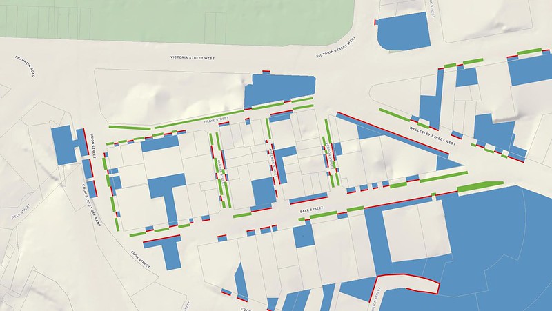
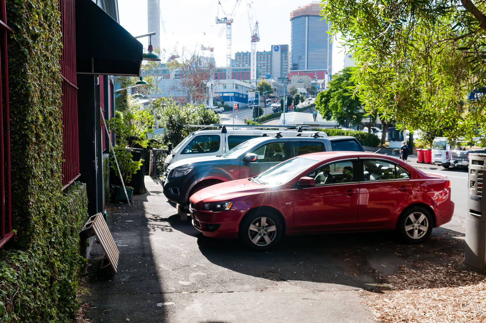
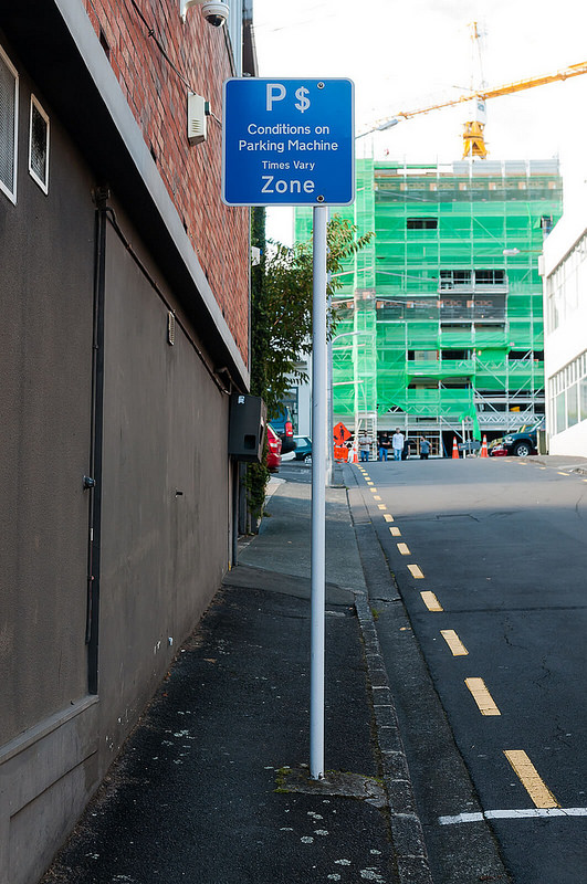
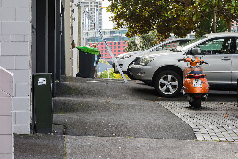
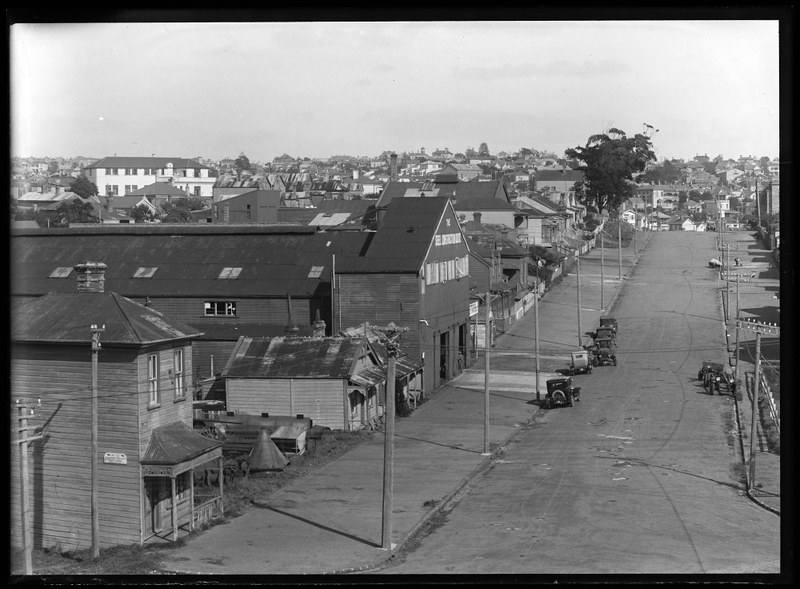
Victoria Quarter suffers from a focus on wide roads and plentiful car parking. The image below highlights this prioritisation and land use by overlaying areas committed solely to the storage of cars (not including the space allocated to movements within the road itself!):
- Blue represents surface level parking or car parking buildings and associated driveways
- Green represents on street parking
- Red lines represent street frontage dedicated to cars (driveways, angle parking)
This prioritisation of car movements and parking results in some fairly negative impacts for the area:
- High vehicle speeds
- Driving encouraged to and within Victoria Quarter
- Inadequate, non-compliant footpaths which are generally obstructed by cars (legally and illegally)
- Difficulty for pedestrians to cross any street, especially children
- Many roads are impossible to cross in a wheelchair or with a pram
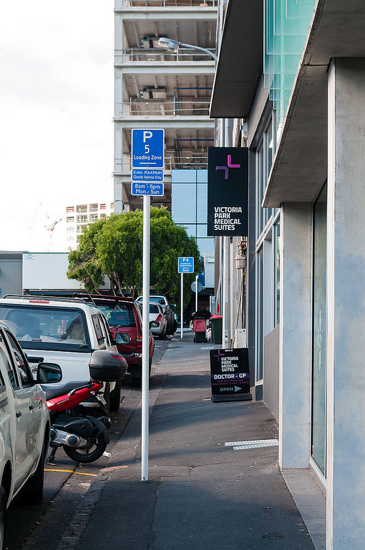
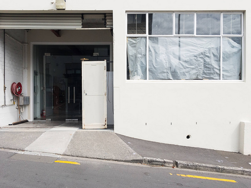
What does this glorified parking-lot-masquerading-as-a-Victoria-Quarter look like?
Wide roads…
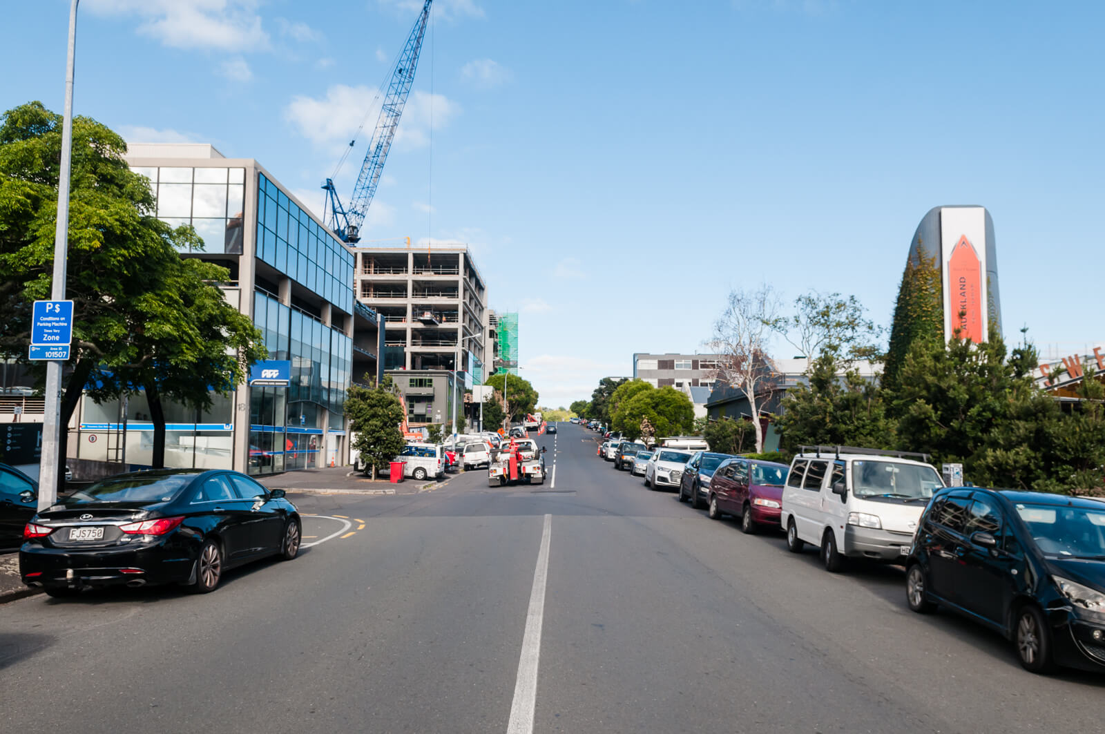
…filled with cars…
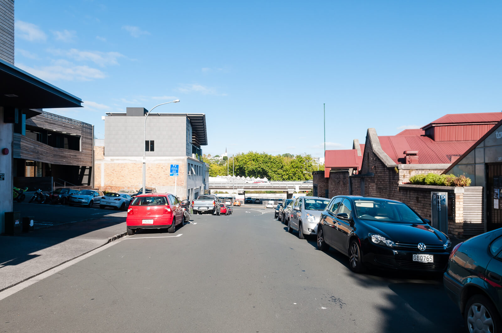
…with footpaths always at risk…
… and aggressive on-street parking allocations, that push aside any doubt that this is a place with no consideration for pedestrians

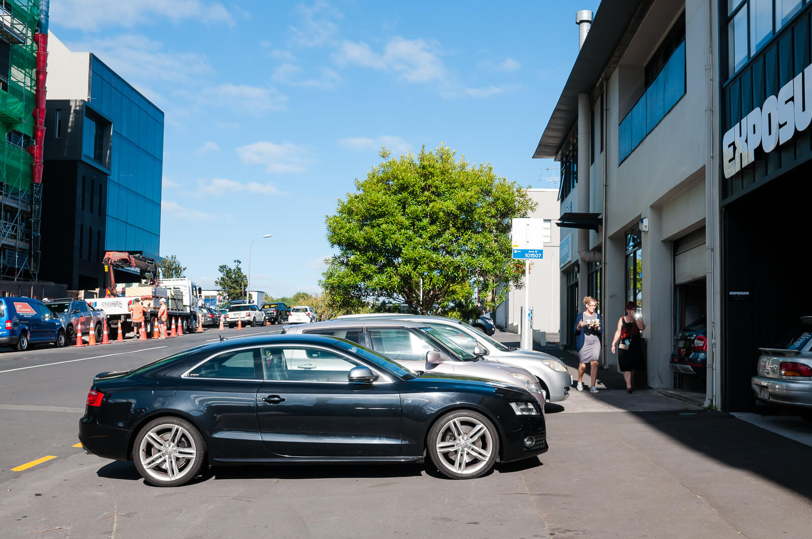
(How many people would blame the bicycle for being in the way of the crossing here?)
On foot
As a result of this car dominance, there are many, many areas where Victoria Quarter falls well short of the standards set in the NZTA Pedestrian Planning Guide (NZTAPPG) and Auckland Transport Code of Practice (ATCOP). Very few footpaths in the area could be considered ‘adequate’, let alone ‘good’ and it is possible to quantify all the ways that they fail by referencing these two standards.
Of course, applying new standards to existing areas will often result in impossible situations, but many are only impossible if the assumption that ample parking and extensive vehicle access are the primary requirement for the area. As mentioned a few times now – these road geometries predate motor vehicles and the roadway was not an especially dangerous place for pedestrians in ~1900 when they were laid out. The roads are as wide as they are now purely because they could be, not because anyone designed them for some specific traffic flow or parking parameters.
In each case I’ll take a standard, give a brief point about where we’re failing, give a reference giving quantifiable reasons why it fails and then some photos.
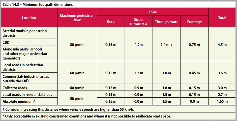
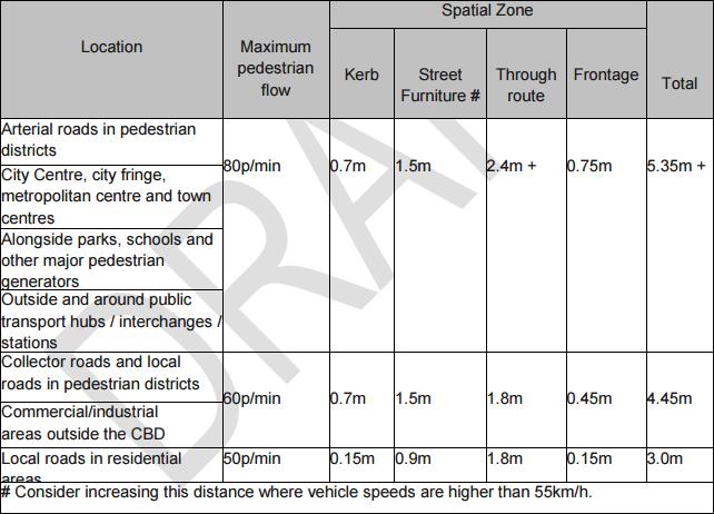
Footpath Widths (NZTAPPG 14.2.2, ATCOP 12.4)
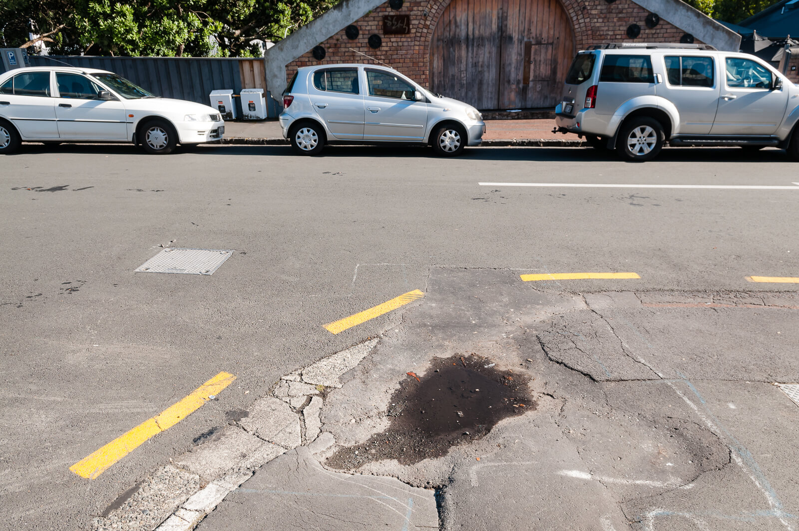
Provision for parking and traffic lanes has eaten away at footpath widths throughout Victoria Quarter.
All new and improved developments should comply with the above widths. Where footpaths have not been provided to a suitable standard in the past, RCAs should develop works programmes to bring them up to a suitable standard.
NZTAPPG and ATCOP seem fairly aligned here:
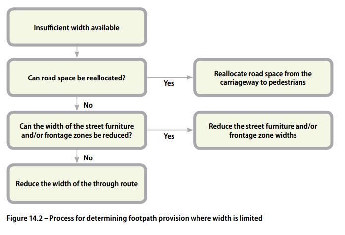
When there appears to be not enough space available to install the appropriate footpath width, the step-by-step process in figure 14.2 should be used:
This seems pretty cut and dried, no?
So many examples….
Passing Places
Existing footpaths are so narrow as to be difficult to navigate in single file on foot and impossible to navigate by wheelchair, never mind two wheel chair users attempting to pass each other.
Where through route width is constrained to less than 1.5 metres wide, passing places should be provided – but only where it is not possible to widen the footpath over a longer distance, and never as a low-cost alternative to a full-width footpath. The advantages of passing places are:
- two wheelchairs can pass each other
- walking pedestrians can pass stationary pedestrians, such as those waiting to use a crossing or waiting for public transport.
How about this one?

Gradient & Crossfall (NZTAPPG 14.4, ATCOP 12.5, 12.6)
Driveway implementation throughout the area have created areas with unsuitable and, in some cases, dangerous gradients and crossfalls – even those of able body will struggle.
Crossfall is the slope of the footpath at right angles to the direction of travel. Some crossfall is required for drainage, but excessive crossfall in the through route requires people using wheelchairs and walking frames to use extra energy to resist the sideways forces. As the crossfall is invariably towards the road where footpaths are in the road reserve, anyone losing their balance is directed towards motorised traffic
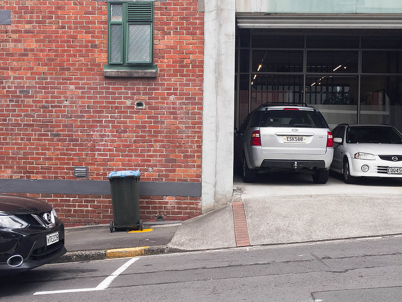
Driveways (NZTAPPG 14.11)
There are a large number of driveway entrances making up large portions of the footpaths. Very few have been designed to meet standards and most provide extreme, awkward gradients and crossfall to pedestrians, with no consideration for visibility or reducing obstructions.
Driveways should have a level landing at the top (similar to a kerb ramp), and be at least 1.2 m wide across the through path. The crossfall should be less than two percent, with the gradient differing from the adjacent through path by less than two percent. To achieve this, the sloped part of the driveway should be within the street furniture zone and/ or the adjacent private property. It may be necessary to lower the footpath
and
Footpaths on either side of the driveway should be kept clear of all obstructions. A five metre by two metre ‘visibility splay’ should be installed in areas with high pedestrian flows and more than 200 expected daily vehicle access manoeuvres
Not so great – the footpaths are so narrow that you’re forced to walk centimeters from corners where cars will be reversing out, with no margin for error.
The narrowness also forces driveways to slope across the footpath to reach the road, and as you’ve seen at the start of this post, there are a lot of driveways, meaning that the footpath doesn’t stand a chance.
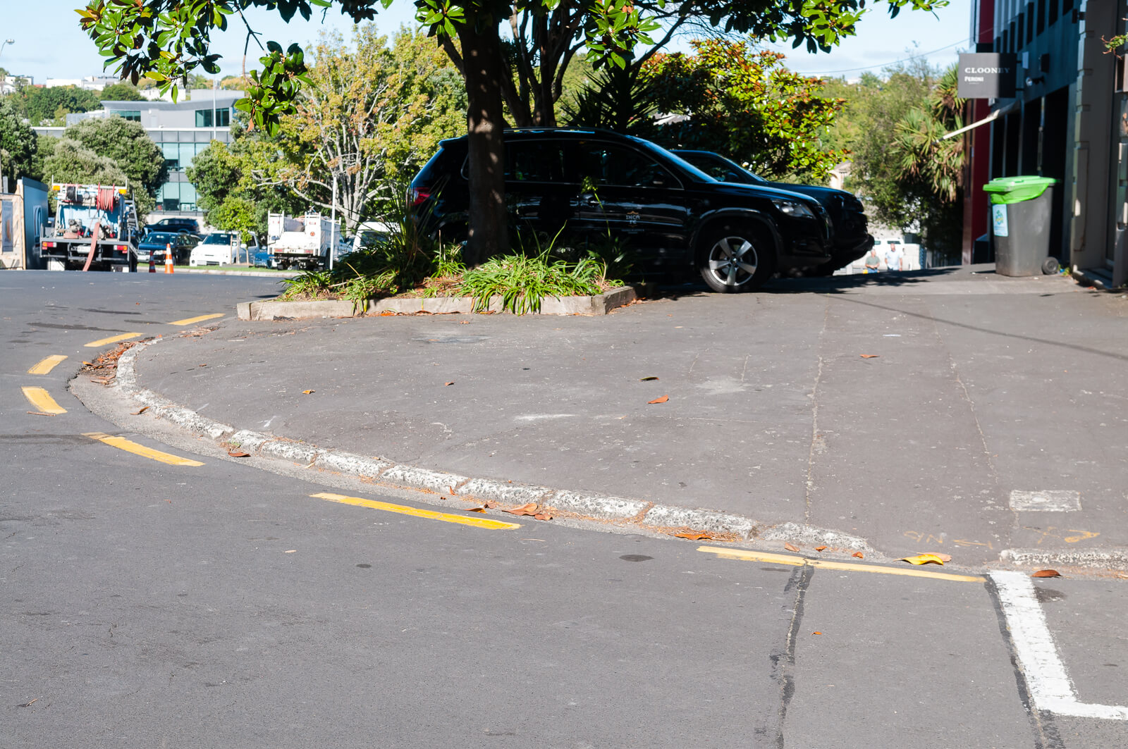
Crossing Site Distance (NZTAPPG 15.3)
Many footpaths, such as those on Adelaide Street, have been cut back so far that buildings exist almost right up to the kerb. This, mixed with parking allocated right up to intersections, massively reduces visibility for pedestrians and drivers. The occurrence of steep hills and blind rises throughout the area exacerbates these issues.
At most crossing points pedestrians need to choose gaps in the traffic stream to cross safely, so they must be able to see the approaching traffic in good time. This distance, known as the ‘crossing sight distance’, is a critical element in ensuring pedestrians can cross the road safely
and
Drivers should be able to see all crossings easily so they can adjust their speed and be aware of the potential for pedestrians to step into the roadway. They should be able to see the crossing over at least the appropriate ‘approach sight distance’ although an extra safety factor is recommended.
This matters, a lot, when parking is permitted right up until the intersections:

Kerb crossing (NZTAPPG 15.6)/Pram Crossings (ATCOP 12.8)
A large number of intersections provide absolutely no kerb treatments, or treatments that are inadequate or crumbling.
Kerb crossings are an integral part of every crossing facility, whether mid-block or at intersections. Kerb crossings are of two types, kerb ramps and blended crossings
When designing kerb ramps, it is important to ensure that:
- if there is a kerb ramp on one side of the roadway, there is also one on the other to prevent pedestrians being ‘stranded’ on the roadway itself
- there are no low points in the gutter where water can collect
- if installed at a pedestrian crossing point, the whole kerb ramp is contained within the crossing markings Every kerb ramp comprises:
- the ramp, which is the area pedestrians cross to change their grade
- the top landing, which is where pedestrians move between the ramp and the footpath
- the approach, which is the section of footpath next to the top landing
- the gutter, which is the drainage trough at the roadway edge
…
Many kerb ramps also have flared sides, which are sloping areas next to the ramp, to prevent pedestrians tripping on the ramp edges. Some ramps also have a bottom landing. Return kerbs can be used instead if the kerb ramp is carefully located within the street furniture zone or at a kerb extension.
…
The various elements of kerb ramps can be combined in a number of ways.
…
Kerb ramps create particular problems for the vision impaired. This is because they often use the kerb face as a tactile cue for the footpath edge and kerb ramps can increase the risk of their inadvertently walking out into the roadway. To avoid this, all kerb ramps should incorporate appropriate tactile ground surface indicators.
…
Pram crossings must be provided at each kerb line at all intersections and also be provided at other locations to suit the logical and safe movement of pedestrians. Particularly on free left turns and where there is a large radius kerb line, pram crossings must be located to ensure adequate sight distances for both the pedestrian and the vehicle road user. Pram crossings should generally be placed to provide the minimum crossing distance, but also in a location where visibility is not restricted by buildings, walls, hedges or other obstructions, to allow pedestrians to assess gaps in traffic and not diminish a driver’s ability to stop safely if required.
There are a handful, but mostly not.


Do these two count count?
Whose fault is this?
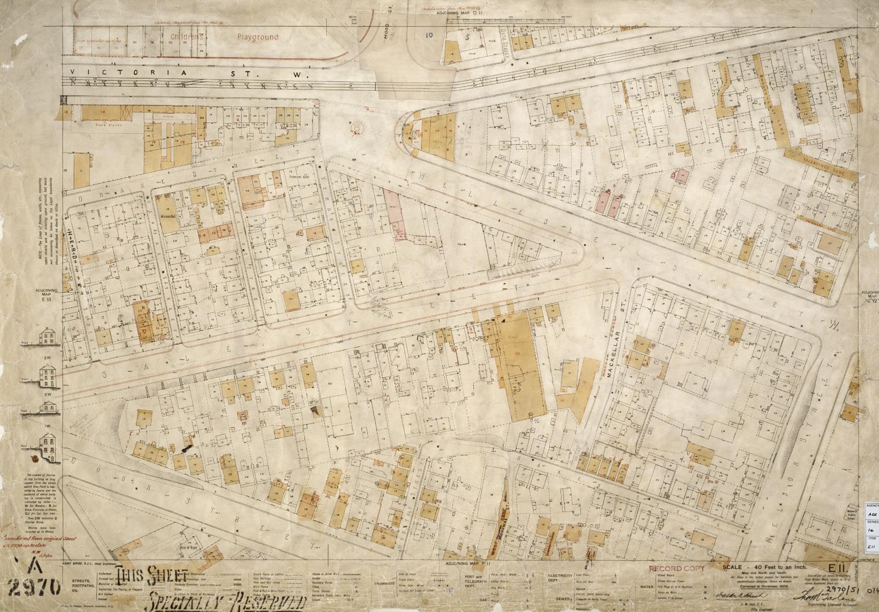
As mentioned in the last post, the current road (and footpath) layout and widths is a result of doing nothing for over 100 years. The layout is identical to that in 1908, with the exception of the motorway and the loss of some streets within the City Works Depot:
Vernon Street has always had narrow footpaths, though they used to at least have a consistent gradient:
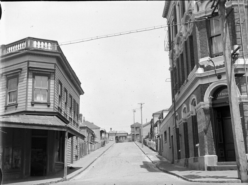
and sale Street has always been wide…
But keep in two things in mind:
- The driveway designs and parking designations were perpetrated against the existing environment – they are not inherent, original nor accidental
- Hobsonville Point and Long Bay were fields, but now have footpaths suitable for all users
Victoria Quarter highlights the lack of imagination and care the inner portions of Auckland City have experienced for the last 50 years.
What to do?
So, does all this indicate that this is somewhere that Auckland Council might envision as a ‘vibrant urban community’? Somewhere that they are suggesting people should give up their backyards, big houses and nice smooth footpaths for?
I suspect not.
The simplest fix will come from deciding what the area is for (already done!) – defining a hierarchy of needs based on the goals of the Auckland PlanCentre Master Plan and the City Centre section of the Unitary Plan. The solutions will become clear once that assessment is done, if it hasn’t been done already.
So where is the plan to achieve this vision?
Next time
Next time I’ll be wrapping up with the intersection design of the area.

 Processing...
Hi David, thanks for taking the effort with this. Well researched and informative. I hope it get used. In many parts of the world where there are narrow footpaths the road signs get attached to the buildings. But oh no, not in New Zealand we always put signs on posts and always put the post in the footpath. Dohhh!
I would echo “thanks for taking the effort with this. Well researched and informative”. Sometimes I find posts to this website rather over the top anti-car but a well researched post with ample example photos is impossible to argue with.
I doubt there is a magic wand that will resolve matters totally overnight but I’ll await your next post with interest.
It is such an easy fix. Just bring in a special rate for anyone who lives in the area or owns a business in the area and start fixing it. Just start at an extra $1000 each per year and if that isn’t enough then raise the rate.
Not sure if you’re being sarcastic, but there is a special rate for residents and businesses in the area – the money is all getting spent elsewhere, however.
Central areas have concentrations of the connecting transport lines between outer areas. In a city which connects these areas with space-efficient PT, that means the central areas have plenty of good PT. In a city like Auckland, that connects the outer areas with space-inefficient roads, the central areas get ruined by cars.
The cost to fix the failure in this area, and elsewhere, needs to carried by the whole city, as the poor development in the whole city has created it. Certainly any new greenfields areas should be rated out of existence. And the motorways dissecting the CBD need to be converted to PT. They are surefire city killers.
Yea I think poor people should pay $750K for a one bedroom apartment too.
I don’t. Thinking that only greenfields areas can provide the volume of cheaper housing we need is playing into the hands of the road construction industry. We can do better than commit people to long commutes, and to saddle the whole city with more induced traffic and poor accessibility. To get our heads around repairing our city with brownfields development we actually need to shed the whole greenfields stupidity.
That’s fine, but you’re already 10,000 houses short a year. How many more will that be with no greenfields until the construction sector can actually finance and deliver apartments en mass? Do we just sit around twiddling our thumbs while we wait?
If only there were a large scale development agency who could step in and lead the development, even better, they could be non-profit.
Government.
Yes, government. But watch the scramble of private construction companies trying to get involved if greenfields development wasn’t allowed – efficiencies would suddenly appear from nowhere.
If Government could be relied on to act effectively, they probably would have done it before we got into this situation. Now they’re going to magically and efficiently get us out of this? Do you really think the equivalent number of houses could have been delivered as brownfield development that have gone in at Hobsonville?
https://www.stuff.co.nz/business/property/93237367/hobsonville-point-hits-its-1000th-home
https://sugartree.co.nz/plans/
Do I think that government could build 6 sugar trees in ten years?
Yes, absolutely. They own enough land for it next to the motorway in Manukau, should be doing it right now.
What has been stopping them from doing it? What’s stopping the current Govt announcing it as an urgent Kiwi-build priority?
That’s a good question to ask your local Labour/NZF/Greens MP.
Yes there is a targeted rate. And even without that, the density means the council receives a lot more rates for that area than a similarly sized area a few kilometres away.
The Council also spends more of the money it raises in this area and areas easily accessible from here so it is swings and roundabouts. The people who live in Hobsonville had to pay for the pedestrian amenity they have when they purchased their site. If people want to buy in an old warehouse area in town then they havent paid for anything other than what is there. Nobody owes them anything. I accept they have problems due to changes in land use, but it is their local problem and not one for the whole of Auckland.
People in greenfields development might pay for their own pavements. They’re not paying for their contribution to extra traffic across the city. (And I’m not blaming residents; we’ve not been given choice.) But this us and them rates thing is just divisive when we know we’ve had rates and taxes mis-spent on roads for decades. Repair is required, and that requires re-allocation of funds and space.
But the Council told us as part of their planning that Greenfields sites cost some $146,000 for infrastructure while the inner city infrastructure is already there. I am sure the Council would never lie about anything as important as this. Maybe we shouldn’t be allowing any intensification in these areas at all if it has to be a burden on the public purse.
Personally I like the idea of buyer beware. If you want to live in a converted light industrial building in a street that looks like a 1950’s industrial street does then that is your choice.
When you realise your humour is lost anywhere but in PR propaganda, mfwic, and fix that little video that’s had you fired up so long, can you also do something about NZTA’s cook-a-hoop advertisements for the Waterview Connection? Those ads claiming temporary travel time improvements as if they’d be permanent were splashed across prime time tv, I believe. Far more damaging than the little video you love to hate which didn’t have a very big reach at all.
That is not entirely true. Even though people in greenfields pay for their own pavements there’s still an expectation that the council will maintain them.
I moved to the suburbs a while ago. Since then I’ve seen maintenance on the footpath. Even though it was in very good condition compared to what’s shown in this post, and even though they’re barely used over there. There’s resurfacing an other works going on left and right. It’s all of a sudden like the council has an infinite well of money for roadworks.
So yeah I think it’s a legitimate question. Why is the council not maintaining those footpaths to the same standard as the footpaths in the suburbs?
But people moving to Silverdale and Whangaparoa are entitled to demand more roads and motorways to support their choices?
Yes even those who move to Whangaparaoa.
At $146,000 per greenfield site, the western part of Victoria Park should be able to spend $80m on footpaths before it’s costing more than those greefield sites. So lets get cracking then.
You have no argument from me, so long as the people who live there pay for it. While we are at it we could levy them and fix their stormwater as well.
They pay developer contributions on every dwelling made or converted, just like everyone else. And unlike everyone else they also pay a special targeted rate. Actually I’ve been paying said rate for six years now and not seen anything in my area.
Perhaps less so in this particular neighborhood, but up the road around Hobson Street I would love to see how much has been spent on residential infrastructure for the 10,000 units that have gone in and paid infrastructure contributions. My guess is it’s a nice round number.
Is there a mfwic-approved certification for which costs need to be borne by the user, and which can be put onto the whole city and future generations?
For some perspective: according to Stuff et. al. “The near 3000 dwellings in Millwater will house well over 10,000 residents by its completion around 2022.”
Interesting about the footpath standards- thanks. There are recent examples of AT building footpaths with driveway crossing totally non compliant with what you have set out (e.g. Onewa Rd shared path). I don’t know if this is still getting ignored.
Excellent post thanks, David. This area fails on so many counts. It’s most depressing, because if the Council and AT won’t even fix such egregious conditions, other areas which need a new mindset to the design – but don’t rate as badly as this area – don’t even stand a chance.
Point is, the mandate for change has long existed in the various documents at AT. Yet the people in the appropriate silos just throw their hands up in the air and say “Good luck trying to do that.”
AT needs to answer WHY has this been left like this? WHY is nothing being done right now?
I think ultimately the answer comes back to “nothing changes until someone complains about it” – it’s the Auckland disease and symptomatic of decades of low rates takes meaning that everything is prioritised by deaths and/or complaints.
I’m working really hard at complaining. Hopefully explicitly showing up their incompetence shames them into action? 🙂
Because no one says anything. AT has a billion other problems to take care of. It’s true. Unless a billion people complain or unless someone dies, nothing will be done.
Imagine the pedestrianisation of this area, integrated with VPM and the Victorial Lineal Park, running through to Wynyard Quarter. Restaurants could flourish within a pleasant pedestrian quarter. Parking could be restricted to existing buildings. Just the imagination I suppose, not likely to be considered any time soon. Interestingly, while the 1928 of Sale Street does show a wide road, it also shows a chunky footpath, far more generous than you would find almost anywhere today. Personally I would spend more time in this area if it weren’t dominated by cars, but many others struggle to comprehend how to move without a private motor vehicle. They are called legs incidentally, they can push pedals and walk you to the bus stop!
Well I guess I’ve been thinking aloud with my mouth flapping but yes – pedestrianisation of this area is a fine idea along with good covered access to the Link buses at Vic Park. And thank you David R for raising it. We all have confirmation biases, and you’ve just challenged mine. Convinced.
+1 Nice. 🙂
Congratulations on the thoroughness of your study, but it feels a bit like “Town Planning” gone nuts – all NZTAPPG and ATCOP and flow charts to aid sensible decisions. The danger is that you risk turning an organic business precinct with heritage elements into Parnell Village, c.1980 – planned, cobbled and just a bit twee. The West Lynn shops are testimony to what can be done with ratepayers’ money, significant disruption and lots of road paint. While running us through chapter and verse of driveway clearances etc, you also take issue with buildings that more-or-less abut the road – a feature of many attractive inner city environments such as inner city Sydney, that add character and yes, some chaos, to urban precincts. Victoria Quarter is as its newly invented name suggests, a higgledy-piggledy piece of Victorian industrial leftover that was all about the log trade in Freeman’s Bay, and is now about getting to and from local businesses, not about distracted phone-starers stumbling across the paths of cars. We’re not on campus.
Look, I know there’s a War on Cars and I agree many decisions are made about lubricating traffic flows at the expense of other uses. But I think in Ponsonby we see an example of schizophrenic planning – on the one hand a wish to slow down major roads to allow cyclists and others to survive, alongside a move, with ever more judder bars, to keep cars off connecting streets and make sure that major roads are the only viable routes, unless you prepare to bottom your suspension and weave your wing mirror past parked cars and one-way chicanes. Do we want more cars on Ponsonby Rd, or fewer, using the osmosis that side streets allow? Planning in Ponsonby delivers very mixed messages. I’ve heard people say that Pride Parade and its aftermath showed us how great Ponsonby Rd would be if it were just for pedestrians. Sure, but where are roads around the piazza? Oh, they’re residential. Ain’t no roads.
I’m intrigued by how cycling and walking campaigns reach their peak during summer months. Auckland also has a winter, folks, that can be bleak and wet and cold, when we scurry under umbrellas between gushing ill-matched awnings. Most of the time we deny our winter, and barely dress for it. On yer bike? Not so much.
Catering to pedestrians and cyclists needs more than just campaigning against cars. Maybe something like a shared precinct with a 10km/h limit on side streets and merged road and footpaths might do it – abandon the demarcation. But please, please don’t turn inner city Auckland into bloody Hobsonville Point! Because it isn’t, and never was.
The area, as you note, predates cars. As does the city, so not sure what your point is.
Are you aware that people driving into the city are a minority of users? Perhaps you should reconsider your feelings of entitlement before throwing shade on efforts to reign in the damage the last 70 years have done to the city.
My sense of entitlement? Careful with your ad hominem stance my friend – I’m a pedestrian around here. And the word is “rein”, as in horses and carts. Reign is a bit, well, royal, and we’ll never be that.
Carefully planned mixed use is a good thing, I agree.
Then why don’t you advocate for it? All I see you doing is failing to understand that mixed use includes people being able to cross roads safely! Did you really read this post and think it was an appropriate place to come in with your criticism?
Well, when you propose public solutions, expect public feedback. Or is this a bubble for relentless positivity and no scrutiny? “Get with the programme”?
Many of these are great ideas and should be encouraged. And yes, crossing the road should be safe, even with a bit of Bolli under your belt. But we are sensitive to “criticism” here, aren’t we?
“Look, I know there’s a War on Cars”
There’s been a war on everything BUT cars for the last 50 years, waged via design decisions and literally billions of dollars. Now that the winds of change are just so slightly shifting, the car proponents cry foul.
It’s called privilege, mate. And for the privileged, any change in the unbalanced nature feels like oppression. Thus your claims of “war on cars” when all we want is footpaths wide enough for human beings, and roads that don’t kill us or require us to wait a minute for the chance to cross them.
+1 This post clearly shows that in Victoria Quarter, people – children, adults with prams, people in wheelchairs, anyone on foot or a bicycle – are endangered by cars through successive failures to maintain and protect amenity.
Peter’s response is to whinge about wing mirrors and suspensions and to suggest that consistent planning in Ponsonby – slowing the main roads and dissuading rat-running – is somehow schizophrenic simply because it doesn’t suit him.
Actually, Peter, there’s no War. There’s only callous disregard of people’s needs. And that’s coming from you. Cycling and walking advocates are simply trying to allow people to live in dignity and safety.
Am I an advocate for cars over pedestrians and cyclists? No! I mostly walk, sometimes cycle and drive to places beyond walking distance in the rain, as I think we all do. Let my doggy on the Link bus and I’ll sell the car.
“Catering to pedestrians and cyclists needs more than just campaigning against cars.”
“it feels a bit like “Town Planning” gone nuts – all NZTAPPG and ATCOP and flow charts”
“While running us through chapter and verse of driveway clearances etc”
“Am I an advocate for cars over pedestrians and cyclists?
You certainly unfairly and patronisingly criticised a well-researched post, whingeing about car drivers’ loss of amenity, despite the post being about an area of town that has egregiously poor pedestrian and cyclist amenity.
I look forward to reading more balanced comments from you that support your claim to be more a pedestrian than a driver. Perhaps your comments are appropriate in other posts – they certainly came across as ignorant here. Perhaps do some research about cycling and weather before coming out with myths like that one?
I agree, mate. But patience crossing the road is a good thing in civil society – a virtue that eludes plenty of highly motivated cyclists who consider themselves vehicles when the lights are green, and very high speed pedestrians when the lights are red. I’ve seen multiple cases of renegade cyclists scattering children and small dogs in a breathless rush across the Franklin Rd lights and who take unkindly to being told to chill. Cycling in Auckland might need campaigners, but some charm wouldn’t go amiss.
Patience crossing the road is a good thing, but so is patience when driving through a town centre or city centre. There’s no reason to give people who are driving total priority over people who are walking.
Who’s proposing that? Can’t we all get along?
Peter, you say you’re a pedestrian. What’s with ignorance about what it’s LIKE to walk? Perhaps you could tag along with someone doing a non-motorised user audit?
No one is proposing to give people driving total priority. No one needs to propose it. That’s already the reality.
Perhaps if you want to shit on people’s hard work you should consider another blog?
Deeply supportive of your project, hope it flies but seriously @Sailor Boy if you treat anyone who raises any question over what’s proposed here as a mindless troll, you’ll simply end up in a bubble. This isn’t Pyongyang, they don’t shoot you for not smiling enough. No shit. Let’s leave out the defecation, shall we?
Peter, you wrote to me that if I “propose public solutions”… you wrote to Sailor Boy “deeply supportive of your project”… and yet neither Sailor Boy nor I have anything to do with writing the post. Furthermore, this post is actually an audit of what’s there, and some analysis of how it doesn’t meet regulations. Even David isn’t proposing a particular solution. He goes so far as to say:
“The solutions will become clear once that assessment is done, if it hasn’t been done already.”
I think your reading of the post must have been quite cursory.
You have chosen to regard everyone here as if we’re from the same mould, when in fact we disagree on many points. What we have in common, however, is pleasure in reading other people’s time-consuming posts which include sometimes quite technical analyses.
You, instead, took issue with David’s analysis as if it was too long-winded. Get over your offense at the vernacular – Sailor Boy was spot on.
Write a post, Peter, and we’ll read it with the same respect as we, and not you, have shown to David.
So many times yes to this post. The area suffers from so many typical Auckland transport diseases, good to start calling them out.
As for asking for special rates to fix this as some commenters have suggested – why? People living in the City Centre already cost Council so much less in transport costs (no new roads or even busways or rail lines to be built for them to travel 30 km every day, both ways).
When you consider how cheap most of these street changes are in comparison, to ask them to pay for the privilege of being treated like human beings in the streets that they live and walk and cycle in seems ridiculous. A bit like Housing New Zealand being asked to pay a dividend to Govt.
Completely agree. Why do proposals like these all end up with objections about “ratepayers’ money”? If it’s a good idea do it.
Narrow footpaths with a pole in the middle seems to be part of the heritage of Vernon Street. Some urban designer must have thought a some fake old-style street lights would be just the go outside the Leopard Tavern.
Is that what they are? Not old gas lamps? 1960s tat? Chop them down!
Second photo from the bottom (on the right) shows where that lamp post is now. It’s not dating back to the first ‘version’ of the street. Archive photos from the 70s outside the leopard show no signs of it. No idea when it was put in.
I just want to know how long AT has to fix this before the very kerbstones rise up in revolt.
Pippa, can you give us an update on progress?
Hi Heidi
I met up with David R last year to walk around all the issues he raises. I’ve logged pretty much all of them with AT. As a result of that site visit AT committed to a redesign of the Cook St off ramp area. David has been very closely involved with the proposal so hopefully he will be reporting on that in part 4 (the plans are currently with NZTA and haven’t come to the local board yet).
AT has been slow to act on the footpath parking because of advice that signage is needed in certain locations such as Sale St and Union St. The latest update I received a couple of weeks ago was that installation of the signage was about to happen now its gone through AT’s decision making process.
And thanks again for your time and attention!
Part 4 will just cover intersection designs. Once the proposals are out for consultation that can form part 5 (or 6…?) 🙂
Lots more to sort outside of Cook, as noted, but it’s a good start!
Thanks Pippa, for your time and effort and for updating us here. Those two changes will make a big difference. I hope AT also make a commitment to continuing to bring the whole area up to a safe and accessible standard.
That is good news.
Love all of your posts on Victoria Quarter, looking forward to the final installment.
As an avowed car driver I have to say I’m with you on the folly of curbside carparks running up to intersections. They make it dangerous for cars too, when trying to turn out of them – especially if they’re narrow streets. Visibility is the key to safety for all ‘transport modes’ IMO. I suspect the council do this so they can boast on their web page “we provide X00 car spaces in Area XYZ”. Better to have a few less spaces if it makes the roadways safer.
Thanks dr for your very thorough Catalogue of Disasters. The sooner the kerbstones rise up in revolt, the sooner we can put them back where they belong – not where they were! Before someone starts helping them… we hope that a serious look at what the right street types for this area should be can be managed, so that a direction for change can be set. Piece by piece, if not all in one piece, but always witha positive objective in mind, not expecting the street to cope with every abuse inflicted to accommodate each little detail with no mitigation.
Standards and Guidance don’t necessarily mean standardised, cookie-cutter streets. They should mean always doing it right, not wrong.
Looking forward to teh next post.
This can be solved via a public-private partnership.
The property owners on those streets need to form a representative association first.
Then they can propose to upgrade the street, design, build and maintain them.
The funding can be creative. For example government can issue special bond, borrowed money is securing against the raise in property capital value. The interest and principle is funded by a special targeted rate.
The beauty of this approach is property owners have skin in the game because they need to pay interest.
Property owners get committed and they can design the street to maximize their property value. They can also use efficient private constructors instead of expensive AT contractors to ensure they get best value for money.
For council, their job is now much easier. They don’t need to care about stakeholders objection anymore. All they need is just to make sure the design is compliant and provide the financing tools.
For example they can actually design the public street to looks like ‘Fortieth & Hurstmere’ in Takapuna
Alternatively it can be solved with a wake-up call to AT to heed its responsibilities for keeping all road users safe. Wouldn’t a PPP set a precedent for allowing lack of maintenance because [in some areas anyway] it’ll get solved by the businesses having enough dosh to take it into their own hands?
1988 was 30 years ago. It didn’t work. This area has paid taxes since forever, the thousands of home owners living here pay their rates.
This is just asking for some dignity and acknowledgement of residents, not some gold plated special treatment.
(and again, there is already a targeted rate on the area that 100% gets spent in the queen street valley)
They already pay the special city centre targeted rate, exactly for this purpose.