This is a guest post from reader Shan L.
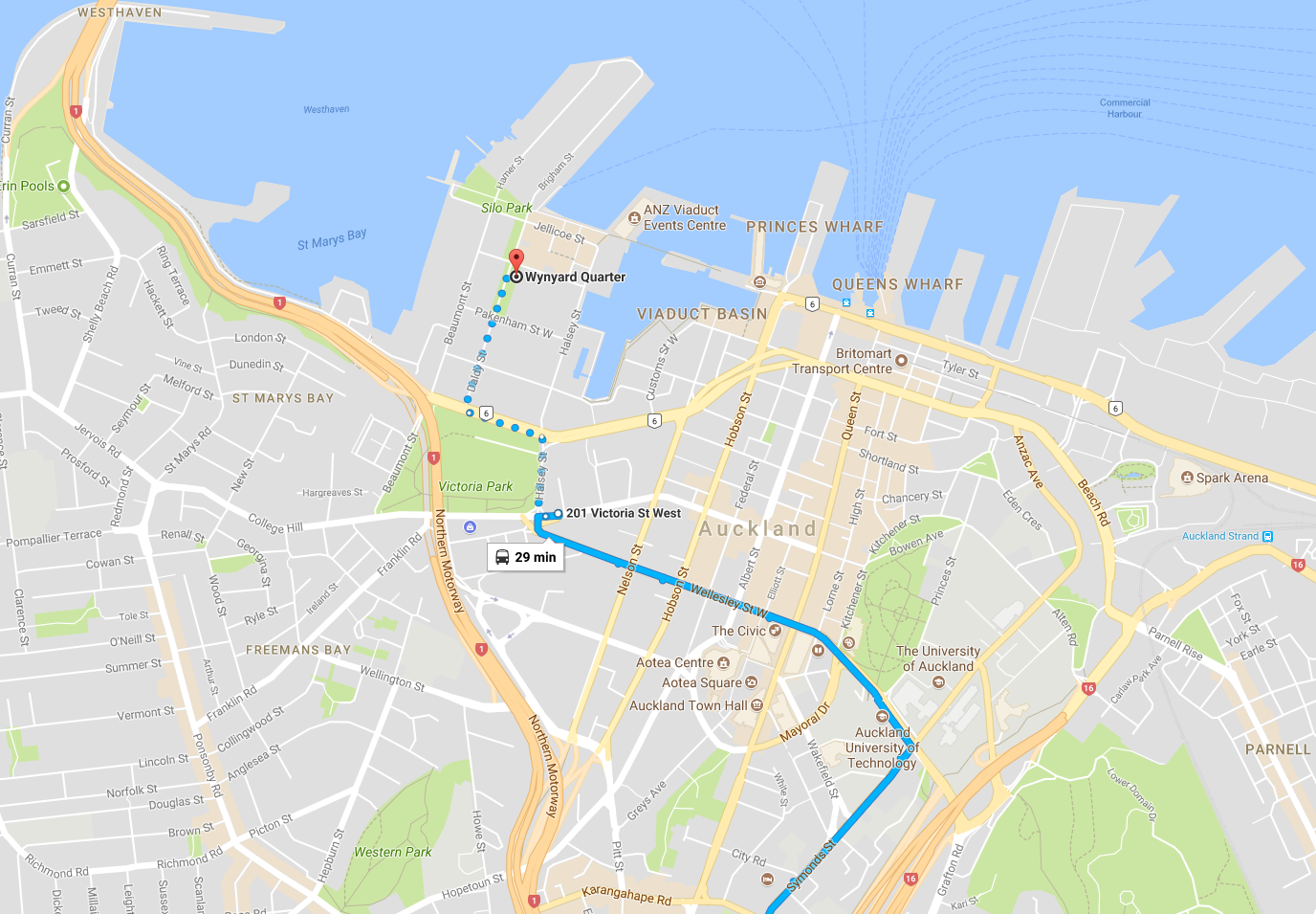
For somewhere so close to the very centre of the city, Wynyard Quarter can sometimes feel surprisingly disconnected – especially if you travel by public transport. In this two-part post I’m going to look at what it’s like to travel to this rapidly growing part of the city from part of the central and southern isthmus: namely the areas serviced by the Dominion and Mt Eden Rd bus lines.
In my personal commute to Wynyard, I’m lucky enough to be able to take both Mt Eden and Dominion Rd buses into the city, allowing me to experience a wide range of the public transport options available to travel to the newest part of Auckland’s CBD.
Unfortunately, what should be a reasonably straightforward bus trip with a single transfer in the well-serviced city core (where there is theoretically plenty of frequency) often ends up an exercise in frustration.
In part one of this post I’ll take a look at travel from Dominion Rd. The Dominion Rd buses travel down Symonds St, then Wellesley St between the universities, and terminate outside the St James, opposite The Civic.
Option 1: Take the City Link from Midtown
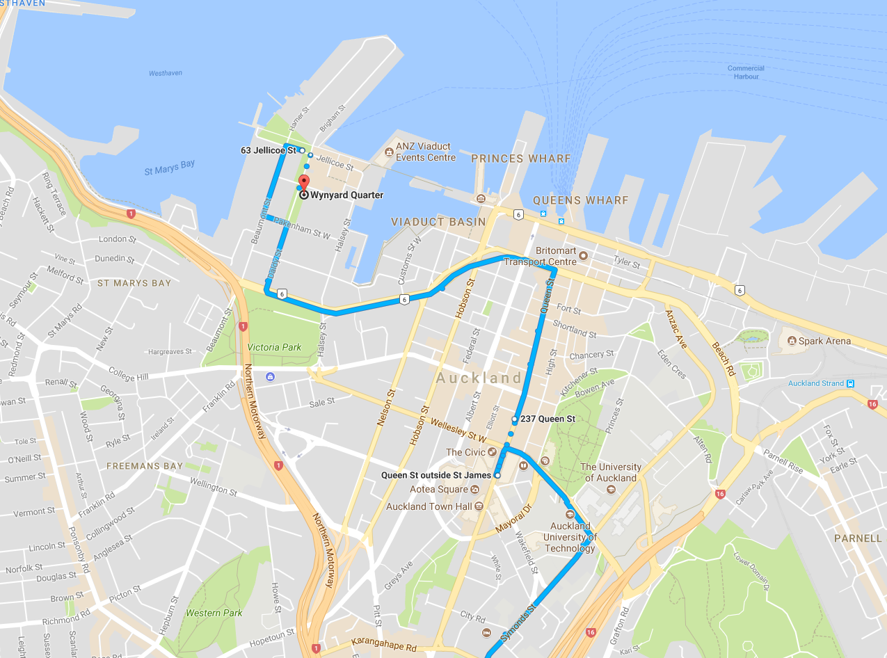
For someone new to PT, this is the most obvious way of connecting to Wynyard and from talking to people, the one that always comes up.
“Oh, the Red Bus, I’ll get that – it goes to Wynyard, it’s easy, right?”
You can get a City Link about 50 metres down Queen St from where the Dominion Rd buses stop outside the St James, so it’s an easy transfer.
But unfortunately, there’s a reason why there’s fine print for that 7-8 minute frequency which sounded so compelling.
After travelling this way for a while you realise that your connecting City Link can turn up anywhere from the moment you get off your first bus, to maybe 15 minutes later on a bad day – by which time you could have walked. You also learn that it moves at a crawl down Queen St, the route is indirect, and the buses small and difficult to move in.
Including waiting, it takes anywhere from 15 to 25 minutes just to travel the final 1.3km from midtown to Wynyard Quarter, in addition to however long your first leg was.
The journey home’s not great either – it tends to get crowded and the bus stop facilities, especially on Fanshawe outside the old Vodafone building, are inadequate for the number of people using them, particularly in the wet. And standing next to Fanshawe is similar in experience to standing next to a motorway: loud and hostile.
Option 2: Take a North Shore bus from Midtown
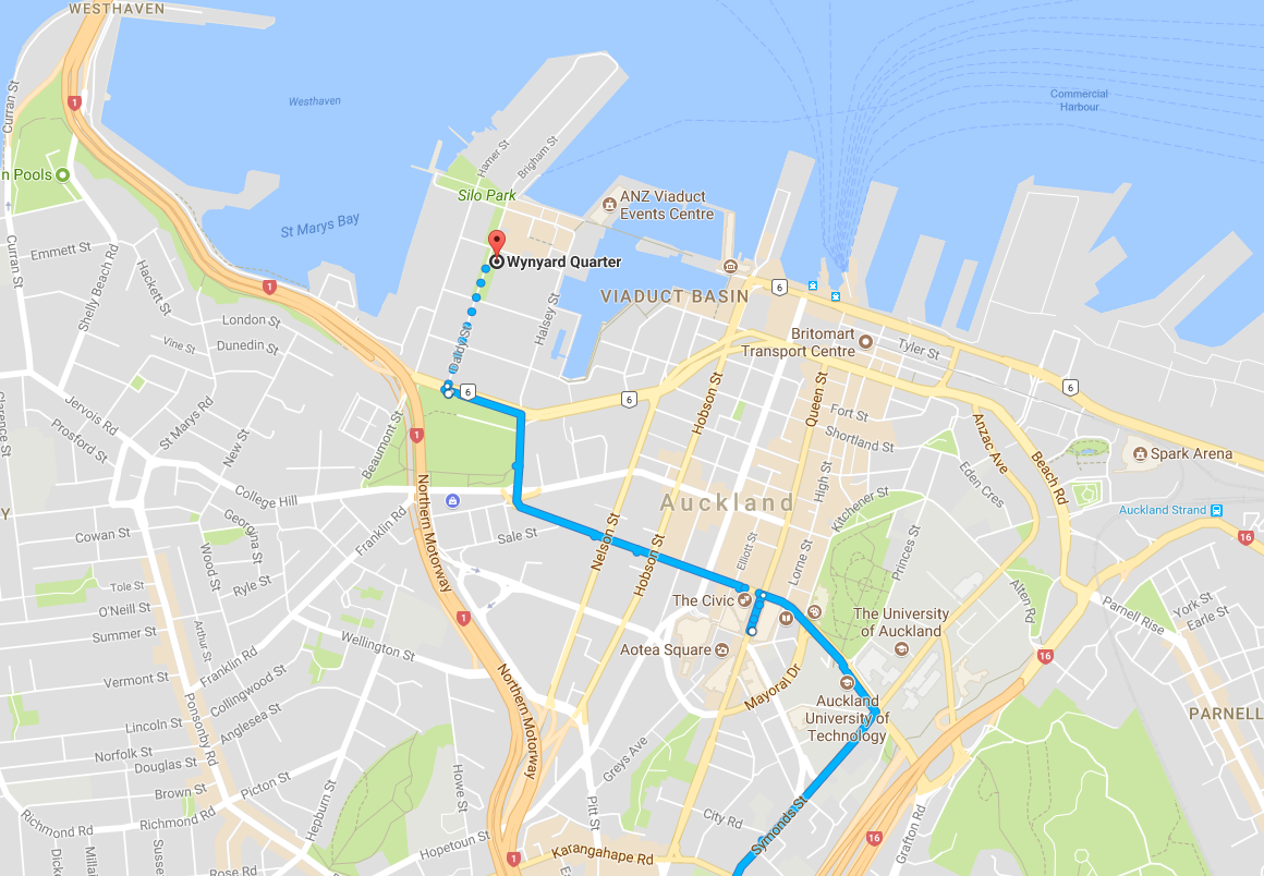
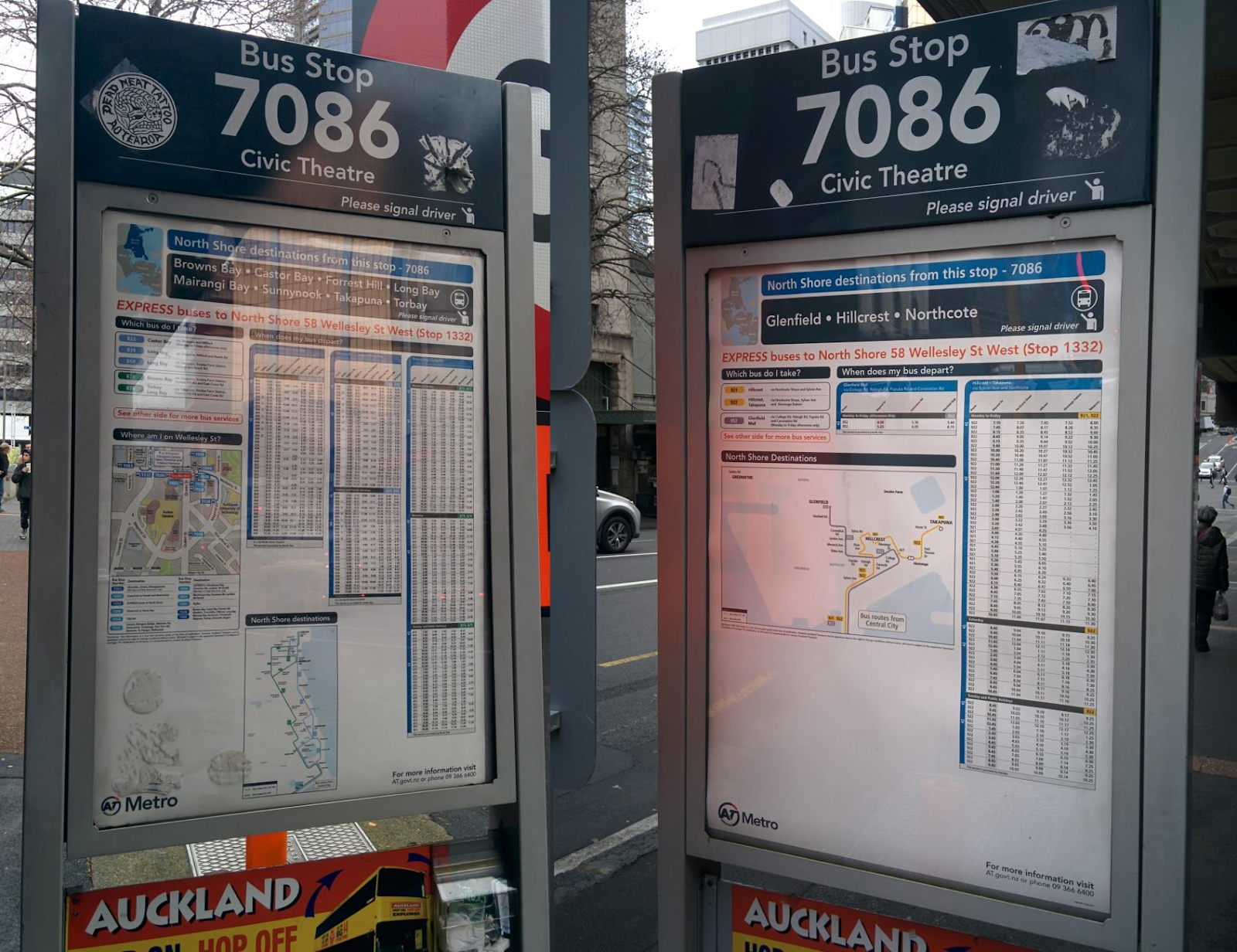
You get off your first bus at the St James as before, and walk around the corner to Wellesley St where there is a large bus stop – crude but effective thanks to the Civic’s awning – and plenty of other people waiting.
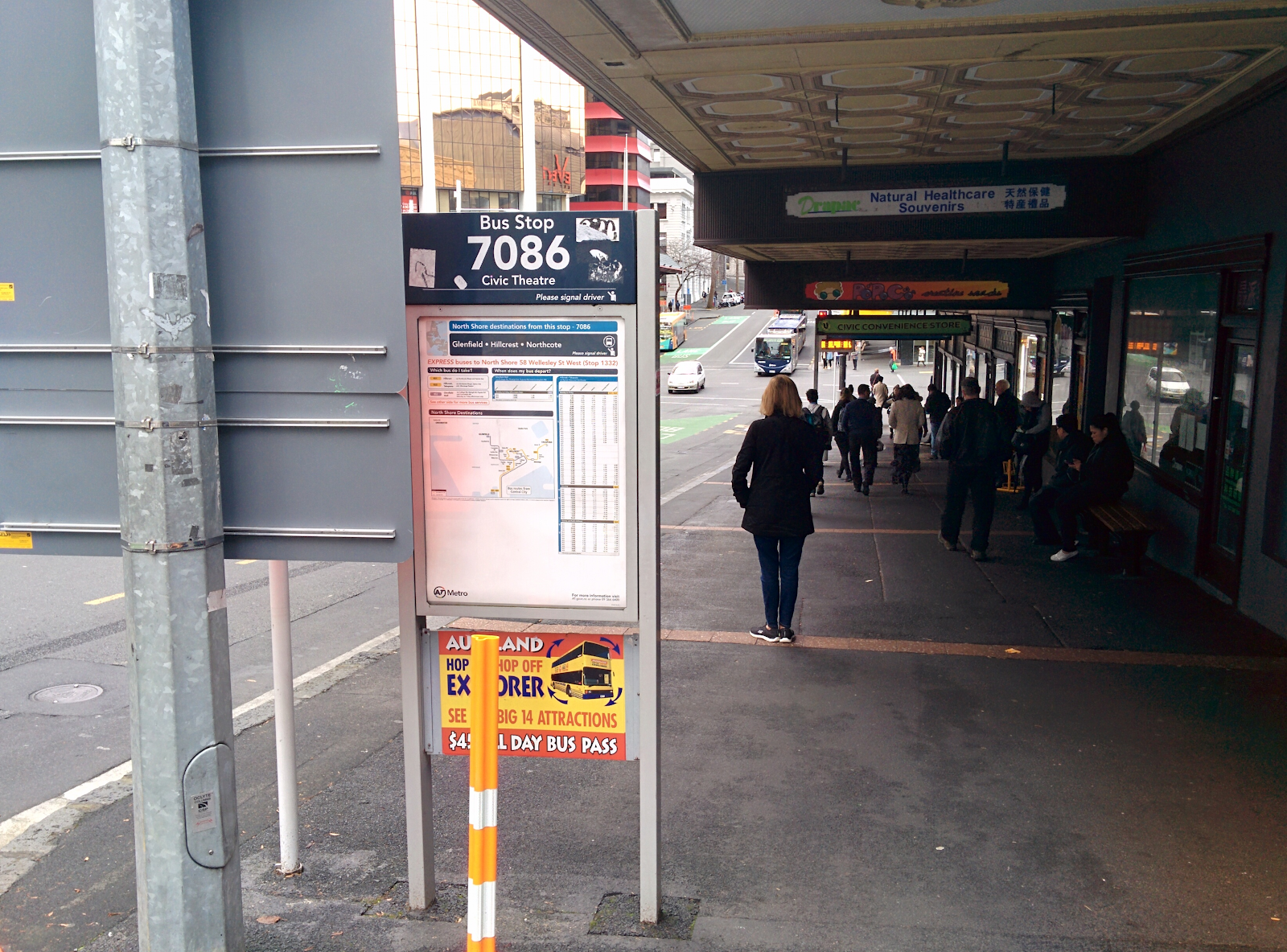
It’s a good location for a transfer:
- There’s a large covered stop
- There are shops right next to you, good for buying emergency twix
- There are always plenty of people around, even at night
- There are buses to the shore via Fanshawe St
- It’s much more direct than the City Link
The bus journey over the hill to Wynyard is usually pretty quick, taking just over 5 minutes to get to the big bus stop on Fanshawe, from which you can walk over to Wynyard in a few minutes.
But there’s catch: inexplicably, the timetable is wildly uneven, with the wait between buses varying between 5 and 15 minutes. 5 minutes is fine, but 15 is extremely off putting when you’re travelling a relatively short distance. And because you’re coming from another bus which itself can be somewhat erratic, you can’t plan around it.
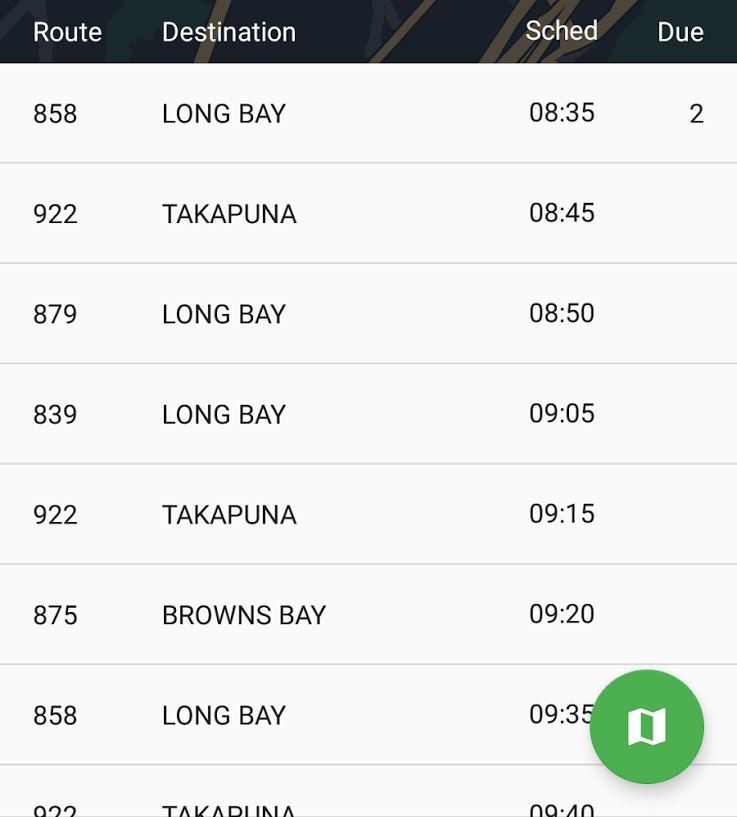
The timetable is clearly designed as an off-peak timetable, with no thought that people might be using these services for short trips across the CBD. The buses used on these routes also tend to be old and unpleasant, and often have drivers who play loud music through the cabin.
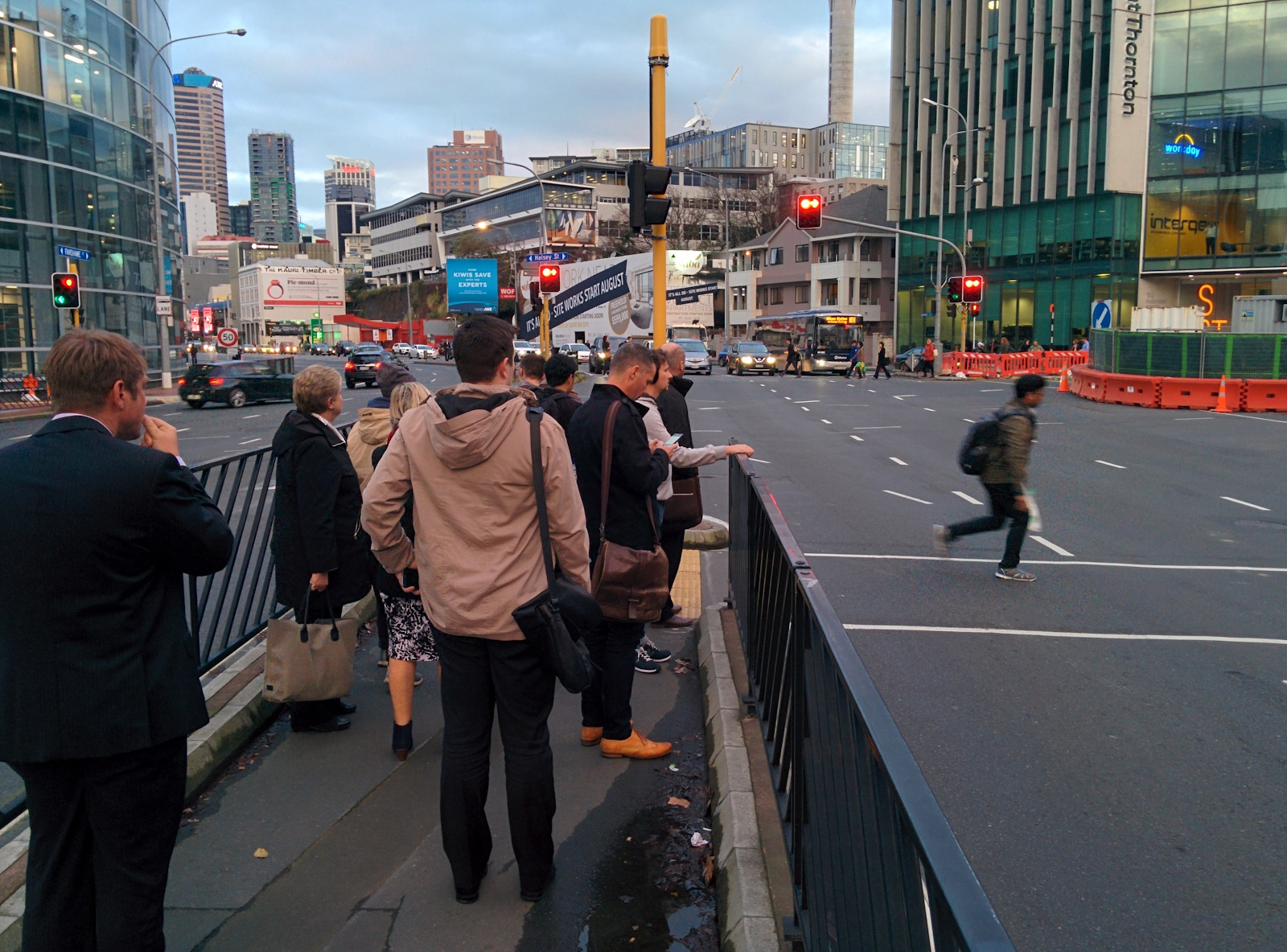
At your destination, you have to cross the Fanshawe St de facto motorway, waiting forever for the pedestrian signals (or just playing frogger with the like traffic like everyone else), while dealing with a poor walking environment.
However – although unpleasant and dangerous – these things are manageable, and if you’re OK with the possibility of a 15 minute wait, you can travel the final leg of your journey in 5-20 minutes.
Unfortunately, getting home is another matter.
Due to roadworks, the bus stop you’d usually wait at outside the Air NZ building is closed, and you have to go to a stop on Beaumont St, on the western side of Victoria Park, as Matt has written about before.
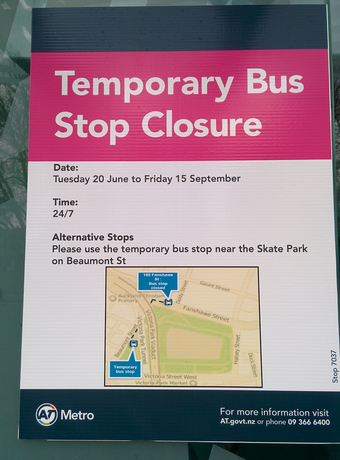
The first time you try and get to the stop you’re in for a special surprise: if you actually try and follow the route on the map you’ll end up having to cross 4 separate pedestrian signals over motorway off ramps, and then run across another busy road where there is no crossing. (There’s a better way, just don’t follow the map, which was apparently drawn by someone assuming you’d be driving)
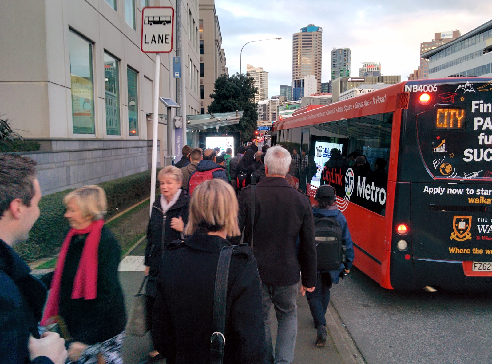
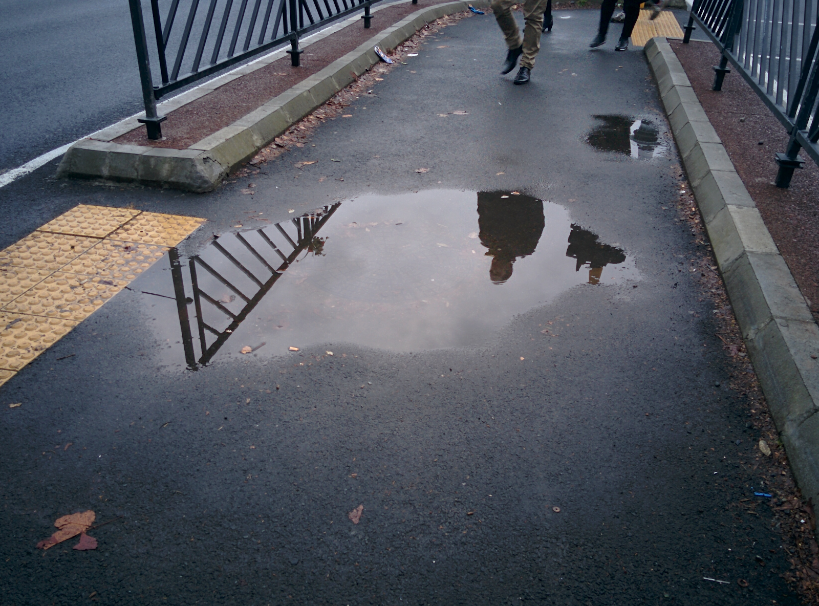
Then you get to the temporary stop, which looks like this:
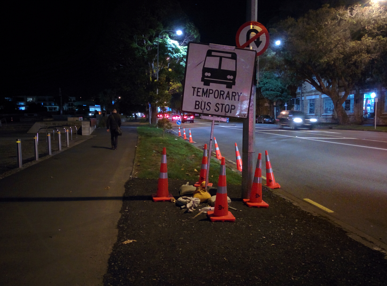
And it suffers from a few critical problems:
- It has no stop number – how do you know it’s the right one?
- It has no timetable or service information – when are you getting home?
- It has no road markings or any clear indication where the buses actually stop
- It has no seating
- It has no lighting
- It has no shelter
- It is made of gravel and dirt
In addition, the bus services themselves are abominable:
- Drivers do not like or do not know about stopping here – you find drivers often almost miss you standing there in the rain, trying to flag them down
- Drivers seem unsure where to stop – the occasional driver will stop well in advance of the official stop position and you’ll have to run to get on, and then they’ll stare at you wordlessly when you ask why they didn’t come up to the sign.
- It seems to be much more unreliable than the inbound journey, you will often find yourself stuck out there for 20 minutes with nothing coming past
- There can be bad traffic during the evening peak causing your journey back over the hill to take 20 minutes – combined with up to a 20 minute wait for a bus… you get the picture.
- It suffers from the same random gaps in service as the inbound journey
- You won’t see anyone else waiting there with you, because it’s such an incredibly awful experience (I’ve taken this trip several times and have always been the only person mad enough to be standing there)
Despite the inbound journey being almost reasonable, this option is near useless, since the journey home is simply too unpleasant and usually too long to bother. The poor environment and the risk of a 40 minute journey just to cover 1.3km – before taking a second bus no less – must be something only a very tiny proportion of the population is willing to do.
This temporary stop has been in operation for at least a month and is due to stay until mid September.
Option 3: Take a Wellesley St isthmus bus from Midtown
At the same Wellesley St bus stop where you catch shore buses to Fanshawe, you can take various 2xx (New North and Sandringham Road) buses to the south eastern corner of Victoria Park. This isn’t as good as taking one all the way, but they come every 1-4 minutes, which makes them much more practical as a transfer.
Unfortunately, this option might not be obvious as the only indication that these buses stop here is on the realtime board; the signage for the stop itself only shows shore services. If you use a journey planning app it will presumably tell you, but that’s not an excuse for having the wrong information at the stops themselves.
Option 4: Walk
This is by the most reliable option. It takes around 15-20 minutes to walk, and it can get you there without the huge variation that the bus options have.
But it’s an unpleasant walk with very little shelter, long and frustrating waits at huge intersections crossing roads which get featured in the news due to cars colliding with pedestrians. It also requires that you are physically able to walk over a kilometre, partly up a large hill, which is not an option for everyone – nor should it be required – a city should easily be able to provide a good PT service over this sort of distance in the core.
What you actually want to do
In my view, the most natural way of making this journey by PT is option 2 (taking a shore bus down Wellesley St to Fanshawe). It has the most pleasant transfer, is the most direct route, and involves the least walking.
But the uneven frequency makes it too frustrating, and the hopeless situation with the temporary bus stop on Beaumont makes it a non-starter, especially for the return journey.
So the best option?
Wait at Wellesley and take any old bus that comes next, and accept that you might be walking part way half of the time.
My question is: how are people meant to work this out if it takes an amateur transport nerd months of experimentation to get right? I suspect most people go with the most obvious but poor solution, the City Link, or even more likely, a car.
There are many fundamental things wrong with the experience which will take some serious effort to repair (like a new network, for instance), but there are lots of smaller things which would go a long way to improving life for the large number of people who now take PT in the city.
- Replace any signs at bus stops which are inaccurate or incomplete
- Do something, anything, about the temporary bus stop. Does it really need to be where it is, on a barren windswept plain with no shelter anywhere in sight? And shouldn’t it at least have a number and service information?
- Train drivers to stop at the correct places
- Start installing quality bus shelters everywhere – I don’t mind having to transfer, but being forced to stand out on the cold and the rain, huddled in an inadequate open shed with a couple of dozen others, while watching those in cars travel comfortable and warm on a runway-sized piece of land… gives you a clear indication of where the agency in charge thinks you stand in the hierarchy of road users
- Increase the time and frequency of pedestrian phases at intersections
- Fix the holes in the footpaths
- Fix the holes in that timetable – keep services evenly spaced out so you’re never left waiting 3 times as long
Note: We welcome guest posts from our readers. Just contact us here and let us know your ideas first.

 Processing...
I live near western park/hopetoun bridge and work in wynyard quarter. I just walk, buses are all a waste of time. Green link is circuitous but saves me a hill when I can’t be bothered.
I tried to get the 010 once but had no idea where it was supposed to pick me up from as the stop was closed. Buses that head through (congested) midtown don’t appeal when I should be skirting it all.
/Edit
Importantly, the new network doesn’t address any of this.
+1
But Wynyard Quarter has light rail!
/s
The solution is simple: close off Queen street to all vehicles except buses, freeing up the backlog for your red bus to be more reliable.
When LRT comes in, Wynyard will be better serviced, however that’s a long way off. Even de-carring Queen will only happen after CRL works…
Would a light rail loop down queen and back up symonds, with all buses terminating at the edge of the loop rather than in the city, be a good option?
There was a post on here yesterday afternoon about the problems with loops.
Better to have a good grid of LR and bus routes running through the CBD that allow easy transfers.
But it would be nice if buses didn’t have to run through the CBD at all (in fact if no vehicles other than LR ran through the city!)
Well I never knew anyone lived in that part of Wynyard quarter and I have never understood why the university clutters the city centre but for myself I’d keep my goldcard in my pocket and walk it. Victoria park is pleasant to walk across but as you say Wellesley St is a uphill drag with little of merit to engage the eyes. You are right about the long delays crossing Nelson, Hobson, Federal, Albert, Queen but with two of them being one way a little jay walking helps and you are not alone since nobody waits for the lights when the road is empty unless they have children with them. Then things do get a bit messy because of the brownian motion of tourists and the way they randomly clump and disperse – you just have to grit your teeth and concentrate.
You have to anticipate a high probability of a poor bus experience unless you are travelling on a Birkenhead bus and their superiority is so clear that AT are now insisting on them painting over their heritage livery with that universal drab colour scheme. It is has made it far too easy to accidentally get on a lower standard bus; happened to me a couple of times – if I had known I would have waited. If there is a reason for Auckland to de-brand it buses then make them all the Birkenhead colour (and get rid of that ugly AT/Metro symbol – at least 100 times too large for purpose). Is anyone keeping a tally of the pedestrians injured by dark buses on wet dull days like today?
Agree about the AT Metro symbol – I’ve always thought it looked like it was designed by an engineer with a tunnel fetish. I’m sure AT could have done better. And in time I hope will do so.
However, I’m a strong supporter of a unified livery. Like any business which is trying to change its image and offer a consistent service and product the packaging is critical. I’ve no doubt we will look back in ten years’ time with great satisfaction at the unified visual image of PT in Auckland and wonder what all the fuss was about.
Yes, AT could have chosen the Birkenhead colour palette as the basis of their unified scheme but if drabness is what you’re concerned about then they could hardly do worse than . . . beige!
I live in the area served by Birkenhead transport, and I can tell you that, especially in leafy areas, the beige is much more visible than the new AT livery.
And that new livery, given we’re a country full of art graduates it is a bit disappointing.
Some one described it as baby poo colour. I still love it and the font they use. Auckland has no concept of heritage. I would accept the concept of a unified livery reluctantly if all bus companies were as well managed and responsive to the local community as Birkenhead buses (no I do not own shares, not work for them not even know anyone who does).
If our buses have to look alike despite being different why do tins of peas in the supermarket look different although their contents are interchangeable?
The unique colour makes it easier to identify the bus I need from a distance – has saved an old guy with high blood pressure running down Fanshaw st several times.
“If our buses have to look alike despite being different why do tins of peas in the supermarket look different although their contents are interchangeable?”
Home Brand peas come from 100s of different farms, yet they are delivered by home brand, under unified packaging. AT are doing the same.
Which supermarket sells only one brand of peas? Our bus companies are not identical; peas are identical.
“peas are identical.”
Then why does anyone buy Watties at twice the price of Home Brand?
Our buses aren’t different either, they all run on routes planned by AT, to schedules set by AT, paid for by AT, with fares collected by AT, as part of a network operated entirely by AT.
People still believe that they cannot get on a bus run be a different operator, unified livery helps to present the buses as a network instead of 600 routes.
The government via its agency Auckland council’s AT is forcing the no choice on us. I like having the option of choosing Watties if I want to – fortunately the government doesn’t force all tins of peas to look the same (except North Korea?).
The government forces all road signs on state highways that it operates to look the same, regardless of which contractor is contracted to maintain and install the network.
Also, the government doesn’t supply peas.
And who owns the buses?
I like all the same colour system, new one not tooo bad I think but a bit dark and heavy. Ideally a lighter blue (think Auckland water) may have been better, but then that wouldn’t go so well with the rapid colour coding of yellow (EMU’s) which I guess stands out for safety & tag posts are easily spotted etc as well.
“I have never understood why the university clutters the city centre”
Because it is the location that provides students the best access to the campus and provides the campus the best access to students.
I studied at Canterbury but was from outside of Christchurch, for me having the University out of the CBD was very handy as it meant rents for flats were lower than other cities.
However, over time it became clear that moving the University out of the CBD was the worst decision for the city. It meant all the staff and students who lived in other parts of the city had to drive or take long PT trips, the carparks at Canterbury are huge compared with Auckland.
The 12,000 students and x number of staff would have been a huge boost for the CBD and made PT improvements a lot more viable.
Fortunately students actually at university will soon be a thing of the past. Why get to uni at 9am for a lecture by a talented but second rate lecturer when on the internet you can see the same subject covered by world leading experts from Harvard, Oxford, MIT, etc. And if it gets tricky you can hit replay.
I attended a 2nd year IT class at Massey uni about 8 years ago and out of a class of 36 I never saw more than half of the students actually attend a 9am lecture. One morning I was the only student and had a pleasant chat with the lecturer until a second student arrived about 9.20am.
Universities are bastions of conservative thinking so it will take a while for reality to sink in but eventually they will all close down, sell their valuable sites to developers and just book a handful of small seminar rooms at SkyCity convention centre – only needed for students allergic to VR.
You appear to have completely ignored the role of Universities as research institutes.
Also collaboration and talking thinks over with lecturers and tutors is a vital part of study.
What percentage of students are involved with research? What percentage get involved talking to lecturers? Many years ago my 1st year maths had 120 students and one lecturer; so how much one on one time could he give? Much the same for physics and chemistry.
I did say students at the university will disappear not the university diasappear. But I can see the research aspects of universities will continue – but again without 95% of students. So will they need to be centralised? For example I appreciate Auckland Uni has a higher ranking than Massey in Albany but not in every subject and nor that much higher. Massey Albany despite poor planning manages to thrive despite not being in the CBD.
I wasn’t thinking of students, however there are also a significant number of graduate students involved in research. Academic staff are generally split 50:50 between teaching and research.
Also students are generally involved in tutorials or laboratories, which are more face-to-face and hands-on.
I think you are overrating the importance of lectures in the overall operation of a University.
Not over rating their importance just the sheer number of people who are dragged into the city to add congestion to roads, buses, Railway and footpaths. I have no numbers for the ratio of undergraduate to graduate student – in my day it was a very high ratio but I’m told that you need at least a Masters to get a decent job these days. I still expect universities to look like ghost towns in the future.
When I was a student I very rarely had days with only lectures, there were generally tutorials and labs as well. I’m not sure there will be much change to travel requirements if lectures are online.
Also being able to meet up with class mates and friends during the day and discuss/work together on projects was an important part of succeeding as a student.
Ah yes, the mythical telecommuting student. I guess the 400 students in my second year mechanical engineering class just didn’t know they could watch online.
I started a masters as remote learning, after the first semester I rejigged it to go in person. Remote is crap.
There are actually world leading experts from MIT lecturing at Auckland Uni. #fail
Temporary roadworks do seem to be something of a blind spot in PT planning. From what I can tell, most of the decisions seem to lie with private Traffic Management companies – the cone guys – who work for the instigator of the roadworks (often not AT). They appear to be responsible for proposals in most instances, with AT approving their ideas, and they compile enormous plans for temporary works, but seem to get lots of stuff wrong and overlook PT as an issue.
Unsurprisingly, the outcomes are far from ideal. Watercare are in the middle of a 12-18 month main sewer upgrade in our area, with a one-way loop movement for the duration. The main contractor and traffic guys deemed roads on one side of the loop too narrow to allow buses to stop, and as a result it’s now nearly 1km between stops. One of those stops is located on a berm with a 40 degree crossfall and at someone’s driveway crossing because they didn’t think it through. Their initial plan for that temporary stop was where there is 1m retaining wall between footpath and road… Clearly nobody engaged brain before submitting a traffic management plan to AT. It’s very telling that lots of people have been driving the wrong way on parts of the loop because of poor signage.
I can’t believe any AT PT team reviewed or even knows about this; essentially vehicle safety is being prioritised way above PT service, when a small effort would doubtless find a solution. I can see some easy wins in this area; would be good to hear from AT how this works, and could work better.
assume you’re referring to glen eden? and when watercare leave, AT are going to have to rebuild the minor streets as they’re becoming potholed and damaged from having buses and way too much traffic for their design standard. but anyway – off topic from wynyard…..
Walk for now. It is the most healthy option. Vote for labour to get light rail in the CBD. Anytime I get into the cbd I just walk to where I am going from Britomart. The are interesting shops to look at plus some days there are some great street performers. Also I find it interesting looking at the mix of people who use this area.
im of the opinion making the walk more pleasant (better priority at intersections) is the best option for such a distance.
Sure, let’s make walking much better in the city centre. But you have to consider many PT users have already walked 800m or more just to access the service from their house/origin. Getting PT service as close to the destinations should be the network design goal, so that the overall journey is a viable option to as many people as possible.
Especially for Wynyard Quarter which is a significant employment destination and is only going to grow.
Hear hear! Full time bus lanes up & down Queen St would greatly relieve part of your pain and so easy to do. We’ve all seen how easily traffic has adapted to the CRL works. Grow some balls AT and start some of this simple stuff in the service of your long suffering PT customers.
Another reason AT’s ideas about the 2xx return route are shortsighted. Wellesley St return with a loop around Wynyard would be an improvement in more ways than one.
I think the third bullet point is meant to be “Bus drivers” 🙂
Yeah, that got me on first reading as well. In case you haven’t figured it out for yourself yet, try rereading it with the first word being a verb rather than a noun.
An entire article about a 1300 metre distance that has a bus every few minutes, complaining about the poor service? Goodness, the vast majority of New Zealanders don’t have any PT at all.
Surely there’s more important things to worry about? 1300 metres is nothing, just walk for 10 minutes!
If you think there are more important things to write about, why not write about them?
“Goodness, the vast majority of New Zealanders don’t have any PT at all.”
Bull shit. The three biggest cities are half of the population and all have PT covering the entire urban area (of varying quality). 2/3 of NZ residents live in 7 cities that all have similar coverage.
https://en.wikipedia.org/wiki/List_of_cities_in_New_Zealand
One issue I’ve noticed at the Fanshawe St stop, outside the soon to be AT headquarters, is that a lot of people are going to Britomart but don’t realise you can catch and bus along Fanshawe to get there. That means Citylink plus all NEX and Birkenhead buses.
At the same time, drivers of those buses don’t thinking about those passengers and are often driving too fast/aggressively to be able to safely stop, or sometimes they actively ignore waiting passengers.
AT need to do a better job at explaining to people how this can be easier for them and in getting bus drivers to drive better. Perhaps them being located there will help.
I’ve found that too, in part I think it’s a testament to the link’s branding, but also because as a city were simply not used to using PT as a network, so people look at the sign, see ‘north shore’ and assume they can’t take it.
Yes. Underinvesting in bus infrastructure has put us in a right pickle. What we need is a nice little high quality bus interchange somewhere around wynyard qrt.
I disagree with dr on the new network though: at the very least it will provide a higher frequency crosstown corridor with more regular headways compared to the dogs vomit breakfast we have now.
Especially if AT see the light and land on Wellesley street rather than victoria
I live in Mt Roskill and over the last few weeks have traveled to Wynyard a numberof times for events. The easiest trip I had was on the 010 route (Mt Albert Rd, Great North, Ponsonby, College Hill). Unfortunately I could only use this once as the service doesn’t run at nights or in the weekends which seems very shortsighted. Other trips have been Dominion Rd and sometimes City link but more often walk the last bit due to the completely erratic Link service.
Logic would dictate the trams at Wynyard connects directly through to Upper Queen St and then as a suggestion through K rd and hook back via Grey’s Ave back down Queen to Wynyard. Own road, more reliable timing.
Practical and tourist oriented too.
Anyway wait until we see who gets voted in first as National have only just got it that decent PT may be a vote winner but have been thoroughly unconvincing in their pseudo embrace of it.
I’ve heard it said that when the Wynyard tram loop was built, a set of points, or foundations for points, was installed so that the lines were ready for extension towards Queen St in the future.
Does anyone know if this is true and if it is why can’t the line extension start construction now?
It was designed to be connected into a Queen St LR however the route was not decided. There are 3 points along the route where it could connect in theory – Continue Jellicoe St alignment across the Viaduct to Quay St (most expensive and disruptive to both the Harbour and LR itself),
Madden St-Customs St W alignment (new bridge but not disruptive as most of the Harbour would still be accessible for taller yachts leaving that small section for lower ones). Is the most direct however does neglect Fanshawe St.
Fanshawe St (likely Halsey but possibly Daldy). Most indirect route but does service Fanshawe St and the many businesses etc around there as well as Vic Park.
Yep I’d personally walk down queen st, down to the ferry terminal then follow the viaduct to wynyard rather than deal with fanshaw st – a bit less direct but a much more pleasant walk with gentle slopes.
True – a good alternative.
Or don’t have Dominion road buses travel all the way to Wynyard!
I still have no idea why this isn’t in place now? What is the advantage to buses terminating in midtown?
Should be ‘do have’ not ‘don’t have’
The problem is the CBD doesn’t have a distributor system. The solution to that is not the CRL, that solves a different problem. The solution is light rail. Until then the Wynyard Quarter will remain a daft place to put offices.
Yes the solution is light rail really. More central bus cross over points would be better though & Wynyard itself could be one of these. Real estate is valuable there now, so I keep posting comment in the past that perhaps an off center compromise solution would be using the old Farmers parking building kind of area. Could make it as big and gold plated as you wanted using underground & multi-flooring with tunnel under Fanshawe. Upgrade all the walkability around it etc, heaps of the city routes could pass through or terminate at it, use a busport type style like in Perth (https://en.wikipedia.org/wiki/Perth_Busport).
For now I would walk via the causeway. Fanshawe Street is one of the worst stroads in the city. It is way too wide, and aweful to cross. Slow and I do not feel very safe doing it. It is also pretty inefficient. The long pedestrian crossing time makes it hard to coordinate the signals.
Whether by bus or LRT ( or could be shared) half of Fanshawe Street should be turned into a transit mall, with a decent footpath between it and the remaining traffic lanes. Could not happen too soon.
Great post – thank you… and then I saw your comment about getting a Twix…. really? Eww! Why do Twix even exist?? 😛
I guess one other option would be to walk down Queen Street and then catch one of the Shore buses from there that go along Fanshawe. Would cut your walking distance in half, is reasonably pedestrian friendly (not much wait for lights), is safe with lot’s of people about and a lot of it is undercover.
Agree, I don’t think I have ever met someone who likes them or seen someone eating one before, but clearly there is a market after all.
Blasphemer
Go and sit in the naughty corner, both of you!
This might end up being an election issue.
Nah your getting a head of yourself there , remember there’s many a slip be twix cup and lip.
Twix is delicious and the official snack of the urbanist Twitter rage set.
Wandering down queen is an option, it’s way longer though, IME.
I generally choose option 4 Walking or option 5 Uber to quickly get between Wynyard Quarter and central city.
I don’t understand why we can’t have an app like the Uber app for buses, I want to get from here to here show me the best routes given the current bus gps location – show me where the buses actually are, and change your recommendation if they get stuck in traffic.
It seems to me that the real time boards are often incorrect for City Link, so I’ve given up on using that bus.
This is a great idea. The buses already have the GPS and so does your phone. As you walk closer to another stop it could update with more route options, including other modes too. Kind of like the AT website route planner except real-time and smarter.
https://citymapper.com
I often take 881 bus from Akl Uni on Symonds St & it goes downtown then past Viaduct & Vic Park. Very frequent around rush hours else every half hour. So you could change buses on Symonds and wait in a cafe or a uni building for 881 – use Track my Bus or AT Mobile apps to know when they’re nearby.
I could do a similar post starting from the downtown police station on Hobson Street. It would be a very short post:
❧ Option 1: Walk 20 minutes. Extremely unpleasant walking environment though.
❧ Option 2: Walk to your parking spot and drive your car. It may be slower than walking, off-peak it will be a lot faster and it will be a lot more pleasant than option 1.
That’s it. There’s no public transport in that area. Which will remain that way until (1) AT stops dicking around with Wellesley Street, and (2) AT stops dicking around with the Outer Link.
+1. AT need to get the Wellesley Street bus corridor running ASAP and massively improve the walking environment in the city centre.
+1
I have the same problem getting from Glenfield to work in Takapuna. Which is a short distance about a 10 min drive or 30 mins on the bus but due to a road being closed and consistently bad traffic for the last few months it is taking me over 45 minutes on the bus.
so I got a electric kick scooter, which takes me 15 mins to get to work, and often bus back home with the scooter.
So considering the short distance between Wynyard quarter and upper Queen, an e scooter or e bike will be a good option.
You speak the truth. I would hate to do that journey every day. However the worst I’ve had recently was from Link drive to home in Birkdale. Could have walked it quicker and I’m old and overweight. That was midday so not a congestion problem. At least I have a Goldcard (in my utopia everyone would have one).
This topic highlights two problems created by historic shortsighted solutions. The first was the idea to scale back Britomart. Originally it included a bus interchange to get all of the services in off the streets. This was on two additional underground levels. With rail at the bottom it was envisaged that rail expansion would enable tunneling under surrounding buildings. There was also retail and apartments on top to recoup the cost which was around $200 million. There was then a bun fight over several years and money was saved by not building the retail or the integrated bus interchange. Cost $200 million. See what happened there. The partial solution ended up costing the same. The second issue is light rail. In the Wynyard quarter you will notice train tracks which end at the entrance to the viaduct. These originally extended down Quay st and I remember sharing the road with trains. There was a lifting bridge where the causeway is now. This was removed. It also removed the direct link for light rail and other bus services through Wynyard. Had the current tram terminated at the Ferry building via that bridge it would most likely have been viable. Without reinstating this bridge the journey through Wynyard becomes a detour. Remember in NZ we often end up with a compromise solution which creates problems in the long term. The short platforms at K road for the CRL are a current example of this.
Vancouver resolved problem with buses in CBD by making them go through CBD and terminate past CBD. Just like our Western buses terminate in Victoria Park, not midtown. That system also means transferring between services is much more convenient too. They also provide their buses with dedicated bus lanes all the way, unlike Auckland.
I think longer term after CRL done, that most of the north and north western buses go the full length of Albert St and terminate, going back up Hobson I guess so pretty close connection with Britomart along with Eastern Buses, & Aotea station.
This.
Prior to the big dig, a bus trip from South Auckland to North Shore or vice versa meant a half-kilometre hike between Civic and QE2. Even worse, Queen St is straight enough that you could see your bus sitting there until you got within 100m at which point it pulled away.
Sure, passing through the CBD would slow buses down, but to me this just highlights the need for bus-only lanes down and across Queen St.
The city bus system needs to be simplifed so average person can easily transfer.
Instead of having different little bus stop for different bus along the same cooridor. All bus should share a few big bus stops.
All bus moving on the same direction sharing the same corridor needs to be grouped and color coded.
For example all bus moving along victoria street will use the same bus stops. Those bus should be color coded to be the same. Or having a same route prefix symbol.
The bus map also need to simplfy and group similar routes together to convert a complex map into a simple map, which just list which color bus goes along which cooridor.
when are the works expected to completed?
Interesting observation for the New Network is the 202 (St Lukes to Wynyard Quarter via Kingsland and Ponsonby Rd) will run more frequently at night and off peak week days (every 15mins).
Perfect scenario for where a bike share system would come in handy – zip down a pedestrianised/ transited queen street to Quay, hang a left over Te Wero and you are there in 5 minutes.
So long as the drawbridge stays down
First time I went to catch the City Link from Wynyard, went to use a new but non operating bus stop.